File:U.S. 61, Wilkinson County, Mississippi.jpg

Original file (2,816 × 2,112 pixels, file size: 2.14 MB, MIME type: image/jpeg)
Captions
Captions
Summary edit
| Description |
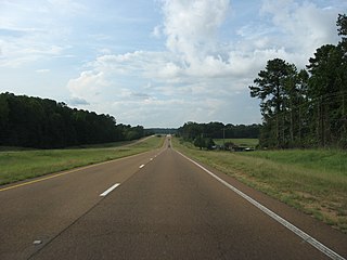
U.S. Route 61 is the official designation for a United States highway that runs 1,400 miles (2,300 km) from New Orleans, Louisiana, to the city of Wyoming, Minnesota, generally following the course of the Mississippi River. As of 2004, the highway's northern terminus in Wyoming, Minnesota, is at an intersection with Interstate 35. Prior to 1991, the highway extended north through Duluth, Minnesota to the United States-Canada border near Grand Portage, Minnesota. Its southern terminus in New Orleans is at an intersection with U.S. Route 90 (Tulane Avenue at South Broad Street), in front of the Orleans Parish Criminal Court. The route was an important north-south connection in the days before the interstate highway system. Many southerners traveled north along Highway 61 to go to St. Louis, Missouri and St. Paul, Minnesota. The highway was also used in the title of Duluth-native Bob Dylan's song (and album) "Highway 61 Revisited." U.S. 61 is divided from the Tennessee state line to U.S. Highway 82 in Leland. The highway south of Vicksburg to Natchez is mostly divided and four-lane; only short sections through Port Gibson need to be upgraded. From Natchez to the Louisiana state line, Highway 61 is now divided and four lanes. The Mississippi Department of Transportation is now upgrading the highway between Vicksburg and Leland to four lanes, beginning with replacement of the dangerously narrow Yazoo River bridge at Redwood in Warren County. The road is also known as the Blues Highway [1] because it runs through the Mississippi Delta country, which was an important source of blues music. U.S. 61 has been referenced in music by various artists with roots in the region. The junction of Highway 61 and Highway 49 in Clarksdale is designated as the famous crossroads where, according to legend, Robert Johnson supposedly sold his soul to the Devil in exchange for mastery of the blues. A 30 mile section of Highway 61 between Clarksdale and Tunica is the longest segment of highway in the world with no horizontal or vertical curves. Like Route 66 in the Western U.S., the iconic Highway 61 sign is so strongly identified with the Clarksdale area that it is used to market different products and services. U.S. Highway 61 is defined in Mississippi Code Annotated § 65-3-3. en.wikipedia.org/wiki/U.S._61 |
| Date | |
| Source |
U.S. 61, Wilkinson County, Mississippi
|
| Author | Ken Lund from Las Vegas, Nevada, USA |
| Camera location | | View this and other nearby images on: OpenStreetMap |
|---|
Licensing edit
- You are free:
- to share – to copy, distribute and transmit the work
- to remix – to adapt the work
- Under the following conditions:
- attribution – You must give appropriate credit, provide a link to the license, and indicate if changes were made. You may do so in any reasonable manner, but not in any way that suggests the licensor endorses you or your use.
- share alike – If you remix, transform, or build upon the material, you must distribute your contributions under the same or compatible license as the original.
| This image, originally posted to Flickr, was reviewed on December 26, 2011 by the administrator or reviewer File Upload Bot (Magnus Manske), who confirmed that it was available on Flickr under the stated license on that date. |
File history
Click on a date/time to view the file as it appeared at that time.
| Date/Time | Thumbnail | Dimensions | User | Comment | |
|---|---|---|---|---|---|
| current | 13:03, 26 December 2011 | | 2,816 × 2,112 (2.14 MB) | File Upload Bot (Magnus Manske) (talk | contribs) | {{Information |Description=U.S. Route 61 is the official designation for a United States highway that runs 1,400 miles (2,300 km) from New Orleans, Louisiana, to the city of Wyoming, Minnesota, generally following the course of the Mississippi River. As o |
You cannot overwrite this file.
File usage on Commons
There are no pages that use this file.