File:USACE Abiquiu Dam New Mexico.jpg

Size of this preview: 800 × 533 pixels. Other resolutions: 320 × 213 pixels | 640 × 427 pixels | 1,024 × 683 pixels | 1,500 × 1,000 pixels.
Original file (1,500 × 1,000 pixels, file size: 756 KB, MIME type: image/jpeg)
Captions
Captions
Add a one-line explanation of what this file represents
| Description |
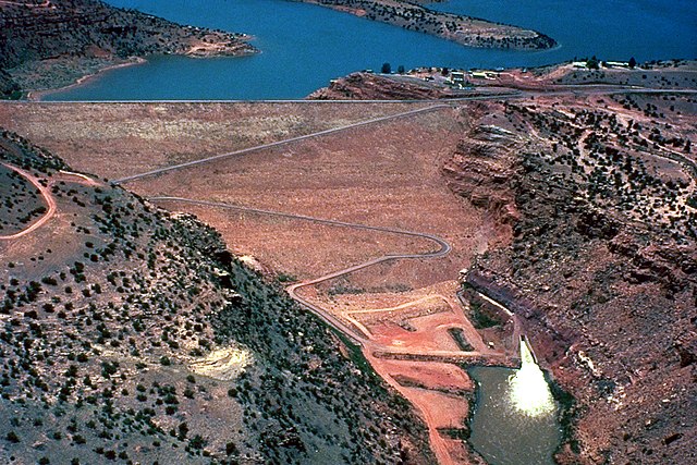
English: Abiquiu Dam, impounding Abiquiu Lake on the Rio Chama in Rio Arriba County, New Mexico, USA. The U.S. Army Corps of Engineers constructed the dam in 1963 for flood control, water storage, and recreation.
Coordinates: 36°14′17.95″N 106°25′36.18″W / 36.2383194°N 106.4267167°W |
|||
| Location | Rio Arriba County, New Mexico, USA | |||
| Date | (Caveat: Dates provided by U.S. Army Corps of Engineers Digital Visual Library are not reliable and may be wrong.) | |||
| Source |
U.S. Army Corps of Engineers Digital Visual Library Image page Image description page Digital Visual Library home page |
|||
| Author | U.S. Army Corps of Engineers, photographer not specified or unknown | |||
| Permission (Reusing this file) |
|
File history
Click on a date/time to view the file as it appeared at that time.
| Date/Time | Thumbnail | Dimensions | User | Comment | |
|---|---|---|---|---|---|
| current | 01:35, 2 May 2007 | | 1,500 × 1,000 (756 KB) | DanMS (talk | contribs) | {{Information | Description = {{en|Abiquiu Dam, impounding Abiquiu Lake on the Rio Chama in Rio Arriba County, New Mexico, USA. The U.S. Army Corps of Engineers constructed the dam in 1963 for flood control, water storage, and recreation.}} Coordinates |
You cannot overwrite this file.
File usage on Commons
The following page uses this file:
File usage on other wikis
The following other wikis use this file:
- Usage on ceb.wikipedia.org
- Usage on de.wikipedia.org
- Usage on en.wikipedia.org
- Usage on www.wikidata.org