File:USA National Forests Map.jpg
Size of this preview: 800 × 537 pixels. Other resolutions: 320 × 215 pixels | 640 × 430 pixels | 1,024 × 687 pixels | 1,280 × 859 pixels | 2,560 × 1,718 pixels | 3,600 × 2,416 pixels.
Original file (3,600 × 2,416 pixels, file size: 1.35 MB, MIME type: image/jpeg)
Captions
Captions
Add a one-line explanation of what this file represents

|
This map image could be re-created using vector graphics as an SVG file. This has several advantages; see Commons:Media for cleanup for more information. If an SVG form of this image is available, please upload it and afterwards replace this template with
{{vector version available|new image name}}.
It is recommended to name the SVG file “USA National Forests Map.svg”—then the template Vector version available (or Vva) does not need the new image name parameter. |

Summary edit
| Description |
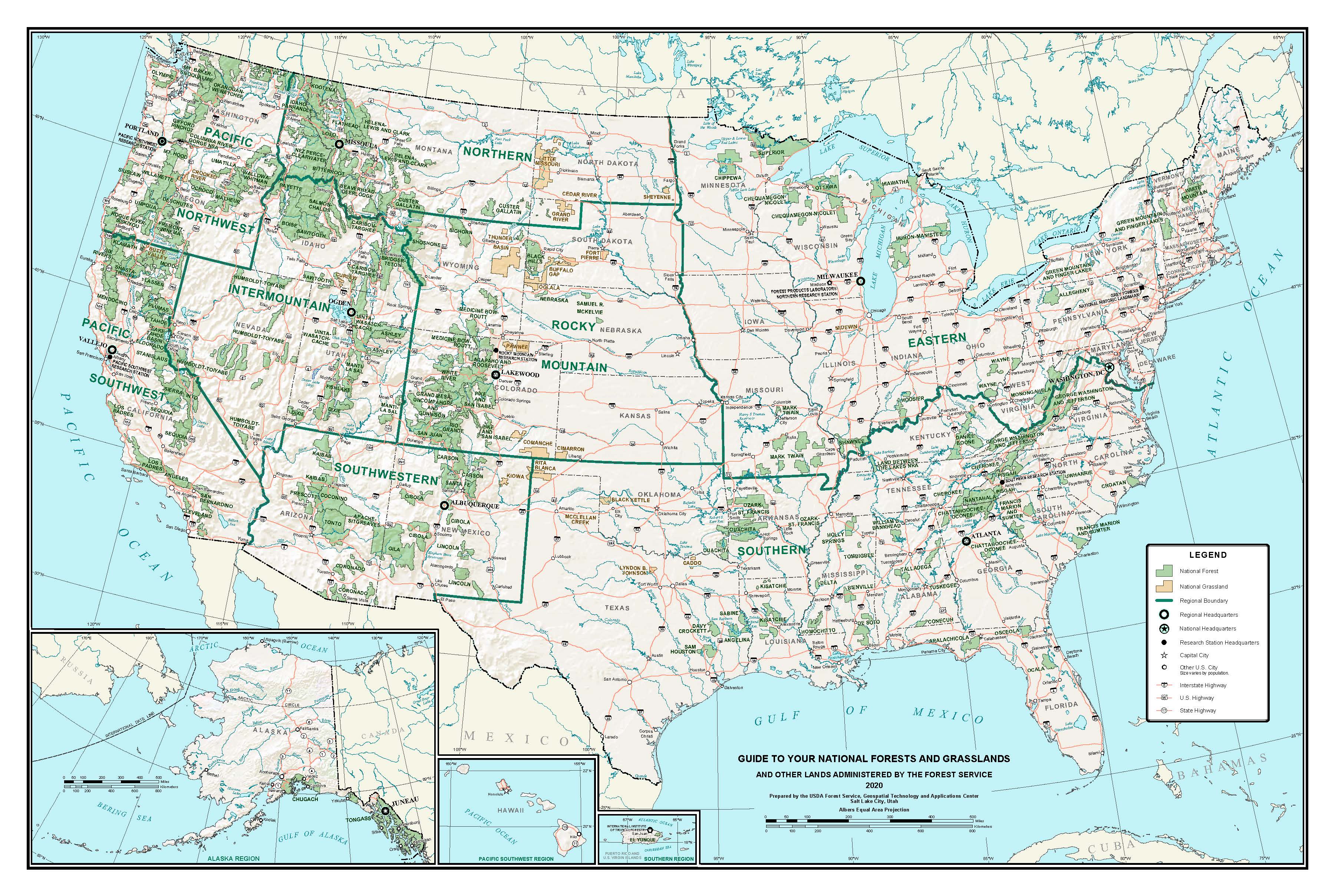
English: Map of National Forests and Grasslands in the United States. |
| Date | |
| Source | https://www.fs.usda.gov/visit/maps |
| Author | U.S. Forest Service |
Licensing edit
This image is a work of the Forest Service of the United States Department of Agriculture. As a work of the U.S. federal government, the image is in the public domain.
|
File history
Click on a date/time to view the file as it appeared at that time.
| Date/Time | Thumbnail | Dimensions | User | Comment | |
|---|---|---|---|---|---|
| current | 17:45, 19 July 2023 | | 3,600 × 2,416 (1.35 MB) | Walterrs220 (talk | contribs) | Updated to 2020 version |
| 19:50, 27 October 2012 |  | 3,000 × 1,948 (5.14 MB) | Fredlyfish4 (talk | contribs) | User created page with UploadWizard |
You cannot overwrite this file.
File usage on Commons
The following page uses this file:
File usage on other wikis
The following other wikis use this file:
- Usage on ar.wikipedia.org
- Usage on ca.wikipedia.org
- Usage on cs.wikipedia.org
- Usage on de.wikipedia.org
- Usage on en.wikipedia.org
- Usage on eo.wikipedia.org
- Usage on es.wikipedia.org
- Usage on fr.wikipedia.org
- Usage on it.wikipedia.org
- Usage on nl.wikipedia.org
- Usage on ru.wikipedia.org
- Usage on uk.wikipedia.org
- Usage on zh.wikipedia.org