File:USA Nevada location map.svg

Size of this PNG preview of this SVG file: 408 × 600 pixels. Other resolutions: 163 × 240 pixels | 326 × 480 pixels | 522 × 768 pixels | 696 × 1,024 pixels | 1,393 × 2,048 pixels | 882 × 1,297 pixels.
Original file (SVG file, nominally 882 × 1,297 pixels, file size: 76 KB)
Captions
Captions
Add a one-line explanation of what this file represents
Summary edit
| Description |
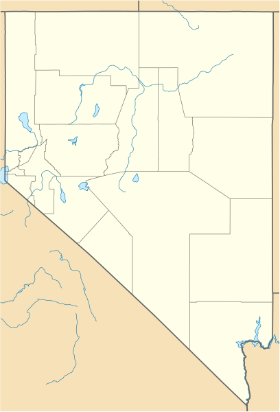
Quadratische Plattkarte, N-S-Streckung 125 %. Geographische Begrenzung der Karte:
Equirectangular projection, N/S stretching 125 %. Geographic limits of the map:
|
| Date | 05-06-2009 |
| Source |
own work, using
|
| Author | NordNordWest |
| Other versions |
Derivative works of this file: |


|
This map has been made or improved in the German Kartenwerkstatt (Map Lab). You can propose maps to improve as well.
|
Licensing edit
I, the copyright holder of this work, hereby publish it under the following licenses:

|
Permission is granted to copy, distribute and/or modify this document under the terms of the GNU Free Documentation License, Version 1.2 or any later version published by the Free Software Foundation; with no Invariant Sections, no Front-Cover Texts, and no Back-Cover Texts. A copy of the license is included in the section entitled GNU Free Documentation License. |
This file is licensed under the Creative Commons Attribution 3.0 Unported license.
- You are free:
- to share – to copy, distribute and transmit the work
- to remix – to adapt the work
- Under the following conditions:
- attribution – You must give appropriate credit, provide a link to the license, and indicate if changes were made. You may do so in any reasonable manner, but not in any way that suggests the licensor endorses you or your use.
You may select the license of your choice.
File history
Click on a date/time to view the file as it appeared at that time.
| Date/Time | Thumbnail | Dimensions | User | Comment | |
|---|---|---|---|---|---|
| current | 09:33, 5 June 2014 | | 882 × 1,297 (76 KB) | NordNordWest (talk | contribs) | c |
| 20:03, 5 June 2009 |  | 882 × 1,297 (121 KB) | NordNordWest (talk | contribs) | {{Information |Description= {{de|Positionskarte von Nevada, USA}} Quadratische Plattkarte, N-S-Streckung 125 %. Geographische Begrenzung der Karte: * N: 42.2° N * S: 34.9° N * W: 120.1° W * O: 113.9° W {{en|Location map of [ |
You cannot overwrite this file.
File usage on Commons
The following 12 pages use this file:
- User:NordNordWest/Gallery/Location maps
- File:Checkers and Rally's footprint.png
- File:Costco footprint map USA 2021-01.png
- File:Dollar Tree footprint map 2020-12.png
- File:Family Dollar footprint map 2020-12.png
- File:Relief map of U.S., Nevada.png
- File:Speedway Footprint 2020 August.png
- File:Speedway Jun2018 to Aug2020 comparison.png
- File:Target stores footprint 2020-12.png
- File:Valero brands branded gas stations 2020-12.png
- File:Walmart branded fuel stations map 2020-12.png
- File:Walmart locations with on-site fuel stations map 2020-20.png
File usage on other wikis
The following other wikis use this file:
- Usage on an.wikipedia.org
- Usage on ar.wikipedia.org
- Usage on ast.wikipedia.org
- Usage on azb.wikipedia.org
- درای ولی، نوادا
- قراس ولی، نوادا
- میجرز پلیس، نوادا
- ماوند هاوس، نوادا
- هلک، نوادا
- آرتور، نوادا
- ماونتن سیتی، نوادا
- نورت فورک، نوادا
- اورتون، نوادا
- جک کریک، نوادا
- پلیسید، نوادا
- کونتاکت، نوادا
- وید هایتس، نوادا
- پتسویل، نوادا
- لوقندیل، نوادا
- میداس، نوادا
- کوری، نوادا
- وندربیلت، نوادا
- مرکوری، نوادا
- ریورساید، نوادا
- دیث، نوادا
- پونی اسپرینقز، نوادا
- سن هسینتو، نوادا
- کارپ، نوادا
- استون هاوس، نوادا
- کارورز، نوادا
- بیووا، نوادا
- اسمیت، نوادا
- فورت مکدرمیت، نوادا
- لونینق، نوادا
- ریندن، نوادا
- نیو واشو سیتی، نوادا
- بارکلی، نوادا
- نورت بتل ماونتین، نوادا
- قلندیل، نوادا
- کرستلاین، نوادا
- میسون، نوادا
- میدلقیت، نوادا
- فرنچمن، نوادا
- لی، نوادا
- لوقن کریک، نوادا
- کارتر اسپرینقز، نوادا
- روهنسترات، نوادا
- تاپاز لیک، نوادا
View more global usage of this file.