File:USGS Kīlauea Episode61 20120126.jpg
Size of this preview: 776 × 599 pixels. Other resolutions: 311 × 240 pixels | 622 × 480 pixels | 994 × 768 pixels | 1,200 × 927 pixels.
Original file (1,200 × 927 pixels, file size: 220 KB, MIME type: image/jpeg)
Captions
Captions
Add a one-line explanation of what this file represents
Summary edit
| Description |
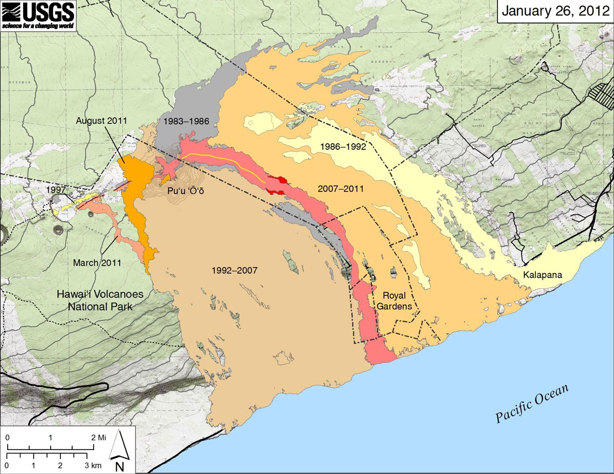
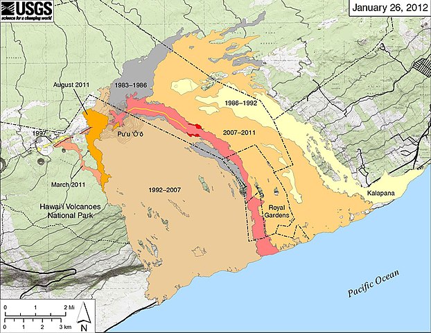
English: map of the Puʻu ʻŌʻō and surrounding area, 1983-2011; active lava flows January 26, 2012 |
| Date | |
| Source | USGS maps |
| Author | United States Geological Survey |
Licensing edit
This image is in the public domain in the United States because it only contains materials that originally came from the United States Geological Survey, an agency of the United States Department of the Interior. For more information, see the official USGS copyright policy.
|
File history
Click on a date/time to view the file as it appeared at that time.
| Date/Time | Thumbnail | Dimensions | User | Comment | |
|---|---|---|---|---|---|
| current | 08:54, 9 February 2017 | | 1,200 × 927 (220 KB) | ThT (talk | contribs) | User created page with UploadWizard |
You cannot overwrite this file.
File usage on Commons
The following page uses this file:
File usage on other wikis
The following other wikis use this file: