File:US 276.svg

Size of this PNG preview of this SVG file: 750 × 600 pixels. Other resolutions: 300 × 240 pixels | 600 × 480 pixels | 960 × 768 pixels | 1,280 × 1,024 pixels | 2,560 × 2,048 pixels.
Original file (SVG file, nominally 750 × 600 pixels, file size: 7 KB)
Captions
Captions
Add a one-line explanation of what this file represents
Summary edit
| Description |
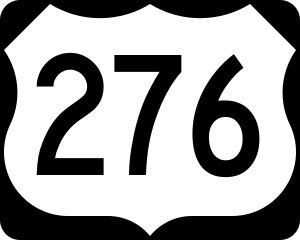
English: 750 mm × 600 mm (30 in × 24 in) U.S. Highway shield, made to the specifications of the 2004 edition of Standard Highway Signs. (Note that there is a missing "J" label on the left side of the diagram.) Uses the Roadgeek 2005 fonts. (United States law does not permit the copyrighting of typeface designs, and the fonts are meant to be copies of a U.S. Government-produced work anyway.) |
| Date | (UTC) |
| Source | 2004 MUTCD Standard Highway Signs |
| Author | Fredddie, originally SPUI |
Licensing edit
This file is in the public domain because it comes from the Manual on Uniform Traffic Control Devices, sign number M1-4, which states specifically on page I-1 that:
|
.svg) |
File history
Click on a date/time to view the file as it appeared at that time.
| Date/Time | Thumbnail | Dimensions | User | Comment | |
|---|---|---|---|---|---|
| current | 01:34, 26 August 2017 | | 750 × 600 (7 KB) | Fredddie (talk | contribs) | |
| 07:59, 27 January 2006 |  | 750 × 600 (4 KB) | SPUI~commonswiki (talk | contribs) | {{spuiother}} 750 mm by 600 mm (30 in by 24 in) U.S. Route shield, made to the specifications of the [http://mutcd.fhwa.dot.gov/SHSm/Guide.pdf 2004 edition of Standard Highway Signs]. (Note that there is a missing "J" label on the left side of the diagram |
You cannot overwrite this file.
File usage on Commons
The following 6 pages use this file:
File usage on other wikis
The following other wikis use this file:
- Usage on bn.wikipedia.org
- Usage on de.wikipedia.org
- Usage on en.wikipedia.org
- Interstate 40
- Greenville County, South Carolina
- Transylvania County, North Carolina
- Haywood County, North Carolina
- Interstate 85
- List of United States Numbered Highways
- Blue Ridge Parkway
- Interstate 385
- U.S. Route 19
- U.S. Route 23
- U.S. Route 25
- Interstate 185 (South Carolina)
- U.S. Route 64
- U.S. Route 74
- U.S. Route 276
- Interstate 277 (North Carolina)
- U.S. Route 64 in North Carolina
- South Carolina Highway 277
- Interstate 85 in South Carolina
- North Carolina Highway 110
- North Carolina Highway 215
- Great Smoky Mountains Expressway
- Interstate 40 in North Carolina
- User:MPD01605/Exit lists
- South Carolina Highway 11
- South Carolina Highway 8
- List of highways numbered 276
- Wikipedia:WikiProject U.S. Roads/Redirects/South Carolina
- Wikipedia:WikiProject U.S. Roads/U.S. Routes/Completion list/102-299
- North Carolina Highway 280
- U.S. Route 25 in South Carolina
- U.S. Route 29 in South Carolina
- U.S. Route 19 in North Carolina
- U.S. Route 23 in North Carolina
- South Carolina Highway 146
- User:Cyndaquazy/South Carolina Highway 417
- South Carolina Highway 417
- South Carolina Highway 291
- South Carolina Highway 253
- South Carolina Highway 274
- North Carolina Highway 275
- User:Tstarl0425/North Greenville Freeway Implementation Project
- User:Niobrara/sandbox
- List of U.S. Highways in South Carolina
- List of U.S. Highways in North Carolina
- List of mountain passes in South Carolina
- Forest Heritage Scenic Byway
- User:Ncchild/Interstate 40
View more global usage of this file.