File:Ulm, Baustelle NBS Wendlingen, 1.jpeg
Size of this preview: 800 × 562 pixels. Other resolutions: 320 × 225 pixels | 640 × 450 pixels | 1,024 × 719 pixels | 1,280 × 899 pixels | 2,560 × 1,799 pixels | 3,712 × 2,608 pixels.
Original file (3,712 × 2,608 pixels, file size: 4.56 MB, MIME type: image/jpeg)
File information
Structured data
Captions
Summary
editDescriptionUlm, Baustelle NBS Wendlingen, 1.jpeg |
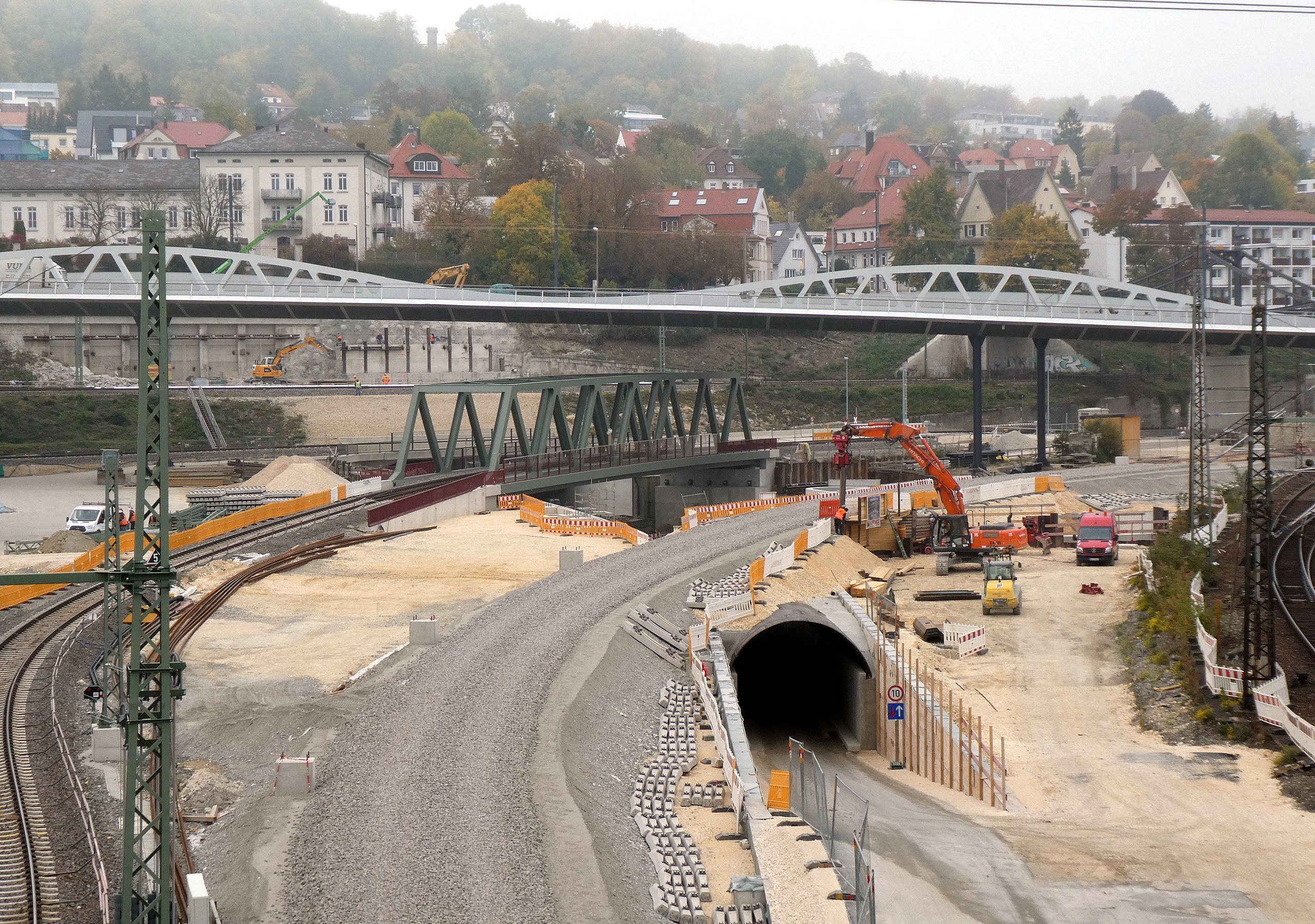
Deutsch: Ulm Hauptbahnhof, Bauarbeiten an der Neubaustrecke nach Wendlingen. Im Hintergrund die Kienlesbergbrücke.
Esperanto: Ulm, ĉefa fervoja stacio, konstrulaboroj pri la nova linio al Wendlingen. Fone la nova trama ponto Kienlesbergbrücke. |
Date | |
Source | Self-photographed |
Author | Renardo la vulpo |
Permission (Reusing this file) |
Renardo la vulpo, the copyright holder of this work, hereby publishes it under the following license: This file is licensed under the Creative Commons Attribution-Share Alike 4.0 International license. Attribution: Renardo la vulpo
|
Camera location | 48° 24′ 10.69″ N, 9° 58′ 56.35″ E | View this and other nearby images on: OpenStreetMap | 48.402970; 9.982320 |
---|
File history
Click on a date/time to view the file as it appeared at that time.
Date/Time | Thumbnail | Dimensions | User | Comment | |
---|---|---|---|---|---|
current | 16:07, 10 October 2018 | 3,712 × 2,608 (4.56 MB) | Renardo la vulpo (talk | contribs) | {{Information |description={{de|1=Ulm Hauptbahnhof, Bauarbeiten an der Neubaustrecke nach Wendlingen. Im Hintergrund die Kienlesbergbrücke.}} {{eo|1=Ulm, ĉefa fervoja stacio, konstrulaboroj pri la nova linio al Wendlingen. Fone la nova trama ponto ''Kienlesbergbrücke''.}} |date= 2018-10-08 |source= {{self-photographed}} |author= {{U|Renardo la vulpo}} |permission= {{self|cc-by-sa-4.0|author=Renardo la vulpo}} |other versions= }} {{Location|48.40297|9.98232|heading:N... |
You cannot overwrite this file.
File usage on Commons
There are no pages that use this file.
Metadata
This file contains additional information such as Exif metadata which may have been added by the digital camera, scanner, or software program used to create or digitize it. If the file has been modified from its original state, some details such as the timestamp may not fully reflect those of the original file. The timestamp is only as accurate as the clock in the camera, and it may be completely wrong.
Camera manufacturer | Panasonic |
---|---|
Camera model | DC-TZ91 |
Exposure time | 1/160 sec (0.00625) |
F-number | f/4.5 |
ISO speed rating | 80 |
Date and time of data generation | 10:32, 8 October 2018 |
Lens focal length | 12.5 mm |
Latitude | 48° 24′ 10.71″ N |
Longitude | 9° 58′ 56.34″ E |
Altitude | 484 meters above sea level |
Orientation | Normal |
Horizontal resolution | 180 dpi |
Vertical resolution | 180 dpi |
Software used | GIMP 2.8.22 |
File change date and time | 17:56, 10 October 2018 |
Y and C positioning | Co-sited |
Exposure Program | Normal program |
Exif version | 2.3 |
Date and time of digitizing | 10:32, 8 October 2018 |
Meaning of each component |
|
Image compression mode | 4 |
APEX exposure bias | 0 |
Maximum land aperture | 4.33984375 APEX (f/4.5) |
Metering mode | Pattern |
Light source | Unknown |
Flash | Flash did not fire, compulsory flash suppression |
DateTime subseconds | 772 |
DateTimeOriginal subseconds | 772 |
DateTimeDigitized subseconds | 772 |
Supported Flashpix version | 1 |
Color space | sRGB |
Sensing method | One-chip color area sensor |
File source | Digital still camera |
Scene type | A directly photographed image |
Custom image processing | Normal process |
Exposure mode | Auto exposure |
White balance | Auto white balance |
Digital zoom ratio | 0 |
Focal length in 35 mm film | 70 mm |
Scene capture type | Standard |
Scene control | None |
Contrast | Normal |
Saturation | Normal |
Sharpness | Normal |
GPS time (atomic clock) | 09:32 |
Receiver status | Measurement in progress |
GPS date | 8 October 2018 |
GPS tag version | 0.0.3.2 |
Image width | 3,712 px |
Image height | 2,784 px |
Name of GPS area | 264 bytes undefined data |