File:Un-qatar.png
Original file (1,905 × 2,859 pixels, file size: 806 KB, MIME type: image/png)
Captions
Captions
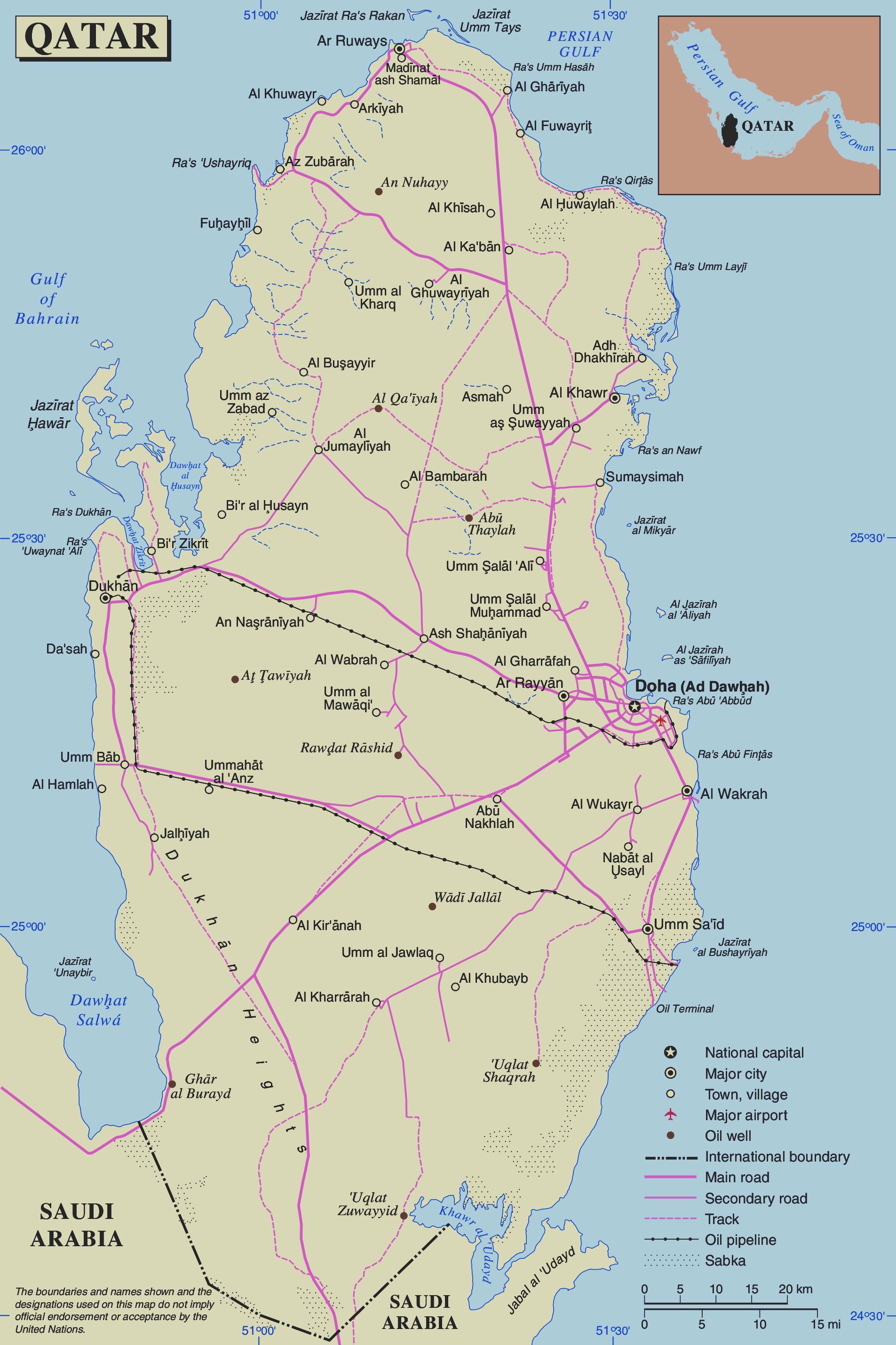
| This image is a map derived from a United Nations map.
Unless stated otherwise, UN maps are to be considered in the public domain. This applies worldwide. UN maps are, in principle, open source material and you can use them in your work or for making your own map. UN requests however that you delete the UN name, logo and reference number upon any modification to the map. Content of your map will be your responsibility. You can state in your publication, if you wish, something like: based on UN map … (map name, map number, revision number and date). See: Geospatial Information Section. And: Geospatial, location data for a better world. |
 |
File history
Click on a date/time to view the file as it appeared at that time.
| Date/Time | Thumbnail | Dimensions | User | Comment | |
|---|---|---|---|---|---|
| current | 17:04, 24 November 2018 | | 1,905 × 2,859 (806 KB) | Sokoljan (talk | contribs) | improved contrast |
| 13:06, 25 April 2011 |  | 1,905 × 2,859 (769 KB) | Ras67 (talk | contribs) | cropped and squeezed | |
| 02:07, 24 October 2007 |  | 1,946 × 2,900 (993 KB) | Jeroen (talk | contribs) | {{UN map}} Category:Maps of Qatar |
You cannot overwrite this file.
File usage on Commons
There are no pages that use this file.
File usage on other wikis
The following other wikis use this file:
- Usage on ar.wikipedia.org
- Usage on az.wikipedia.org
- Usage on ca.wikipedia.org
- Usage on cs.wikipedia.org
- Usage on de.wikipedia.org
- Usage on en.wikipedia.org
- Usage on eo.wikipedia.org
- Usage on fr.wikipedia.org
- Usage on gom.wikipedia.org
- Usage on ja.wikipedia.org
- Usage on nl.wikipedia.org
- Usage on pl.wiktionary.org
- Usage on uk.wikipedia.org
- Usage on vls.wikipedia.org