File:Ushi-jima Island, Shiwaku Islands.jpg

Size of this preview: 628 × 600 pixels. Other resolutions: 251 × 240 pixels | 503 × 480 pixels | 804 × 768 pixels | 1,072 × 1,024 pixels | 1,780 × 1,700 pixels.
Original file (1,780 × 1,700 pixels, file size: 449 KB, MIME type: image/jpeg)
Captions
Captions
Add a one-line explanation of what this file represents
Summary edit
| Description |
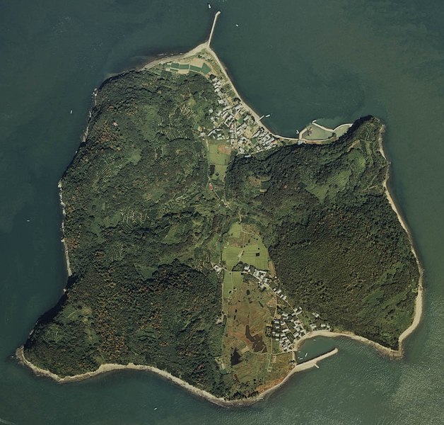
日本語: 香川県丸亀市沖にある牛島全体の空中写真。
|
| Date | |
| Source | 国土画像情報 (カラー空中写真) |
| Author | User:ラハール |
| Permission (Reusing this file) |
©Ministry of Land |
| Camera location | | View this and other nearby images on: OpenStreetMap |
|---|
Licensing edit

|
The copyright holder of this file, the Ministry of Land, Infrastructure, Transport and Tourism of Japan, allows anyone to use it for any purpose, provided that the copyright holder is properly attributed. Redistribution, derivative work, commercial use, and all other use is permitted. |
Attribution:
Copyright © National Land Image Information (Color Aerial Photographs), Ministry of Land, Infrastructure, Transport and Tourism
|
 |
This image is copyrighted by the Ministry of Land, Infrastructure, Transport and Tourism of Japan. For terms of use, see the stipulation to use of National Land Information (in Japanese) and message from MLIT (in Japanese and English). When you display this image on an article, include the following phrase in the description: "Made based on National Land Image Information (Color Aerial Photographs), Ministry of Land, Infrastructure, Transport and Tourism".
|
File history
Click on a date/time to view the file as it appeared at that time.
| Date/Time | Thumbnail | Dimensions | User | Comment | |
|---|---|---|---|---|---|
| current | 19:43, 21 December 2011 | | 1,780 × 1,700 (449 KB) | ラハール (talk | contribs) | {{Information |Description={{ja|1=香川県丸亀市沖にある牛島全体の空中写真。 ; 撮影詳細 * 空中写真の北方向: 5px| * 整理番号: CSI-80-1 * 撮影年度: 昭和55年度 (1980年度) * 地区名:高松 * |
You cannot overwrite this file.
File usage on Commons
The following 2 pages use this file:
File usage on other wikis
The following other wikis use this file:
- Usage on www.wikidata.org