File:Ushirotateyama-map 01.png
Size of this preview: 277 × 599 pixels. Other resolutions: 111 × 240 pixels | 341 × 738 pixels.
Original file (341 × 738 pixels, file size: 546 KB, MIME type: image/png)
Captions
Captions
Add a one-line explanation of what this file represents
Summary edit
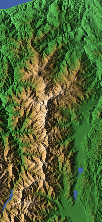
| Description |
English: Topographic map of the Ushirotateyama Mountains in Japan
|
||||||||
| Date | 6 December 2008 (upload date) | ||||||||
| Source | Own work | ||||||||
| Author | Σ64 | ||||||||
| Permission (Reusing this file) |
|

File history
Click on a date/time to view the file as it appeared at that time.
| Date/Time | Thumbnail | Dimensions | User | Comment | |
|---|---|---|---|---|---|
| current | 09:51, 6 December 2008 | | 341 × 738 (546 KB) | Σ64 (talk | contribs) | {{Information| |Source=own work |Description={{ja|後立山連峰のCG画像。[http://www.kashmir3d.com/ カシミール3D]を使用し作成。編集。}}{{en|Map of Ushirotateyama-peaks (後立山連峰 ''Ushiro-tateyama-rempō' |
You cannot overwrite this file.
File usage on Commons
The following 2 pages use this file:
File usage on other wikis
The following other wikis use this file:
- Usage on ja.wikipedia.org
- Usage on www.wikidata.org
- Usage on zh.wikipedia.org