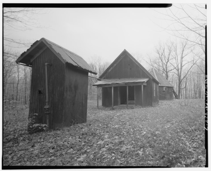
File:VIEW WEST, SOUTH PENN POWERHOUSE, (FROM LEFT) BLEEDER SHED, ENGINE HOUSE, BELT SHED, ECCENTRIC HOUSE. - South Penn Oil Company, G. M. Mead Lot 492 Lease, Morrison Run Field, HAER PA,62-CLAR.V,1-7.tif

Size of this JPG preview of this TIF file: 743 × 600 pixels. Other resolutions: 298 × 240 pixels | 595 × 480 pixels | 952 × 768 pixels | 1,269 × 1,024 pixels | 2,538 × 2,048 pixels | 5,000 × 4,035 pixels.
Original file (5,000 × 4,035 pixels, file size: 19.24 MB, MIME type: image/tiff)
Captions
Captions
Add a one-line explanation of what this file represents
Summary edit
| VIEW WEST, SOUTH PENN POWERHOUSE, (FROM LEFT) BLEEDER SHED, ENGINE HOUSE, BELT SHED, ECCENTRIC HOUSE. - South Penn Oil Company, G. M. Mead Lot 492 Lease, Morrison Run Field, Clarendon, Warren County, PA | ||||
|---|---|---|---|---|
| Photographer |
Nicely, John, creator |
|||
| Title |
VIEW WEST, SOUTH PENN POWERHOUSE, (FROM LEFT) BLEEDER SHED, ENGINE HOUSE, BELT SHED, ECCENTRIC HOUSE. - South Penn Oil Company, G. M. Mead Lot 492 Lease, Morrison Run Field, Clarendon, Warren County, PA |
|||
| Description |
Drake, Edwin; South Penn Oil Company; Pennzoil Company; Titusville Iron Company; West Virginia University Institute for the History of Technology and Industrial Archaeology, sponsor; Allegheny National Forest, sponsor; Southwestern Pennsylvania Heritage Preservation Commission, sponsor; Marston, Christopher H, project manager; Elmer, Eric, field team project manager; Christianson, Justine, transmitter; Caplinger, Michael, historian; Lapins, Arturs, delineator; Boxley, Paul, delineator; Daley, Scott, delineator; Hurst, Kara, delineator; McClung, Kevin, delineator; Nicely, John T, photographer |
|||
| Depicted place | Pennsylvania; Warren County; Clarendon | |||
| Date | 1996 | |||
| Dimensions | 4 x 5 in. | |||
| Current location |
Library of Congress Prints and Photographs Division Washington, D.C. 20540 USA http://hdl.loc.gov/loc.pnp/pp.print |
|||
| Accession number |
HAER PA,62-CLAR.V,1-7 |
|||
| Credit line |
|
|||
| Notes |
|
|||
| Source | https://www.loc.gov/pictures/item/pa3553.photos.360894p | |||
| Permission (Reusing this file) |
|
|||

File history
Click on a date/time to view the file as it appeared at that time.
| Date/Time | Thumbnail | Dimensions | User | Comment | |
|---|---|---|---|---|---|
| current | 03:35, 1 August 2014 |  | 5,000 × 4,035 (19.24 MB) | Fæ (talk | contribs) | GWToolset: Creating mediafile for Fæ. HABS 31 July 2014 (3000:3200) |
You cannot overwrite this file.
File usage on Commons
The following page uses this file: