File:VIEWtiful Place.jpg

Size of this preview: 800 × 585 pixels. Other resolutions: 320 × 234 pixels | 640 × 468 pixels | 1,024 × 749 pixels | 1,280 × 936 pixels | 2,560 × 1,872 pixels | 3,990 × 2,918 pixels.
Original file (3,990 × 2,918 pixels, file size: 6.1 MB, MIME type: image/jpeg)
Captions
Captions
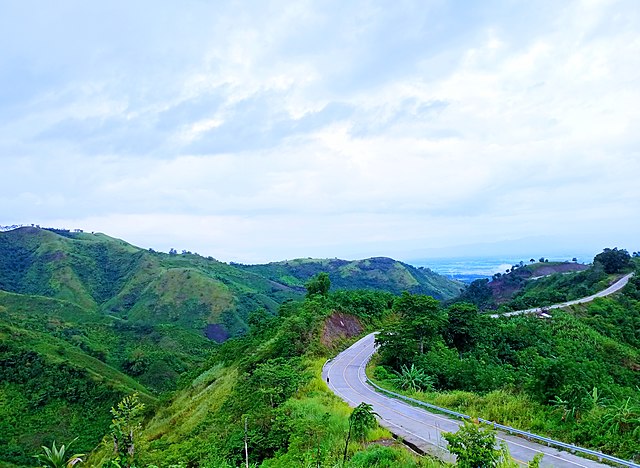
An open road with a astounding panorama of the mountains at Palavilla, Lutayan, Sultan Kudarat. 🌄✨
Summary edit
| Description |
English: This is the top view of the mountains at Palavilla, Lutayan, Sultan Kudarat. Palavilla is a barangay in the municipality of Lutayan, in the province of Sultan Kudarat. It is a long road going up before you will see the beautiful view of mountains where you can feel peace and fresh air. |
| Date | |
| Source | Own work |
| Author | Cjsanpedro0327 |
| Camera location | | View this and other nearby images on: OpenStreetMap |
|---|
Licensing edit
I, the copyright holder of this work, hereby publish it under the following license:
This file is licensed under the Creative Commons Attribution-Share Alike 4.0 International license.
- You are free:
- to share – to copy, distribute and transmit the work
- to remix – to adapt the work
- Under the following conditions:
- attribution – You must give appropriate credit, provide a link to the license, and indicate if changes were made. You may do so in any reasonable manner, but not in any way that suggests the licensor endorses you or your use.
- share alike – If you remix, transform, or build upon the material, you must distribute your contributions under the same or compatible license as the original.
This image was uploaded as part of Wiki Loves Earth 2021.
|
 |
File history
Click on a date/time to view the file as it appeared at that time.
| Date/Time | Thumbnail | Dimensions | User | Comment | |
|---|---|---|---|---|---|
| current | 05:14, 15 May 2021 | | 3,990 × 2,918 (6.1 MB) | Cjsanpedro0327 (talk | contribs) | Uploaded own work with UploadWizard |
You cannot overwrite this file.
File usage on Commons
The following 2 pages use this file:
File usage on other wikis
The following other wikis use this file:
- Usage on ar.wikipedia.org
- Usage on azb.wikipedia.org
- Usage on bcl.wikipedia.org
- Usage on cbk-zam.wikipedia.org
- Usage on en.wikipedia.org
- Usage on es.wikipedia.org
- Usage on id.wikipedia.org
- Usage on ms.wikipedia.org
- Usage on no.wikipedia.org
- Usage on os.wikipedia.org
- Usage on pag.wikipedia.org
- Usage on pam.wikipedia.org
- Usage on pt.wikipedia.org
- Usage on ru.wikipedia.org
- Usage on tl.wikipedia.org
- Usage on uk.wikipedia.org
- Usage on vi.wikipedia.org
- Usage on www.wikidata.org