File:Vancouver-island-lambert-azimuthal.png
Vancouver-island-lambert-azimuthal.png (514 × 411 pixels, file size: 13 KB, MIME type: image/png)
Captions
Captions
Transferred from en.wikipedia to Commons by Maksim.
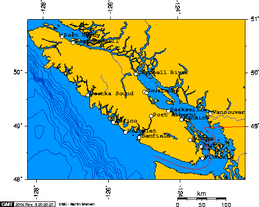
Cities of Vancouver Island

|
Permission is granted to copy, distribute and/or modify this document under the terms of the GNU Free Documentation License, Version 1.2 or any later version published by the Free Software Foundation; with no Invariant Sections, no Front-Cover Texts, and no Back-Cover Texts. A copy of the license is included in the section entitled GNU Free Documentation License. |
| This file is licensed under the Creative Commons Attribution-Share Alike 3.0 Unported license. | ||
| ||
| This licensing tag was added to this file as part of the GFDL licensing update. |
| I, the copyright holder of this work, release this work into the public domain. This applies worldwide. In some countries this may not be legally possible; if so: I grant anyone the right to use this work for any purpose, without any conditions, unless such conditions are required by law. |
Created using this online map creation archive copy at the Wayback Machine tool.
The longitude and latitude of the Cities, as used to create this map, follow:
- -127.4193,50.6949,Port Hardy
- -123.3655,48.4286,Victoria
- -124.8055,49.2339,Port Alberni
- -123.9378,49.1638,Nanaimo
- -123.7079,48.7787,Duncan
- -125.8813,49.1140,Tofino
- -125.5339,48.9273,Ucluelet
- -126.6265,49.6170,Nootka Sound
- -123.1136,49.2618,Vancouver
- -127.0848,50.5901,Port McNeill
- -125.2454,50.0231,Campbell River
- -124.3150,49.3187,Parksville
- -124.9927,49.6869,Courtenay
- -124.9283,49.6729,Comox
- -125.1426,48.8334,Bamfield
- -123.3986,48.6506,Sidney
| date/time | username | edit summary |
|---|---|---|
| 02:00, 1 December 2005 | en:User:Skookum1 | |
| 16:08, 4 November 2004 | en:User:Zigger | (Disambiguated <a href="/wiki/Victoria" title="Victoria">Victoria</a>.) |
| 19:28, 3 November 2004 | en:User:Geo Swan | (added longitude and latitude of the cities) |
| 18:30, 3 November 2004 | en:User:Geo Swan | (Cities of Vancouver Island) |
Politically neutral version: File:Vancouver-island-lambert-azimuthal-without-border.png
Original upload log edit
Legend: (cur) = this is the current file, (del) = delete this old version, (rev) = revert to this old version.
Click on date to download the file or see the image uploaded on that date.
- (del) (cur) 19:23, 3 November 2004 . . en:User:Geo_Swan Geo Swan ( en:User_talk:Geo_Swan Talk) . . 514x411 (13119 bytes) (Cities of Vancouver Island)
- (del) (rev) 18:46, 3 November 2004 . . en:User:Geo_Swan Geo Swan ( en:User_talk:Geo_Swan Talk) . . 514x411 (13052 bytes) (Cities of Vancouver Island)
- (del) (rev) 18:30, 3 November 2004 . . en:User:Geo_Swan Geo Swan ( en:User_talk:Geo_Swan Talk) . . 514x411 (12923 bytes) (Cities of Vancouver Island)
File history
Click on a date/time to view the file as it appeared at that time.
| Date/Time | Thumbnail | Dimensions | User | Comment | |
|---|---|---|---|---|---|
| current | 18:59, 18 March 2006 | | 514 × 411 (13 KB) | Maksim (talk | contribs) | La bildo estas kopiita de wikipedia:en. La originala priskribo estas: Cities of Vancouver Island {{GFDL-small}} Created using this [http://www.aquarius.geomar.de/omc/ online map creation] tool. The longitude and latitude of the Cities, as used to crea |
You cannot overwrite this file.
File usage on Commons
There are no pages that use this file.
File usage on other wikis
The following other wikis use this file:
- Usage on ar.wikipedia.org
- Usage on ba.wikipedia.org
- Usage on en.wikipedia.org
- Usage on eo.wikipedia.org
- Usage on nn.wikipedia.org
- Usage on ru.wikipedia.org