File:Varhely terkep anno1880.jpg

Original file (2,400 × 1,800 pixels, file size: 2.97 MB, MIME type: image/jpeg)
Captions
Captions
Summary edit
| Description |
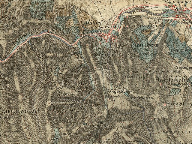
Magyar: A Várhely/Burgstall (Sopron, Magyarország) és környéke Magyarország harmadik katonai felmérésének térképén.
English: Burgstall/Várhely (Sopron, Hungary) and the surrounding area on map of 3rd Military Mapping Survey of Austria-Hungary
Deutsch: Burgstall/Várhely (Sopron, Ungarn) und Umgebung. Landesaufnahme der österreichisch-ungarischen Monarchie. |
| Date | |
| Source |
This file was derived from: Aufnahmeblatt 4957-1 Mattersdorf, Agendorf, Sieggraben, Ödenburg.jpg:  |
| Author |
|
| Permission (Reusing this file) |
historisches amtliches Werk aus dem 19. Jahrhundert, freies Werk |
Licensing edit
- original:
|
This work is in the public domain in its country of origin and other countries and areas where the copyright term is the author's life plus 70 years or fewer.
| |
| This file has been identified as being free of known restrictions under copyright law, including all related and neighboring rights. | |
- derivated:
| I, the copyright holder of this work, release this work into the public domain. This applies worldwide. In some countries this may not be legally possible; if so: I grant anyone the right to use this work for any purpose, without any conditions, unless such conditions are required by law. |
| Annotations | This image is annotated: View the annotations at Commons |
File history
Click on a date/time to view the file as it appeared at that time.
| Date/Time | Thumbnail | Dimensions | User | Comment | |
|---|---|---|---|---|---|
| current | 16:56, 17 May 2016 | | 2,400 × 1,800 (2.97 MB) | Fizped (talk | contribs) | {{LargeImage}} {{Information |Description= {{hu|1=A Várhely/Burgstall (Sopron, Magyarország) és környéke Magyarország harmadik katonai felmérésének térképén.}} {{en|1=Burgstall/Várhely (Sopron, Hungary) and the surrounding area on map of 3... |
You cannot overwrite this file.
File usage on Commons
The following 2 pages use this file:
File usage on other wikis
The following other wikis use this file:
- Usage on hu.wikipedia.org