File:Venezuela Guyana dispute with Stabroek Block.png

Size of this preview: 776 × 600 pixels. Other resolutions: 311 × 240 pixels | 621 × 480 pixels | 994 × 768 pixels | 1,280 × 989 pixels | 2,560 × 1,978 pixels | 7,920 × 6,120 pixels.
Original file (7,920 × 6,120 pixels, file size: 1,021 KB, MIME type: image/png)
Captions
Captions
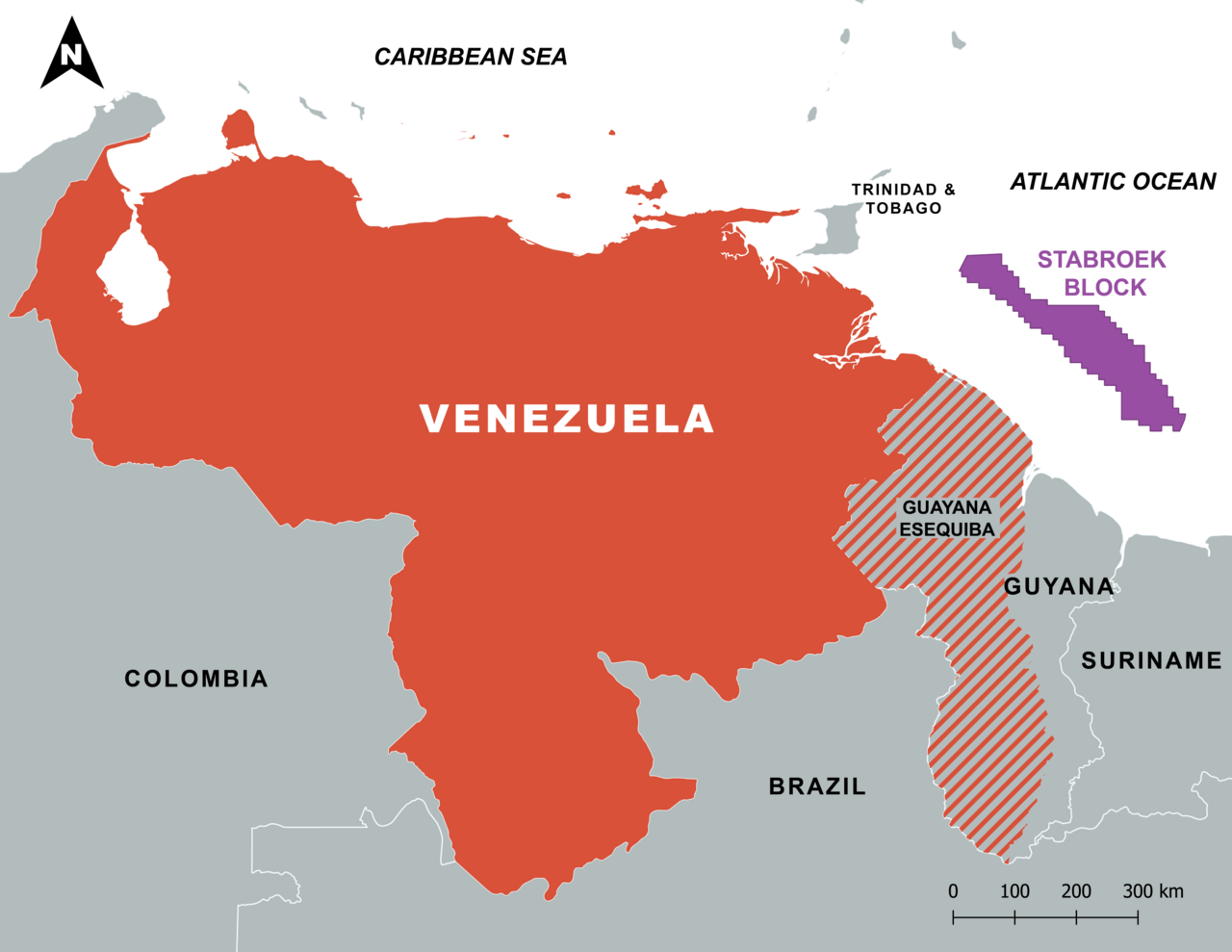
This is a detailed map illustrating the boundaries of the Guayana Esequiba region.
Summary edit
| Description |
English: This is a detailed map illustrating the boundaries of the Guayana Esequiba region. Additionally, the geographical position of the Stabroek oil block is distinctly marked. This map shows the Surinamese POV of the borders. |
| Date | |
| Source | Own work |
| Author | SurinameCentral |
Licensing edit
I, the copyright holder of this work, hereby publish it under the following license:
This file is licensed under the Creative Commons Attribution-Share Alike 4.0 International license.
- You are free:
- to share – to copy, distribute and transmit the work
- to remix – to adapt the work
- Under the following conditions:
- attribution – You must give appropriate credit, provide a link to the license, and indicate if changes were made. You may do so in any reasonable manner, but not in any way that suggests the licensor endorses you or your use.
- share alike – If you remix, transform, or build upon the material, you must distribute your contributions under the same or compatible license as the original.
File history
Click on a date/time to view the file as it appeared at that time.
| Date/Time | Thumbnail | Dimensions | User | Comment | |
|---|---|---|---|---|---|
| current | 21:53, 29 April 2024 | | 7,920 × 6,120 (1,021 KB) | SurinameCentral (talk | contribs) | Uploaded own work with UploadWizard |
You cannot overwrite this file.
File usage on Commons
There are no pages that use this file.