File:View across the Missouri River at New Town, North Dakota- Fort Berthold.JPG
No higher resolution available.
View_across_the_Missouri_River_at_New_Town,_North_Dakota-_Fort_Berthold.JPG (640 × 480 pixels, file size: 56 KB, MIME type: image/jpeg)
Captions
Captions
Add a one-line explanation of what this file represents
Summary edit
| Object location | | View this and other nearby images on: OpenStreetMap |
|---|
| Description |
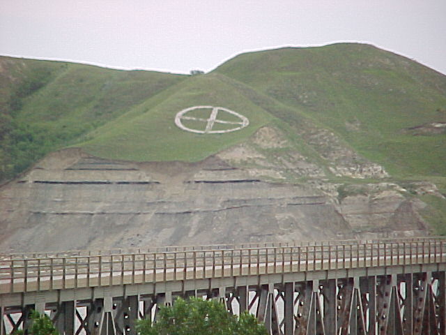
English: A view looking eastward across the Missouri River at New Town North Dakota. The land belongs to the Three Affiliated Tribes, the Mandan, Hidatsa, and Arikara Nation |
| Date | |
| Source | Own work |
| Author | M. Readey |
Licensing edit
I, the copyright holder of this work, hereby publish it under the following license:
This file is licensed under the Creative Commons Attribution-Share Alike 3.0 Unported license.
- You are free:
- to share – to copy, distribute and transmit the work
- to remix – to adapt the work
- Under the following conditions:
- attribution – You must give appropriate credit, provide a link to the license, and indicate if changes were made. You may do so in any reasonable manner, but not in any way that suggests the licensor endorses you or your use.
- share alike – If you remix, transform, or build upon the material, you must distribute your contributions under the same or compatible license as the original.
File history
Click on a date/time to view the file as it appeared at that time.
| Date/Time | Thumbnail | Dimensions | User | Comment | |
|---|---|---|---|---|---|
| current | 21:45, 15 January 2012 | | 640 × 480 (56 KB) | Circa24 (talk | contribs) |
You cannot overwrite this file.
File usage on Commons
There are no pages that use this file.