File:View of Harbour and Town of Çeşme (Chesme), from Admiralty Chart No 1635, Surveyed 1837.jpg
Size of this preview: 800 × 133 pixels. Other resolutions: 320 × 53 pixels | 2,171 × 361 pixels.
Original file (2,171 × 361 pixels, file size: 142 KB, MIME type: image/jpeg)
Captions
Captions
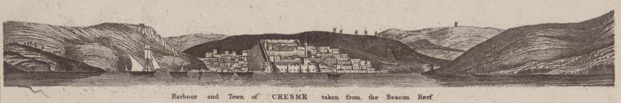
View of Harbour and Town of Çeşme, Turkey, in 1837
Summary edit
,_from_Admiralty_Chart_No_1635,_Surveyed_1837.jpg&action=edit§ion=1)
| Description |
English: View of Harbour and Town of Çeşme (Chesme), Turkey, from Admiralty Chart No 1635, Surveyed by Thomas Graves in 1837 |
| Date | |
| Source | Cropped from File:Admiralty Chart No 1635 Plans of anchorages in the Strait of Khios (Chios), Published 1897.jpg |
| Author | Thomas Graves (1802-1856) |
Licensing edit
,_from_Admiralty_Chart_No_1635,_Surveyed_1837.jpg&action=edit§ion=2)
This work created by the United Kingdom Government is in the public domain.
This is because it is one of the following:
HMSO has declared that the expiry of Crown Copyrights applies worldwide (ref: HMSO Email Reply)
|
 |
File history
Click on a date/time to view the file as it appeared at that time.
| Date/Time | Thumbnail | Dimensions | User | Comment | |
|---|---|---|---|---|---|
| current | 09:36, 10 January 2020 | 2,171 × 361 (142 KB) | Kognos (talk | contribs) | User created page with UploadWizard |
You cannot overwrite this file.
File usage on Commons
There are no pages that use this file.
File usage on other wikis
The following other wikis use this file:
- Usage on en.wikipedia.org
,_from_Admiralty_Chart_No_1635,_Surveyed_1837.jpg&oldid=871520153)