File:Viimsi-Juminda.svg

Size of this PNG preview of this SVG file: 800 × 494 pixels. Other resolutions: 320 × 198 pixels | 640 × 395 pixels | 1,024 × 633 pixels | 1,280 × 791 pixels | 2,560 × 1,582 pixels.
Original file (SVG file, nominally 971 × 600 pixels, file size: 270 KB)
Captions
Captions
Add a one-line explanation of what this file represents
Summary edit
| Description |
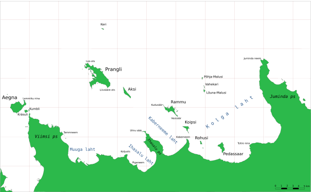
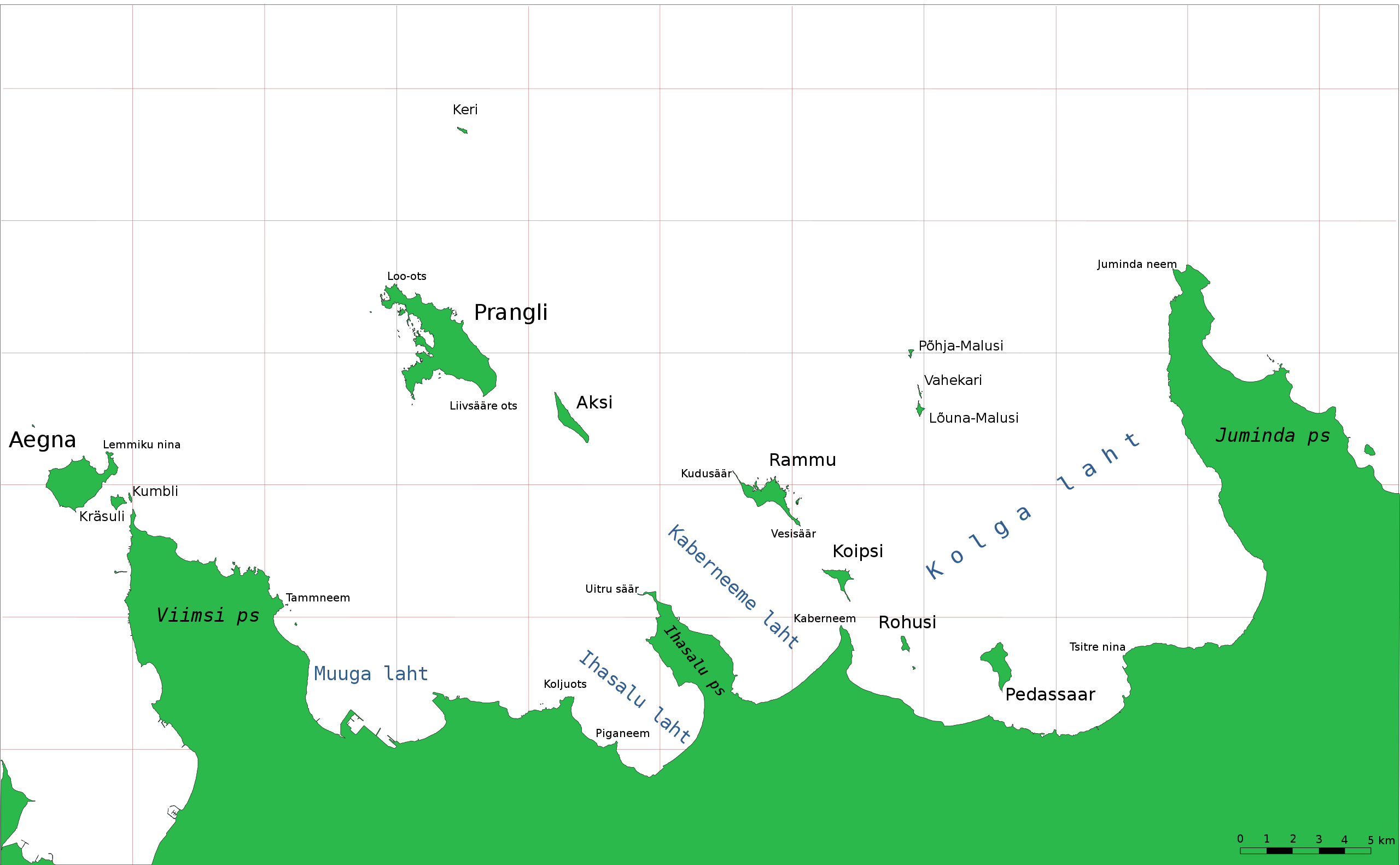
English: Viimsi-Juminda coastline, Estonia |
| Date | |
| Source | Own work |
| Author | WikedKentaur |
Licensing edit

|
This map uses administrative map from Estonian Land Board (01.01.2006) as its data source. Reproduction is authorised, provided the data source is acknowledged and validity date is provided.
Eesti: Andmete kasutamisel tuleb viitena ära märkida andmeallikana Maa-amet ning viidata andmete seisule.
|
File history
Click on a date/time to view the file as it appeared at that time.
| Date/Time | Thumbnail | Dimensions | User | Comment | |
|---|---|---|---|---|---|
| current | 10:01, 8 April 2006 | | 971 × 600 (270 KB) | Wkentaur (talk | contribs) | |
| 19:50, 7 April 2006 |  | 971 × 600 (268 KB) | Wkentaur (talk | contribs) | Viimsi-Juminda coastline, Estonia {{EST-Land Board|01.01.2006}} Category:Maps of Estonia |
You cannot overwrite this file.
File usage on Commons
There are no pages that use this file.
File usage on other wikis
The following other wikis use this file:
- Usage on az.wikipedia.org
- Usage on da.wikipedia.org
- Usage on de.wikipedia.org
- Usage on en.wikipedia.org
- Usage on et.wikipedia.org
- Usage on fi.wikipedia.org
- Usage on fr.wikipedia.org
- Usage on nl.wikipedia.org
- Usage on pt.wikipedia.org
- Usage on ru.wikipedia.org
- Usage on sv.wikipedia.org