File:VillaLiebenstein2.jpg
Size of this preview: 415 × 599 pixels. Other resolutions: 166 × 240 pixels | 332 × 480 pixels | 532 × 768 pixels | 709 × 1,024 pixels | 2,273 × 3,283 pixels.
Original file (2,273 × 3,283 pixels, file size: 1.55 MB, MIME type: image/jpeg)
Captions
Captions
Add a one-line explanation of what this file represents
| Description |
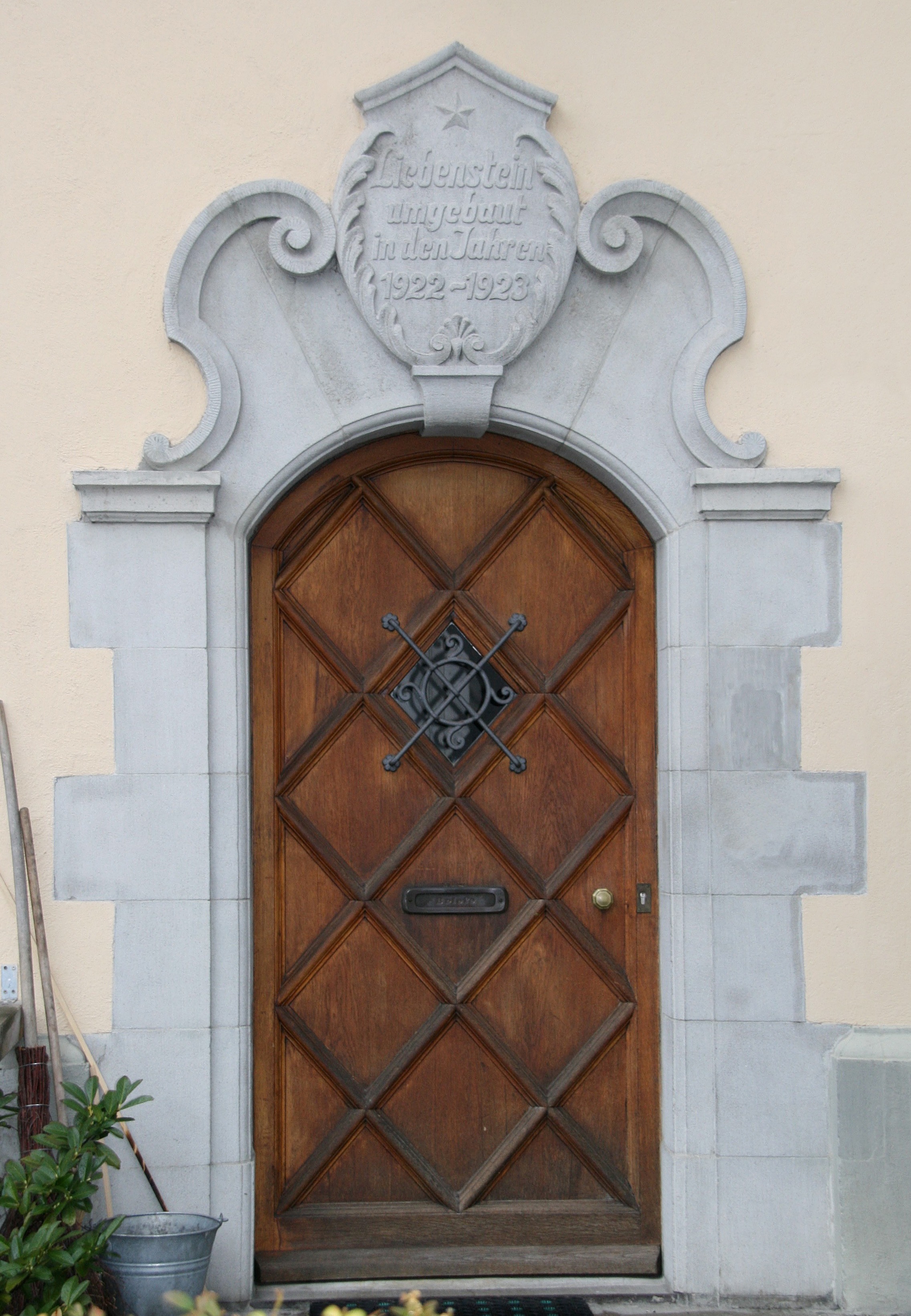
Deutsch: aus dem DEHIO Vorarlberg 1983: (Römerstrasse) Arlbergstrasse Nr.66: Villa Liebenstein, in spitzwinkeligem Zwickel zwischen Arlbergstraße und Riedergasse. Späthistoristisch, von Johann Anton Tscharner, 1915 Umbau durch Ziegler, 1922 durch Palmer. Besonderer Repräsentationskarakter durch neobarocke Formen, Mansardwalmdach, Straßenseitig 8 Fensterachsen, Dacherker mit Rundbogenschluß, Gaupen. Eingang schmalseitig mit als Balkon dienender Verdachung, originale Parkanlage mit Einfriedung. *** Quelle 2: Vermutlicher Erbauer: Freiherr Gustav Adolf von Liebenstein, k.k. Leutnant und Gutsbesitzer in Rieden. Ab 1880 Handelsschule des Direktors Alwin Hauser, 1910 im Besitz der Familie Schoeller. Nach dem Zweiten Weltkrieg: Dienststelle der französischen Besatzungsmacht. 1953 trat Rudolf Schoeller die Villa an die Wollgarnspinnerei Schoeller Ges.m.b.H. ab. Seit 1982 im Besitz der Stadt Bregenz. *** in Bregenz, Vorarlberg.
|
| Date | |
| Source | Own work |
| Author | böhringer friedrich |
| Permission (Reusing this file) |
I, the copyright holder of this work, hereby publish it under the following license: This file is licensed under the Creative Commons Attribution-Share Alike 2.5 Generic license.
|
| Other versions |
|


| Object location | | View this and other nearby images on: OpenStreetMap |
|---|
This Photo was taken by Böhringer Friedrich.
|
Feel free to use my photos, but please mention me as the author and if you want send me a message. or (rufre@lenz-nenning.at) |
Quelle: Dehio Vorarlberg Quelle2: http://www.bregenz.at
File history
Click on a date/time to view the file as it appeared at that time.
| Date/Time | Thumbnail | Dimensions | User | Comment | |
|---|---|---|---|---|---|
| current | 20:18, 29 February 2008 | | 2,273 × 3,283 (1.55 MB) | Böhringer (talk | contribs) | {{Information |Description= {{de| '''aus dem DEHIO Vorarlberg 1983:''' (Römerstrasse) Arlbergstrasse Nr.66: Villa Liebenstein, in spitzwinkeligem Zwickel zwischen Arlbergstraße und Riedergasse. Späthistoristisch, von [ |
You cannot overwrite this file.
File usage on Commons
The following 6 pages use this file: