File:Viperisland.jpg

No higher resolution available.
Viperisland.jpg (413 × 343 pixels, file size: 100 KB, MIME type: image/jpeg)
Captions
Captions
Add a one-line explanation of what this file represents
Summary edit
| Description |
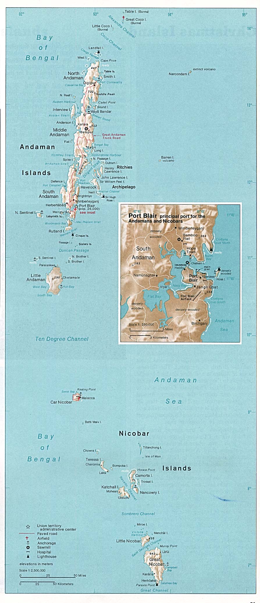
English: Location of Viper Island, Andaman Islands
Deutsch: Lage der Vipern-Insel, Andamanen |
|||||||||
| Date | ||||||||||
| Source | http://www.lib.utexas.edu/maps/islands_oceans_poles/andaman_nicobar_76.jpg | |||||||||
| Creator |
Taken from Perry-Castañeda Library (PCL) of the Texas University (Austin), originally from CIA Indian Ocean Atlas |
|||||||||
| Permission (Reusing this file) |
It qualifies to the rules stated at http://www.lib.utexas.edu/usage_statement.html | |||||||||
| Geotemporal data | ||||||||||
| Bounding box |
|
|||||||||
| Georeferencing | ||||||||||
| Other versions | http://commons.wikimedia.org/wiki/Image:Andaman_nicobar_76.jpg | |||||||||
Licensing edit
| This image is a work of a Central Intelligence Agency employee, taken or made as part of that person's official duties. As a Work of the United States Government, this image or media is in the public domain in the United States.
|

|
File history
Click on a date/time to view the file as it appeared at that time.
| Date/Time | Thumbnail | Dimensions | User | Comment | |
|---|---|---|---|---|---|
| current | 12:32, 14 October 2008 | | 413 × 343 (100 KB) | Ulrich Kaden (talk | contribs) | {{Information |Description={{en|1=Viper Island}} {{de|1=Vipern-Insel}} |Source=http://www.lib.utexas.edu/maps/islands_oceans_poles/andaman_nicobar_76.jpg |Author=CIA / University of Texas |Date=1976 |Permission= |other_versions=http://commons.wikimedia.or |
You cannot overwrite this file.
File usage on Commons
The following page uses this file:
File usage on other wikis
The following other wikis use this file:
- Usage on ceb.wikipedia.org
- Usage on de.wikipedia.org
- Usage on nl.wikipedia.org
- Usage on sv.wikipedia.org
- Usage on www.wikidata.org