File:WA18 topo map 1948.jpg
No higher resolution available.
WA18_topo_map_1948.jpg (436 × 508 pixels, file size: 302 KB, MIME type: image/jpeg)
Captions
Captions
Add a one-line explanation of what this file represents
Summary edit
| Description |
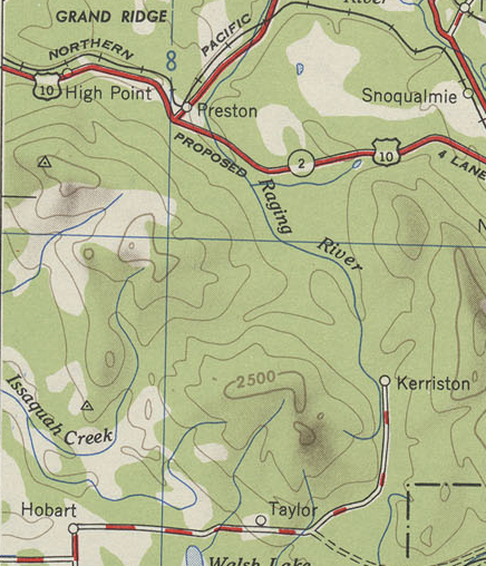
English: A zoomed in section of the 1948 Wenatchee USACE Topographic map, focusing on the area around Tiger Mountain.
Scale 1:250,000. Full map: http://www.lib.utexas.edu/maps/topo/250k/txu-pclmaps-topo-us-wenatchee-1948.jpg |
| Date | |
| Source | United States Army Corps of Engineers |
| Author | U.S. Army Map Service |
Licensing edit
This image or file is a work of a U.S. Army Corps of Engineers soldier or employee, taken or made as part of that person's official duties. As a work of the U.S. federal government, the image is in the public domain.
|
File history
Click on a date/time to view the file as it appeared at that time.
| Date/Time | Thumbnail | Dimensions | User | Comment | |
|---|---|---|---|---|---|
| current | 21:32, 21 July 2009 | | 436 × 508 (302 KB) | Admrboltz (talk | contribs) | {{Information |Description={{en|1=A zoomed in section of the 1948 Wenatchee USACE Topographic map, focusing on the area around Tiger Mountain. Scale 1:250,000}} |Source=United States Army Corps of Engineers |Au |
You cannot overwrite this file.
File usage on Commons
There are no pages that use this file.