File:Wadley, Alabama Railroad Depot.JPG

Size of this preview: 800 × 572 pixels. Other resolutions: 320 × 229 pixels | 640 × 457 pixels | 1,024 × 732 pixels | 1,280 × 915 pixels | 2,560 × 1,830 pixels | 4,013 × 2,868 pixels.
Original file (4,013 × 2,868 pixels, file size: 5.01 MB, MIME type: image/jpeg)
Captions
Captions
Add a one-line explanation of what this file represents
|
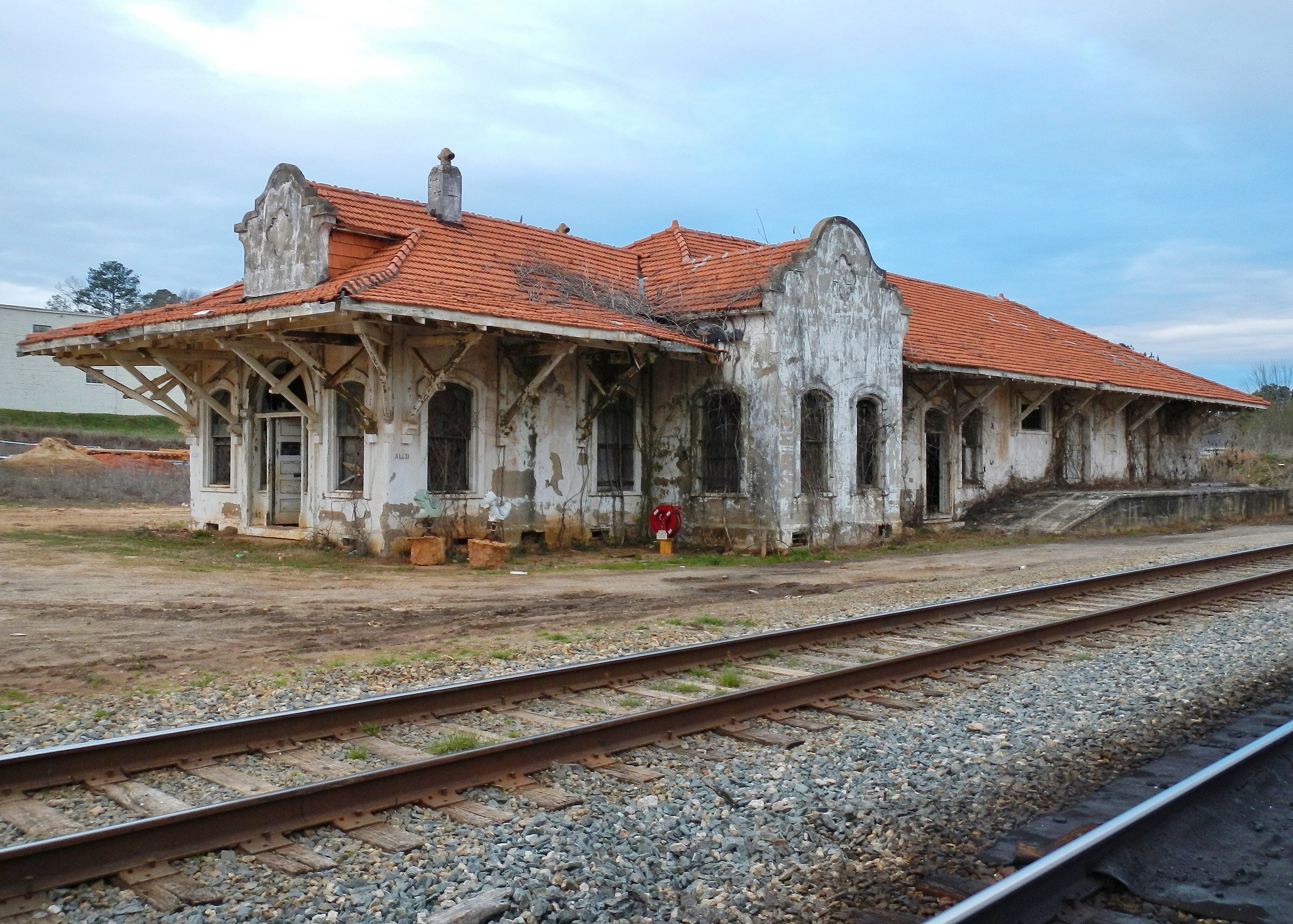
This is an image of a place or building that is listed on the National Register of Historic Places in the United States of America. Its reference number is 11000428. |
Summary edit
| Description |
English: This is a photograph of the Wadley Railroad Depot in Wadley, Alabama. It was added to the National Register of Historic Places on July 14, 2011. |
||
| Date | |||
| Source | Own work | ||
| Author | Rivers Langley; SaveRivers | ||
| Permission (Reusing this file) |
I, the copyright holder of this work, hereby publish it under the following licenses: This file is licensed under the Creative Commons Attribution-Share Alike 3.0 Unported license.
You may select the license of your choice. |

| Camera location | | View this and other nearby images on: OpenStreetMap |
|---|
File history
Click on a date/time to view the file as it appeared at that time.
| Date/Time | Thumbnail | Dimensions | User | Comment | |
|---|---|---|---|---|---|
| current | 23:50, 13 February 2012 | | 4,013 × 2,868 (5.01 MB) | SaveRivers (talk | contribs) | {{Information |Description ={{en|1=This is a photograph of the Wadley Railroad Depot in Wadley, Alabama. It was added to the National Register of Historic Places on July 14, 2011.}} |Source ={{own}} |Author =Rivers Langley; [[User:SaveR |
You cannot overwrite this file.
File usage on Commons
There are no pages that use this file.
File usage on other wikis
The following other wikis use this file:
- Usage on de.wikipedia.org
- Usage on en.wikipedia.org
- Usage on fa.wikipedia.org
- Usage on uk.wikipedia.org