File:Wallis islands map DE.svg

Size of this PNG preview of this SVG file: 531 × 600 pixels. Other resolutions: 212 × 240 pixels | 425 × 480 pixels | 680 × 768 pixels | 907 × 1,024 pixels | 1,813 × 2,048 pixels | 1,082 × 1,222 pixels.
Original file (SVG file, nominally 1,082 × 1,222 pixels, file size: 356 KB)
Captions
Captions
Add a one-line explanation of what this file represents
Summary edit
| Description |
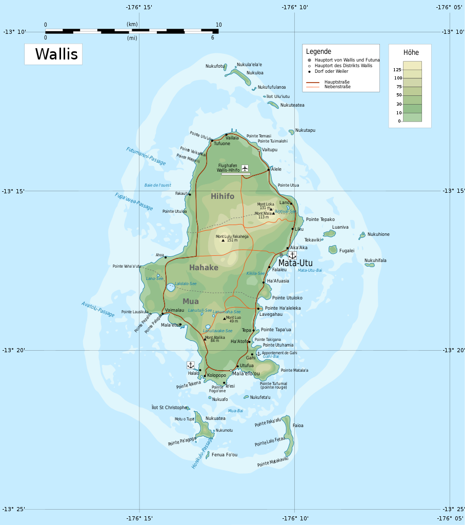
Deutsch: Karte der Insel Wallis. Français : Carte de Wallis (version allemande). Русский: Топографическая карта островов Уоллис Македонски: Топографска карта островот Валис со придружните острови, дел од земјата Валис и Футуна. |
| Date | |
| Source |
This file was derived from: Wallis islands map RU.svg |
| Author |
|
| Permission (Reusing this file) |
I, the copyright holder of this work, hereby publish it under the following license: This file is licensed under the Creative Commons Attribution-Share Alike 3.0 Unported license.
|
| Other versions |
|


.svg)
File history
Click on a date/time to view the file as it appeared at that time.
| Date/Time | Thumbnail | Dimensions | User | Comment | |
|---|---|---|---|---|---|
| current | 16:16, 5 January 2020 | | 1,082 × 1,222 (356 KB) | Furfur (talk | contribs) | =={{int:filedesc}}== {{Information |description={{de|1=Karte der Insel Wallis.}}{{fr|1=Carte de Wallis (version allemande).}}{{ru|1= Топографическая карта островов Уоллис}}{{mk|1=Топографска карта островот Валис со придружните острови, дел од земјата Валис и Футуна.}} |date=2020-01-05 |source={{Derived from|Wallis islands map RU.svg}} |author=* Wallis islands map RU.svg: Boodjoom85 * this file: {{U|Furfur}} |permission={{self|cc-by-sa-3.... |
You cannot overwrite this file.
File usage on Commons
There are no pages that use this file.
File usage on other wikis
The following other wikis use this file:
- Usage on de.wikipedia.org
- Usage on frr.wikipedia.org