File:War Memorial, Montgomery - geograph.org.uk - 1116353.jpg

Original file (480 × 640 pixels, file size: 34 KB, MIME type: image/jpeg)
Captions
Captions
Summary edit
| DescriptionWar Memorial, Montgomery - geograph.org.uk - 1116353.jpg |
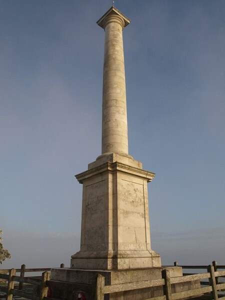
English: War Memorial, Montgomery. The fine memorial on Town Hill. See 1088025 for the inscriptions.
"Constructed from Portland stone, it has a square carved plinth and base that is surmounted by a circular stone column topped by a stone capping with ornate cornice. It stands some 50 feet high and at a height of 1050 feet. Listed by CADW as being of architectural importance, it is a truly beautiful structure with inscriptions in both English and Welsh engraved on the base. "The monument was initially built and completed in 1923. A committee chaired by Sir Watkin Williams Wynn raised some £2500 by public subscription. The heavy stone materials were transported by train to Montgomery Station and were carried to the site by motor vehicles and a team of horses ... "... Unfortunately some years ago the area suffered an earth tremor that twisted the column, opening it up in parts and allowing the weather to get in. A local committee was formed in 1998 and with help from the Heritage Lottery, sufficient funds were raised to enable the repair work to be carried out. The work is now completed and the results far exceed expectations. A re-dedication and unveiling ceremony took place on Saturday 5th October 2002" Further details at http://www.bbc.co.uk/wales/mid/sites/montgomery/pages/terry_boundy.shtml |
| Date | |
| Source | From geograph.org.uk |
| Author | Derek Harper |
| Attribution (required by the license) InfoField | Derek Harper / War Memorial, Montgomery / |
InfoField | Derek Harper / War Memorial, Montgomery |
| Camera location | 52° 33′ 13″ N, 3° 09′ 28″ W | View this and other nearby images on: OpenStreetMap |
|---|
| Object location | 52° 33′ 13″ N, 3° 09′ 28″ W | View this and other nearby images on: OpenStreetMap |
|---|
Licensing edit

|
This image was taken from the Geograph project collection. See this photograph's page on the Geograph website for the photographer's contact details. The copyright on this image is owned by Derek Harper and is licensed for reuse under the Creative Commons Attribution-ShareAlike 2.0 license.
|
- You are free:
- to share – to copy, distribute and transmit the work
- to remix – to adapt the work
- Under the following conditions:
- attribution – You must give appropriate credit, provide a link to the license, and indicate if changes were made. You may do so in any reasonable manner, but not in any way that suggests the licensor endorses you or your use.
- share alike – If you remix, transform, or build upon the material, you must distribute your contributions under the same or compatible license as the original.
File history
Click on a date/time to view the file as it appeared at that time.
| Date/Time | Thumbnail | Dimensions | User | Comment | |
|---|---|---|---|---|---|
| current | 22:51, 24 February 2011 |  | 480 × 640 (34 KB) | GeographBot (talk | contribs) | == {{int:filedesc}} == {{Information |description={{en|1=War Memorial, Montgomery The fine memorial on Town Hill. See 1088025 for the inscriptions. "Constructed from Portland stone, it has a square carved plinth and base that is surmounted by a ci |
You cannot overwrite this file.
File usage on Commons
The following page uses this file:
File usage on other wikis
The following other wikis use this file:
- Usage on en.wikipedia.org
Metadata
This file contains additional information such as Exif metadata which may have been added by the digital camera, scanner, or software program used to create or digitize it. If the file has been modified from its original state, some details such as the timestamp may not fully reflect those of the original file. The timestamp is only as accurate as the clock in the camera, and it may be completely wrong.
| _error | 0 |
|---|