File:Warminsko-mazurskie mapa fizyczna.png
Size of this preview: 800 × 482 pixels. Other resolutions: 320 × 193 pixels | 640 × 385 pixels | 1,024 × 616 pixels | 1,280 × 771 pixels | 2,837 × 1,708 pixels.
Original file (2,837 × 1,708 pixels, file size: 937 KB, MIME type: image/png)
Captions
Captions
Add a one-line explanation of what this file represents
Summary edit
| Description |
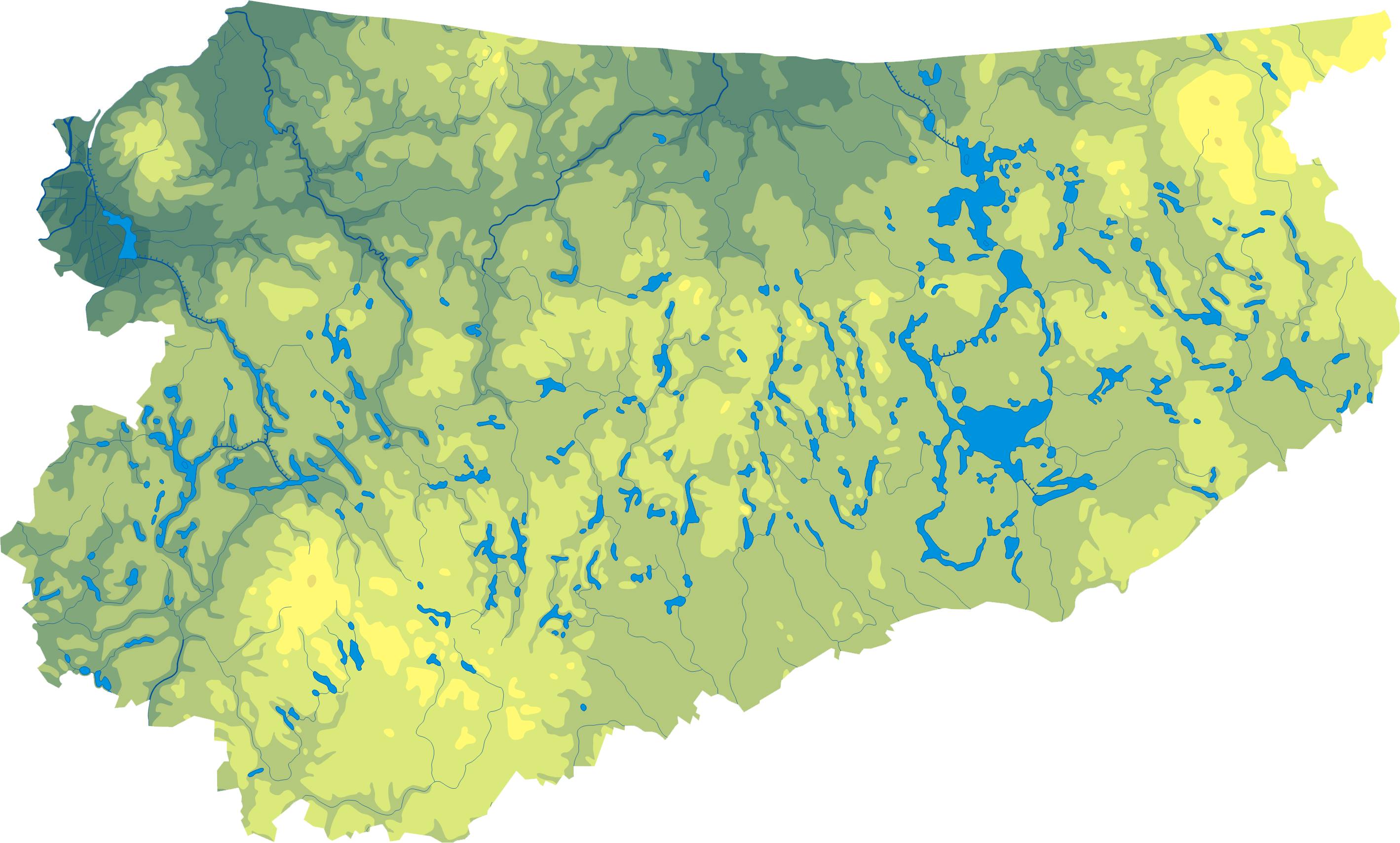
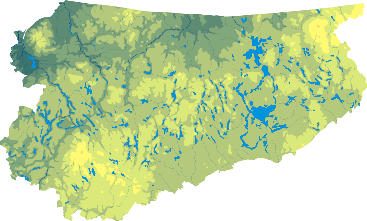
Mapa wód i ukształtowania powierzchni województwa warmińsko-mazurskiego. Autor: Aotearoa
Legenda |
| Date | 29 August 2006 (original upload date) |
| Source | Transferred from pl.wikipedia to Commons. |
| Author | Aotearoa at Polish Wikipedia |
Licensing edit

|
Permission is granted to copy, distribute and/or modify this document under the terms of the GNU Free Documentation License, Version 1.2 or any later version published by the Free Software Foundation; with no Invariant Sections, no Front-Cover Texts, and no Back-Cover Texts. A copy of the license is included in the section entitled GNU Free Documentation License. |
| This file is licensed under the Creative Commons Attribution-Share Alike 3.0 Unported license. | ||
| ||
| This licensing tag was added to this file as part of the GFDL licensing update. |
Aotearoa at Polish Wikipedia, the copyright holder of this work, hereby publishes it under the following license:
|
|
Permission is granted to copy, distribute and/or modify this document under the terms of the GNU Free Documentation License, Version 1.2 or any later version published by the Free Software Foundation; with no Invariant Sections, no Front-Cover Texts, and no Back-Cover Texts. A copy of the license is included in the section entitled GNU Free Documentation License. |
Original upload log edit
The original description page was here. All following user names refer to pl.wikipedia.
- 2006-08-29 18:34 Aotearoa 584×356×8 (123865 bytes) Mapa wód i ukształtowania powierzchni województwa warmińsko-mazurskiego. Autor: [[Wikipedysta:Aotearoa|Aotearoa]]
File history
Click on a date/time to view the file as it appeared at that time.
| Date/Time | Thumbnail | Dimensions | User | Comment | |
|---|---|---|---|---|---|
| current | 11:03, 29 October 2012 | | 2,837 × 1,708 (937 KB) | Aotearoa (talk | contribs) | drobne techniczne |
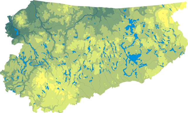
| 08:46, 15 May 2007 |  | 584 × 356 (121 KB) | Kocio (talk | contribs) | {{Information |Description=Mapa wód i ukształtowania powierzchni województwa warmińsko-mazurskiego. Autor: Aotearoa == Legenda == 75px == Licencja == |Source=Originally from [http |
You cannot overwrite this file.
File usage on Commons
There are no pages that use this file.
File usage on other wikis
The following other wikis use this file:
- Usage on be.wikipedia.org
- Usage on bg.wikipedia.org
- Usage on ce.wikipedia.org
- Usage on hu.wikipedia.org
- Usage on lv.wikipedia.org
- Usage on pl.wikipedia.org
- Usage on pt.wikipedia.org
- Usage on ru.wikipedia.org
- Usage on uk.wikipedia.org