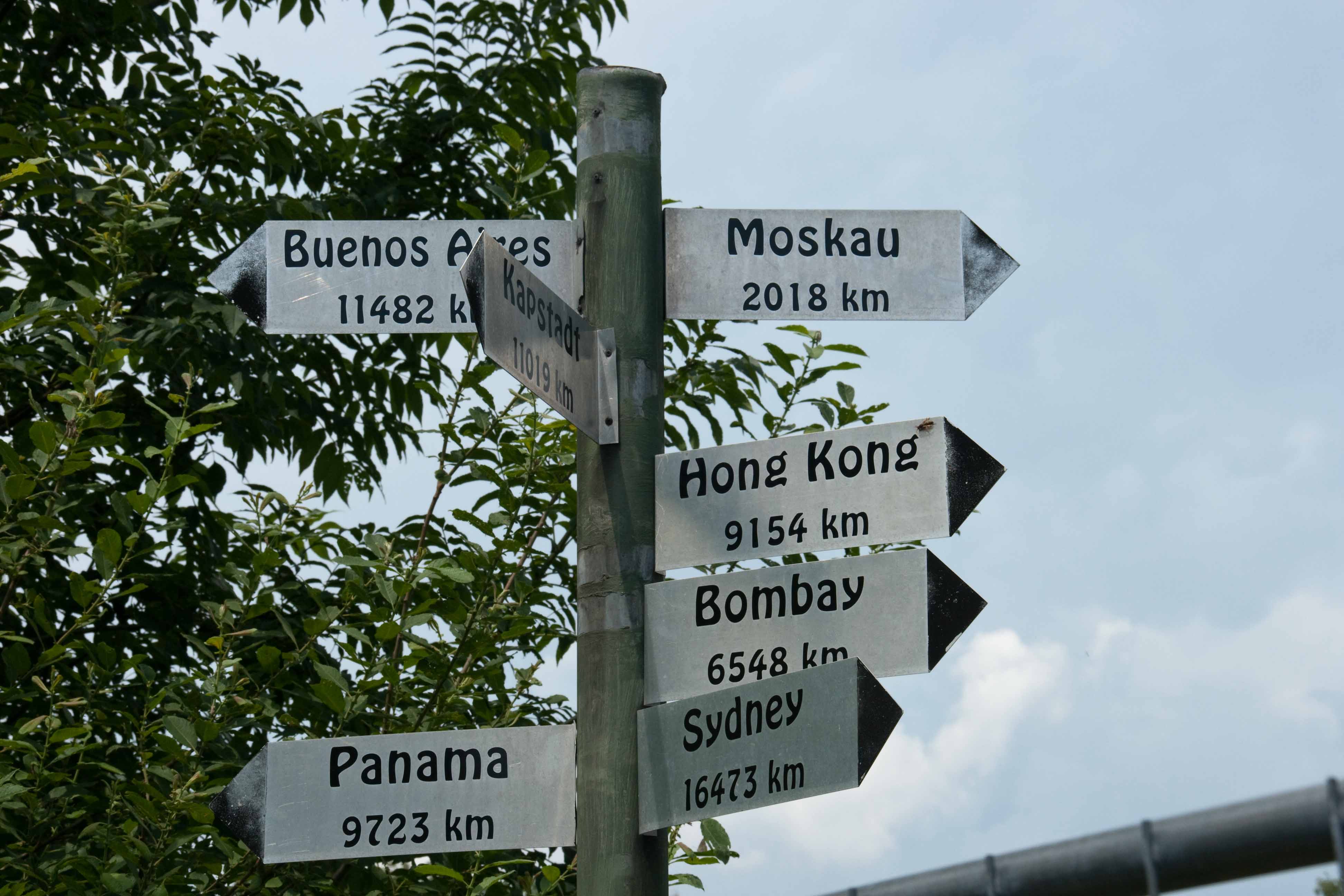
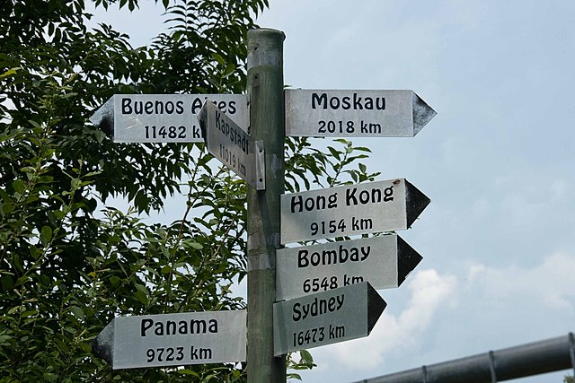
File:Wegweiser bei Grassau - panoramio.jpg
Size of this preview: 800 × 533 pixels. Other resolutions: 320 × 213 pixels | 640 × 427 pixels | 1,024 × 683 pixels | 1,280 × 853 pixels | 2,560 × 1,707 pixels | 3,888 × 2,592 pixels.
Original file (3,888 × 2,592 pixels, file size: 494 KB, MIME type: image/jpeg)
File information
Structured data
Captions
DescriptionWegweiser bei Grassau - panoramio.jpg | Wegweiser bei Grassau | ||
Date | Taken on 5 July 2009 | ||
Source | https://web.archive.org/web/20161014061401/http://www.panoramio.com/photo/24255357 | ||
Author | ramses II | ||
Permission (Reusing this file) |
This file is licensed under the Creative Commons Attribution-Share Alike 3.0 Unported license. Attribution: ramses II
|
Camera location | 47° 47′ 06.99″ N, 12° 25′ 50.12″ E | View this and other nearby images on: OpenStreetMap | 47.785275; 12.430590 |
---|
File history
Click on a date/time to view the file as it appeared at that time.
Date/Time | Thumbnail | Dimensions | User | Comment | |
---|---|---|---|---|---|
current | 10:33, 29 October 2016 | 3,888 × 2,592 (494 KB) | Panoramio upload bot (talk | contribs) | {{Information |description=Wegweiser bei Grassau |date={{Taken on|2009-07-05}} |source=http://www.panoramio.com/photo/24255357 |author=[http://www.panoramio.com/user/2797976?with_photo_id=24255357 ramses II] |permission={{cc-by-sa-3.0|ramses II}} {{Pan... |
You cannot overwrite this file.
File usage on Commons
There are no pages that use this file.
Metadata
This file contains additional information such as Exif metadata which may have been added by the digital camera, scanner, or software program used to create or digitize it. If the file has been modified from its original state, some details such as the timestamp may not fully reflect those of the original file. The timestamp is only as accurate as the clock in the camera, and it may be completely wrong.
Camera manufacturer | Canon |
---|---|
Camera model | Canon EOS Kiss Digital X |
Author | unknown |
Exposure time | 1/320 sec (0.003125) |
F-number | f/11 |
ISO speed rating | 200 |
Date and time of data generation | 13:30, 5 July 2009 |
Lens focal length | 59 mm |
Latitude | 47° 47′ 6.97″ N |
Longitude | 12° 25′ 50.04″ E |
Altitude | 537.99 meters above sea level |
City shown | Grassau |
Horizontal resolution | 72 dpi |
Vertical resolution | 72 dpi |
File change date and time | 20:18, 8 July 2009 |
Exposure Program | Normal program |
Exif version | 2.21 |
Date and time of digitizing | 13:30, 5 July 2009 |
APEX shutter speed | 8.321928 |
APEX aperture | 6.918863 |
APEX exposure bias | 0 |
Maximum land aperture | 4.34375 APEX (f/4.51) |
Metering mode | Average |
Flash | Flash did not fire, compulsory flash suppression |
Focal plane X resolution | 4,433.2953249715 |
Focal plane Y resolution | 4,453.6082474227 |
Focal plane resolution unit | inches |
Custom image processing | Normal process |
Exposure mode | Auto exposure |
White balance | Auto white balance |
Scene capture type | Standard |
GPS time (atomic clock) | 11:31 |
Geodetic survey data used | WGS-84 |
GPS date | 5 July 2009 |
GPS tag version | 0.0.2.2 |
Lens used | 18.0-200.0 mm |
Owner of camera | unknown |
Serial number of camera | 2011103182 |
Image width | 3,888 px |
Image height | 2,592 px |
Width | 3,888 px |
Height | 2,592 px |
Date metadata was last modified | 22:18, 8 July 2009 |
Software used | Adobe Photoshop Lightroom |
Keywords | Moorlehrpfad |
Country shown | Germany |
Province or state shown | Bayern |
IIM version | 2 |