File:West Nile virus map United States 2012 outbreak.png
No higher resolution available.
West_Nile_virus_map_United_States_2012_outbreak.png (580 × 482 pixels, file size: 48 KB, MIME type: image/png)
Captions
Captions
Add a one-line explanation of what this file represents
Summary edit
| Description |
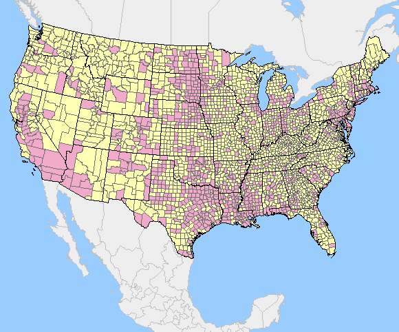
English: Map of the United States showing counties where West Nile virus infections have been reported. Final data from May 3, 2013. |
| Date | |
| Source | http://diseasemaps.usgs.gov/wnv_us_human.html |
| Author | United States Geological Service |
Licensing edit
This image is in the public domain in the United States because it only contains materials that originally came from the United States Geological Survey, an agency of the United States Department of the Interior. For more information, see the official USGS copyright policy.
|
File history
Click on a date/time to view the file as it appeared at that time.
| Date/Time | Thumbnail | Dimensions | User | Comment | |
|---|---|---|---|---|---|
| current | 14:03, 13 October 2016 | | 580 × 482 (48 KB) | Ost316 (talk | contribs) | Updated version from http://diseasemaps.usgs.gov/2012/wnv_us_human.html. Final 2012, as of May 14, 2013 |
| 23:14, 4 September 2012 |  | 580 × 482 (47 KB) | 7mike5000 (talk | contribs) | User created page with UploadWizard |
You cannot overwrite this file.
File usage on Commons
There are no pages that use this file.
File usage on other wikis
The following other wikis use this file:
- Usage on ar.wikipedia.org
- Usage on de.wikipedia.org
- Usage on en.wikipedia.org