File:West of Botolph Court - geograph.org.uk - 1020658.jpg

Size of this preview: 800 × 535 pixels. Other resolutions: 320 × 214 pixels | 640 × 428 pixels | 1,024 × 685 pixels | 1,280 × 856 pixels | 1,620 × 1,084 pixels.
Original file (1,620 × 1,084 pixels, file size: 367 KB, MIME type: image/jpeg)
Captions
Captions
Add a one-line explanation of what this file represents
Summary edit
| Description |
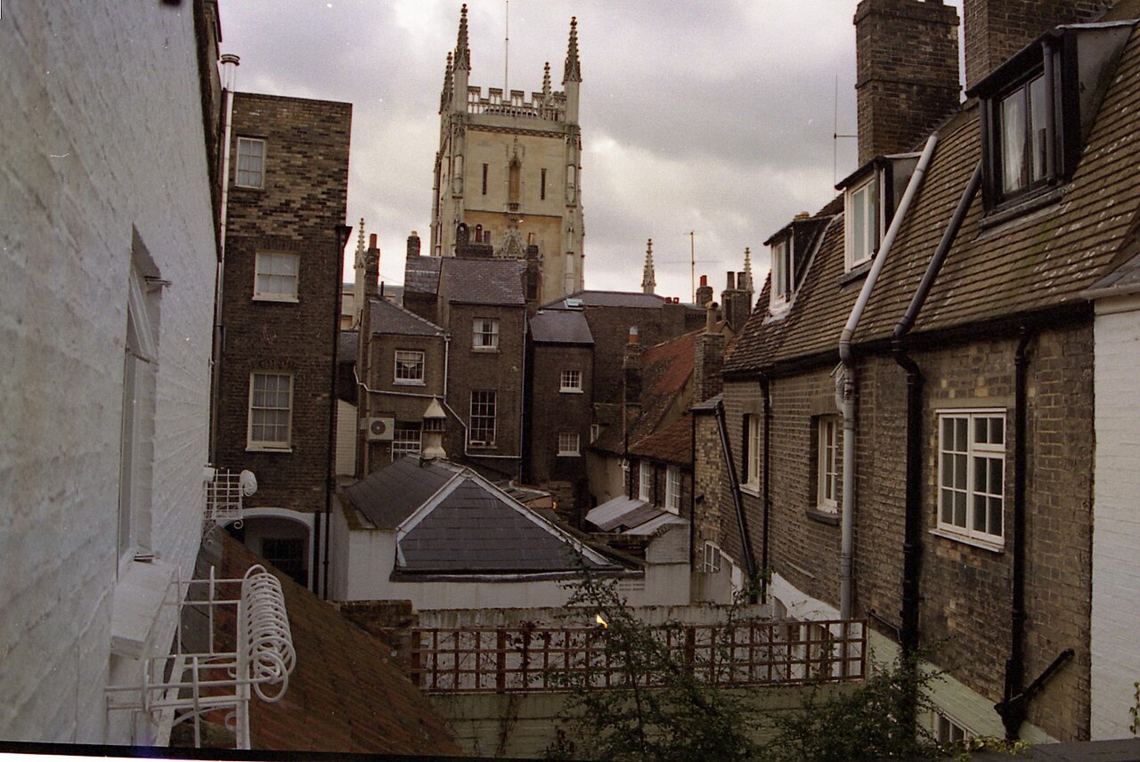
English: West of Botolph Court This view shows the backs of the houses and shops on Pembroke Street and Botolph Lane to the west of Botolph Court, along with those on Trumpington Street and behind them the tower of the Pitt Building. According to OS MasterMap data, the long low building is part of 52 Trumpinton Street, which is Fitzbillies bakery. |
| Date | |
| Source | From geograph.org.uk |
| Author | Ben Harris |
| Attribution (required by the license) | Ben Harris / West of Botolph Court / |
| Camera location | | View this and other nearby images on: OpenStreetMap |
|---|
_heading:247.00&language=en)
| Object location | | View this and other nearby images on: OpenStreetMap |
|---|
_heading:247.00&language=en)
Licensing edit

|
This image was taken from the Geograph project collection. See this photograph's page on the Geograph website for the photographer's contact details. The copyright on this image is owned by Ben Harris and is licensed for reuse under the Creative Commons Attribution-ShareAlike 2.0 license.
|
This file is licensed under the Creative Commons Attribution-Share Alike 2.0 Generic license.
Attribution: Ben Harris
- You are free:
- to share – to copy, distribute and transmit the work
- to remix – to adapt the work
- Under the following conditions:
- attribution – You must give appropriate credit, provide a link to the license, and indicate if changes were made. You may do so in any reasonable manner, but not in any way that suggests the licensor endorses you or your use.
- share alike – If you remix, transform, or build upon the material, you must distribute your contributions under the same or compatible license as the original.
File history
Click on a date/time to view the file as it appeared at that time.
| Date/Time | Thumbnail | Dimensions | User | Comment | |
|---|---|---|---|---|---|
| current | 03:40, 10 March 2023 | | 1,620 × 1,084 (367 KB) | Geograph Update Bot (talk | contribs) | Higher-resolution version from Geograph |
| 16:08, 23 February 2011 |  | 640 × 428 (67 KB) | GeographBot (talk | contribs) | == {{int:filedesc}} == {{Information |description={{en|1=West of Botolph Court This view shows the backs of the houses and shops on Pembroke Street and Botolph Lane to the west of Botolph Court, along with those on Trumpington Street and behind them the t |
You cannot overwrite this file.
File usage on Commons
There are no pages that use this file.