File:Western-Addition.jpg
Original file (2,032 × 969 pixels, file size: 379 KB, MIME type: image/jpeg)
Captions
Captions
Summary edit
| Camera location | | View this and other nearby images on: OpenStreetMap |
|---|
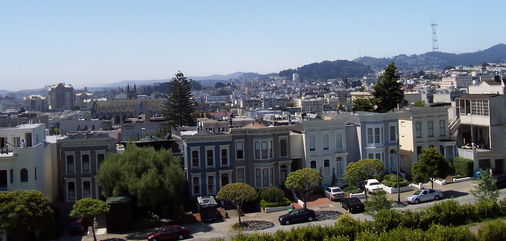
A southern view from Alta Plaza Park in San Francisco, California. The park is in the Pacific Heights neighborhood. Most of the valley in the central part of this image is in the Western Addition neighborhood. In the background on the right can be seen Sutro Tower, which is west of Twin Peaks. The darker hill to the left and slightly more in the foreground is Buena Vista Heights, which is directly south of Haight Street (between the Haight-Fillmore and Haight-Ashbury neighborhoods). Cathedral Hill is visible to the left, just west of Van Ness Avenue and north of Hayes Valley.
- Photographer: Christopher Beland
- Date: 14 July 2005
| I, the copyright holder of this work, release this work into the public domain. This applies worldwide. In some countries this may not be legally possible; if so: I grant anyone the right to use this work for any purpose, without any conditions, unless such conditions are required by law. |
File history
Click on a date/time to view the file as it appeared at that time.
| Date/Time | Thumbnail | Dimensions | User | Comment | |
|---|---|---|---|---|---|
| current | 22:33, 18 July 2005 | | 2,032 × 969 (379 KB) | Beland (talk | contribs) | A southern view from Alta Plaza Park in San Francisco, California. The park is in the Pacific Heights neighborhood. Most of the valley in the central part of this image is in the Western Addition neighborhood. In the background on the right can be seen |
You cannot overwrite this file.
File usage on Commons
The following page uses this file:
File usage on other wikis
The following other wikis use this file:
- Usage on bg.wikipedia.org
- Usage on en.wikipedia.org
- Usage on www.wikidata.org