File:White Cliffs of Dover map.png
Size of this preview: 800 × 588 pixels. Other resolutions: 320 × 235 pixels | 640 × 471 pixels | 1,024 × 753 pixels | 1,280 × 941 pixels | 1,500 × 1,103 pixels.
Original file (1,500 × 1,103 pixels, file size: 389 KB, MIME type: image/png)
Captions
Captions
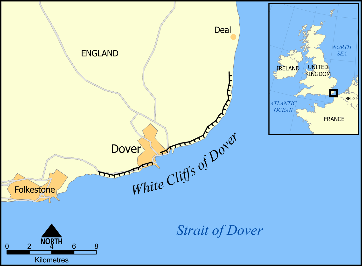
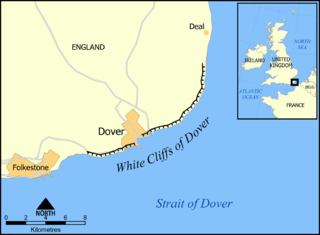
The English set of iconic high white cliffs facing the Short Straits, which to the English is usually the Straits of Dover, to the French the "Pas de Calais".
Summary edit
| Description |
This map shows the location and roughly the extent of the White Cliffs of Dover. Created by NormanEinstein, December 19, 2005. |
| Date | 19 December 2005 (original upload date) |
| Source | No machine-readable source provided. Own work assumed (based on copyright claims). |
| Author | No machine-readable author provided. NormanEinstein assumed (based on copyright claims). |
Licensing edit
I, the copyright holder of this work, hereby publish it under the following licenses:

|
Permission is granted to copy, distribute and/or modify this document under the terms of the GNU Free Documentation License, Version 1.2 or any later version published by the Free Software Foundation; with no Invariant Sections, no Front-Cover Texts, and no Back-Cover Texts. A copy of the license is included in the section entitled GNU Free Documentation License. |
| This file is licensed under the Creative Commons Attribution-Share Alike 3.0 Unported license. | ||
| ||
| This licensing tag was added to this file as part of the GFDL licensing update. |
You may select the license of your choice.
File history
Click on a date/time to view the file as it appeared at that time.
| Date/Time | Thumbnail | Dimensions | User | Comment | |
|---|---|---|---|---|---|
| current | 18:29, 20 December 2005 | | 1,500 × 1,103 (389 KB) | NormanEinstein (talk | contribs) | Changed map extent. |
| 18:49, 19 December 2005 |  | 1,000 × 1,119 (283 KB) | NormanEinstein (talk | contribs) | This map shows the location and roughly the extent of the White Cliffs of Dover. Created by NormanEinstein, December 19, 2005. {{GFDL-self}} [[Category:Maps of England}} |
You cannot overwrite this file.
File usage on Commons
There are no pages that use this file.
File usage on other wikis
The following other wikis use this file:
- Usage on ca.wikipedia.org
- Usage on cs.wikipedia.org
- Usage on de.wikipedia.org
- Usage on en.wikipedia.org
- Usage on es.wikipedia.org
- Usage on fi.wikipedia.org
- Usage on fr.wikipedia.org
- Usage on hu.wikipedia.org
- Usage on hy.wikipedia.org
- Usage on ja.wikipedia.org
- Usage on nl.wikipedia.org
- Usage on nn.wikipedia.org
- Usage on no.wikipedia.org
- Usage on ro.wikipedia.org
- Usage on sl.wikipedia.org
- Usage on sr.wikipedia.org
- Usage on sv.wikipedia.org
- Usage on uk.wikipedia.org
- Usage on zh.wikipedia.org