File:WickhamAttackMap.jpg

Size of this preview: 774 × 599 pixels. Other resolutions: 310 × 240 pixels | 620 × 480 pixels | 992 × 768 pixels | 1,280 × 991 pixels | 1,400 × 1,084 pixels.
Original file (1,400 × 1,084 pixels, file size: 160 KB, MIME type: image/jpeg)
Captions
Captions
Add a one-line explanation of what this file represents
Summary edit
| Description |
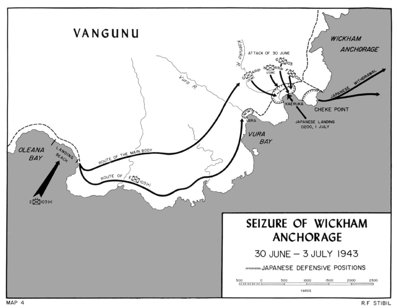
English: Map of the attack on Wickham Harbor, Vangunu Island, New Georgia island group, Solomon Islands, July, 1943. |
| Date | Unknown date |
| Source | |
| Author | US Department of Defense |
Licensing edit
| This image or media file contains material based on a work of a National Park Service employee, created as part of that person's official duties. As a work of the U.S. federal government, such work is in the public domain in the United States. See the NPS website and NPS copyright policy for more information. |
File history
Click on a date/time to view the file as it appeared at that time.
| Date/Time | Thumbnail | Dimensions | User | Comment | |
|---|---|---|---|---|---|
| current | 15:05, 5 May 2020 | | 1,400 × 1,084 (160 KB) | Hohum (talk | contribs) | Clearer version |
| 07:38, 4 August 2008 |  | 750 × 566 (58 KB) | Cla68 (talk | contribs) | {{Information |Description={{en|1=Map of the attack on Wickham Harbor, Vangunu Island, New Georgia island group, Solomon Islands, July, 1943.}} |Source=[http://www.nps.gov/archive/wapa/indepth/extContent/usmc/pcn-190-003130-00/images/fig38.jpg] [http://ww |
You cannot overwrite this file.
File usage on Commons
The following page uses this file:
File usage on other wikis
The following other wikis use this file:
- Usage on de.wikipedia.org
- Usage on en.wikipedia.org