File:Wilderness May5 0700.png
Size of this preview: 800 × 324 pixels. Other resolutions: 320 × 130 pixels | 640 × 259 pixels | 1,024 × 415 pixels | 1,280 × 518 pixels | 2,719 × 1,101 pixels.
Original file (2,719 × 1,101 pixels, file size: 636 KB, MIME type: image/png)
Captions
Captions
Add a one-line explanation of what this file represents
| Description |
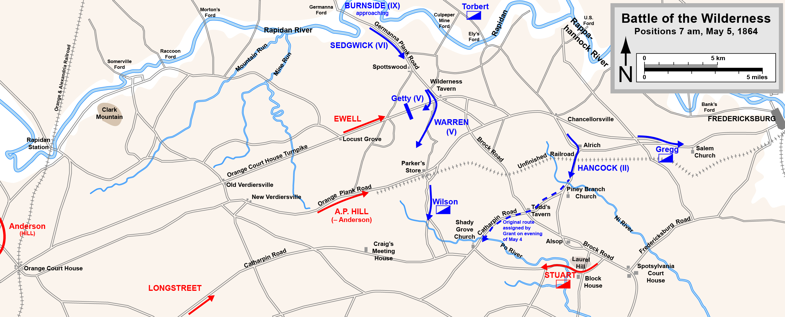
English: Map of the initial positions in the Battle of the Wilderness of the American Civil War.
Drawn in Adobe Illustrator CS5 by Hal Jespersen. Graphic source file is available at http://www.posix.com/CWmaps/ This file is licensed under the Creative Commons Attribution 3.0 Unported license. Attribution: Map by Hal Jespersen, www.posix.com/CW
|
| Date | |
| Source | Own work |
| Author | Hlj |
File history
Click on a date/time to view the file as it appeared at that time.
| Date/Time | Thumbnail | Dimensions | User | Comment | |
|---|---|---|---|---|---|
| current | 20:10, 17 March 2011 | 2,719 × 1,101 (636 KB) | Hlj (talk | contribs) | Minor graphical changes to conform to new ACW map style for roads and rivers. Same license. | |
| 00:48, 25 October 2010 | 2,719 × 1,101 (483 KB) | Hlj (talk | contribs) | {{Information |Description={{en|1=Map of the initial positions in the Battle of the Wilderness of the American Civil War. Drawn in Adobe Illustrator CS5 by Hal Jespersen. Graphic source file is available at http://www.posix.com/CWmaps/ {{cc-by-3.0|Map by |
You cannot overwrite this file.
File usage on Commons
There are no pages that use this file.
File usage on other wikis
The following other wikis use this file:
- Usage on de.wikipedia.org
- Usage on es.wikipedia.org
- Usage on hu.wikipedia.org
- Usage on hy.wikipedia.org
- Usage on nl.wikipedia.org