File:Wizernes site local map.jpg

Size of this preview: 621 × 600 pixels. Other resolutions: 249 × 240 pixels | 497 × 480 pixels | 795 × 768 pixels | 1,071 × 1,034 pixels.
Original file (1,071 × 1,034 pixels, file size: 550 KB, MIME type: image/jpeg)
Captions
Captions
Add a one-line explanation of what this file represents
| Description |
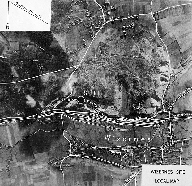
English: Wizernes site: map of the area |
|||
| Date | ||||
| Source | Investigation of the "Heavy" Crossbow installations in Northern France. Report by the Sanders Mission to the Chairman of the Crossbow Committee. Technical details; Vol III, "Wizernes" | |||
| Author | Sanders, T.R.B. | |||
| Permission (Reusing this file) |
|

File history
Click on a date/time to view the file as it appeared at that time.
| Date/Time | Thumbnail | Dimensions | User | Comment | |
|---|---|---|---|---|---|
| current | 00:15, 16 June 2011 | | 1,071 × 1,034 (550 KB) | Prioryman (talk | contribs) | {{Information |Description ={{en|1=Wizernes site: map of the area}} |Source =Investigation of the "Heavy" Crossbow installations in Northern France. Report by the Sanders Mission to the Chairman of the Crossbow Committee. Technical details; Vol |
You cannot overwrite this file.
File usage on Commons
There are no pages that use this file.
File usage on other wikis
The following other wikis use this file:
- Usage on de.wikipedia.org
- Usage on en.wikipedia.org
- Usage on es.wikipedia.org
- Usage on fr.wikipedia.org