File:Województwo śląskie (1924-1934) powiaty.svg

Size of this PNG preview of this SVG file: 418 × 599 pixels. Other resolutions: 167 × 240 pixels | 335 × 480 pixels | 536 × 768 pixels | 715 × 1,024 pixels | 1,429 × 2,048 pixels | 617 × 884 pixels.
Original file (SVG file, nominally 617 × 884 pixels, file size: 29 KB)
Captions
Captions
Add a one-line explanation of what this file represents
Summary edit
_powiaty.svg&action=edit§ion=1)
| Description |
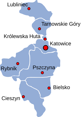
Polski: Województwo śląskie - podział wg powiatów w latach 1924-1934 |
| Date | |
| Source | Own work, based on map by Qqerim |
| Author | Yarl |
Licensing edit
_powiaty.svg&action=edit§ion=2)
This file is licensed under the Creative Commons Attribution-Share Alike 2.5 Generic license.
- You are free:
- to share – to copy, distribute and transmit the work
- to remix – to adapt the work
- Under the following conditions:
- attribution – You must give appropriate credit, provide a link to the license, and indicate if changes were made. You may do so in any reasonable manner, but not in any way that suggests the licensor endorses you or your use.
- share alike – If you remix, transform, or build upon the material, you must distribute your contributions under the same or compatible license as the original.
File history
Click on a date/time to view the file as it appeared at that time.
| Date/Time | Thumbnail | Dimensions | User | Comment | |
|---|---|---|---|---|---|
| current | 11:44, 19 April 2008 | | 617 × 884 (29 KB) | Yarl (talk | contribs) | ==Summary== {{Information |Description={{pl|Autonomiczne województwo śląskie}} |Source=own work based on map by Qqerim |Date=2008 |Author=~~~ |Permission= |other_versions= }} ==Licensing== {{cc-by-sa-2.5}} [[Category:Maps of Silesi |
You cannot overwrite this file.
File usage on Commons
The following page uses this file:
File usage on other wikis
The following other wikis use this file:
- Usage on be-tarask.wikipedia.org
- Usage on cs.wikipedia.org
- Usage on el.wikipedia.org
- Usage on es.wikipedia.org
- Usage on it.wikipedia.org
- Usage on pl.wikipedia.org
- Usage on ru.wikipedia.org
- Usage on szl.wikipedia.org
_powiaty.svg&oldid=518802322)