File:World in 900 CE.png
(Redirected from File:World Map 900 CE.PNG)

Size of this preview: 800 × 407 pixels. Other resolutions: 320 × 163 pixels | 640 × 326 pixels | 1,024 × 521 pixels | 1,280 × 652 pixels | 4,000 × 2,036 pixels.
Original file (4,000 × 2,036 pixels, file size: 1.76 MB, MIME type: image/png)
Captions
Captions
Add a one-line explanation of what this file represents
Summary edit
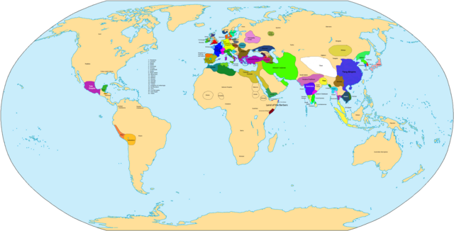
| Description | Map of the world in 900 AD. |
| Source | Own work |
| Author | Javierfv1212 |

|
This historical map image could be re-created using vector graphics as an SVG file. This has several advantages; see Commons:Media for cleanup for more information. If an SVG form of this image is available, please upload it and afterwards replace this template with
{{vector version available|new image name}}.
It is recommended to name the SVG file “World in 900 CE.svg”—then the template Vector version available (or Vva) does not need the new image name parameter. |
| Maps of world history | |
| BC | |
|
| |
| AD |
1 · 50 · 100 · 200 · 250 · 300 · 400 · 500 · 700 · 750 · 820 · 900 · 1200 · 1500 · 1556 · 1648 · 1700 · 1750 · 1815 · 1859 · 1871 · 1914 · 1989 · 2000 · |
|
Maps of colonization history | |
|
see also: Eastern Hemisphere only maps template (1300BC-1500AD) | |
| (this template: · view · discuss ) | |
.jpg)
._LOC_2001620596.jpg)
Licensing edit
| I, the copyright holder of this work, release this work into the public domain. This applies worldwide. In some countries this may not be legally possible; if so: I grant anyone the right to use this work for any purpose, without any conditions, unless such conditions are required by law. |
File history
Click on a date/time to view the file as it appeared at that time.
| Date/Time | Thumbnail | Dimensions | User | Comment | |
|---|---|---|---|---|---|
| current | 09:32, 3 April 2021 | | 4,000 × 2,036 (1.76 MB) | Glennznl (talk | contribs) | Reverted to version as of 23:14, 31 October 2020 (UTC) Completely unsourced, the Igorot society article has been deleted from Wikipedia as it is a hoax |
| 02:54, 27 March 2021 |  | 4,000 × 2,036 (1.57 MB) | Enola gay0 (talk | contribs) | Reverted to version as of 09:48, 29 May 2019 (UTC) tondo-LCI | |
| 23:14, 31 October 2020 |  | 4,000 × 2,036 (1.76 MB) | Glennznl (talk | contribs) | Reverted to version as of 18:02, 5 July 2015 (UTC) | |
| 09:48, 29 May 2019 |  | 4,000 × 2,036 (1.57 MB) | Enola gay0 (talk | contribs) | ||
| 05:20, 7 December 2017 |  | 4,000 × 2,036 (1.76 MB) | Gunkarta (talk | contribs) | Reverted to version as of 18:02, 5 July 2015 (UTC) false pseudohistory | |
| 12:39, 2 June 2017 |  | 4,000 × 2,036 (1.57 MB) | Theseeker2016 (talk | contribs) | Tondo, Tundun or Lusung <ref>{{cite book|author=Keat Gin Ooi|title=Southeast Asia: A Historical Encyclopedia, from Angkor Wat to East Timor|url=https://books.google.com/books?id=QKgraWbb7yoC|year=2004|publisher=ABC-CLIO|isbn=978-1-57607-770-2|page=[htt... | |
| 18:02, 5 July 2015 |  | 4,000 × 2,036 (1.76 MB) | BartekChom (talk | contribs) | Veleti and Czechs did not live on territory of modern Poland, for example File:Europe around 900.jpg | |
| 15:47, 10 January 2013 |  | 4,000 × 2,036 (1.95 MB) | Runehelmet (talk | contribs) | Updated | |
| 17:20, 20 March 2009 |  | 4,000 × 2,036 (1.79 MB) | Huhsunqu (talk | contribs) | wari instead moche | |
| 01:50, 4 November 2007 |  | 4,000 × 2,036 (1.8 MB) | Javierfv1212 (talk | contribs) | {{Information |Description= |Source=self-made |Date= |Author= Javierfv1212 |Permission= |other_versions= }} Category:Maps of the world showing history |
You cannot overwrite this file.
File usage on Commons
The following 2 pages use this file:
- 900
- File:World Map 900 CE.PNG (file redirect)
File usage on other wikis
The following other wikis use this file:
- Usage on bs.wikipedia.org
- Usage on de.wikipedia.org
- Usage on el.wikipedia.org
- Usage on en.wikipedia.org
- Usage on es.wikipedia.org
- Usage on fr.wikipedia.org
- Usage on he.wikipedia.org
- Usage on ka.wikipedia.org
- Usage on lt.wikipedia.org
- Usage on nl.wikipedia.org
- Usage on ru.wikipedia.org
- Usage on sv.wikipedia.org
- Usage on tt.wikipedia.org
- Usage on uk.wikipedia.org
- Usage on zh.wikipedia.org