File:Wrexham UK map.svg

Size of this PNG preview of this SVG file: 800 × 566 pixels. Other resolutions: 320 × 226 pixels | 640 × 453 pixels | 1,024 × 724 pixels | 1,280 × 905 pixels | 2,560 × 1,811 pixels | 1,425 × 1,008 pixels.
Original file (SVG file, nominally 1,425 × 1,008 pixels, file size: 346 KB)
Captions
Captions
Add a one-line explanation of what this file represents
| Description |
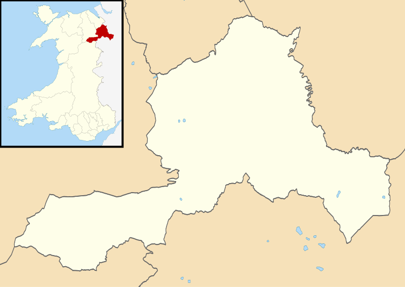
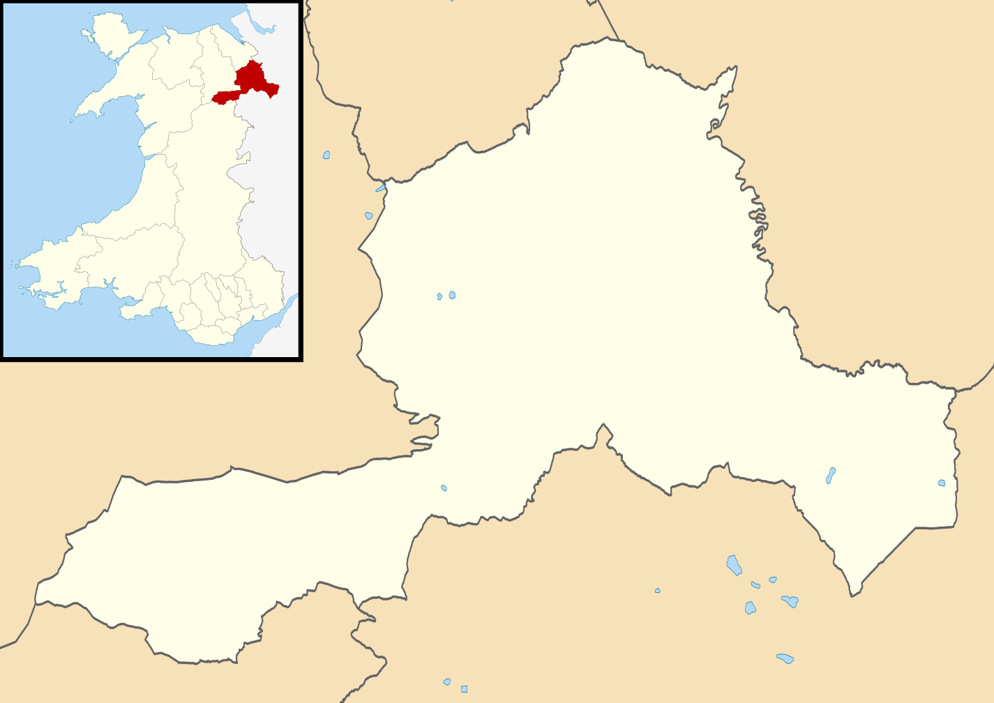
Blank map of Wrexham, UK with districts shown. Equirectangular map projection on WGS 84 datum, with N/S stretched 165% Geographic limits:
|
| Date | |
| Source | Ordnance Survey OpenData. Most data from Boundary-Line product. Lake data from Meridian 2 product. Inset derived from File: United Kingdom location map.svg by NordNordWest. |
| Author | Nilfanion, created using Ordnance Survey data |
| Permission (Reusing this file) |
This file is licensed under the Creative Commons Attribution-Share Alike 3.0 Unported license. Attribution: Contains Ordnance Survey data © Crown copyright and database right
|
File history
Click on a date/time to view the file as it appeared at that time.
| Date/Time | Thumbnail | Dimensions | User | Comment | |
|---|---|---|---|---|---|
| current | 10:02, 4 August 2010 | | 1,425 × 1,008 (346 KB) | Nilfanion (talk | contribs) | alter inset - Wales not UK |
| 19:58, 1 August 2010 |  | 1,425 × 1,008 (376 KB) | Nilfanion (talk | contribs) | {{Information |Description=Blank map of Wrexham, UK with districts shown. Equirectangular map projection on WGS 84 datum, with N/S stretched 165% Geographic limits: *West: 3.40W *East: 2.70W *North: 53.15N *South: 52.85N |Source=[[w:Ordnan |
You cannot overwrite this file.
File usage on Commons
The following 3 pages use this file:
File usage on other wikis
The following other wikis use this file:
- Usage on de.wikipedia.org