File:X04.28 Škurda, Kraftwerk.jpg

Size of this preview: 800 × 533 pixels. Other resolutions: 320 × 213 pixels | 640 × 427 pixels | 1,024 × 683 pixels | 1,280 × 853 pixels | 2,560 × 1,707 pixels | 5,605 × 3,737 pixels.
Original file (5,605 × 3,737 pixels, file size: 6.47 MB, MIME type: image/jpeg)
Captions
Captions
Add a one-line explanation of what this file represents
Summary edit
| Description |
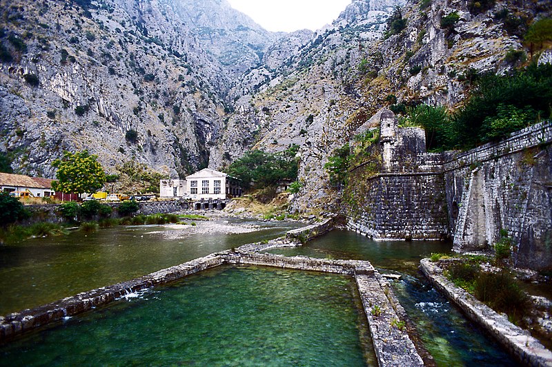
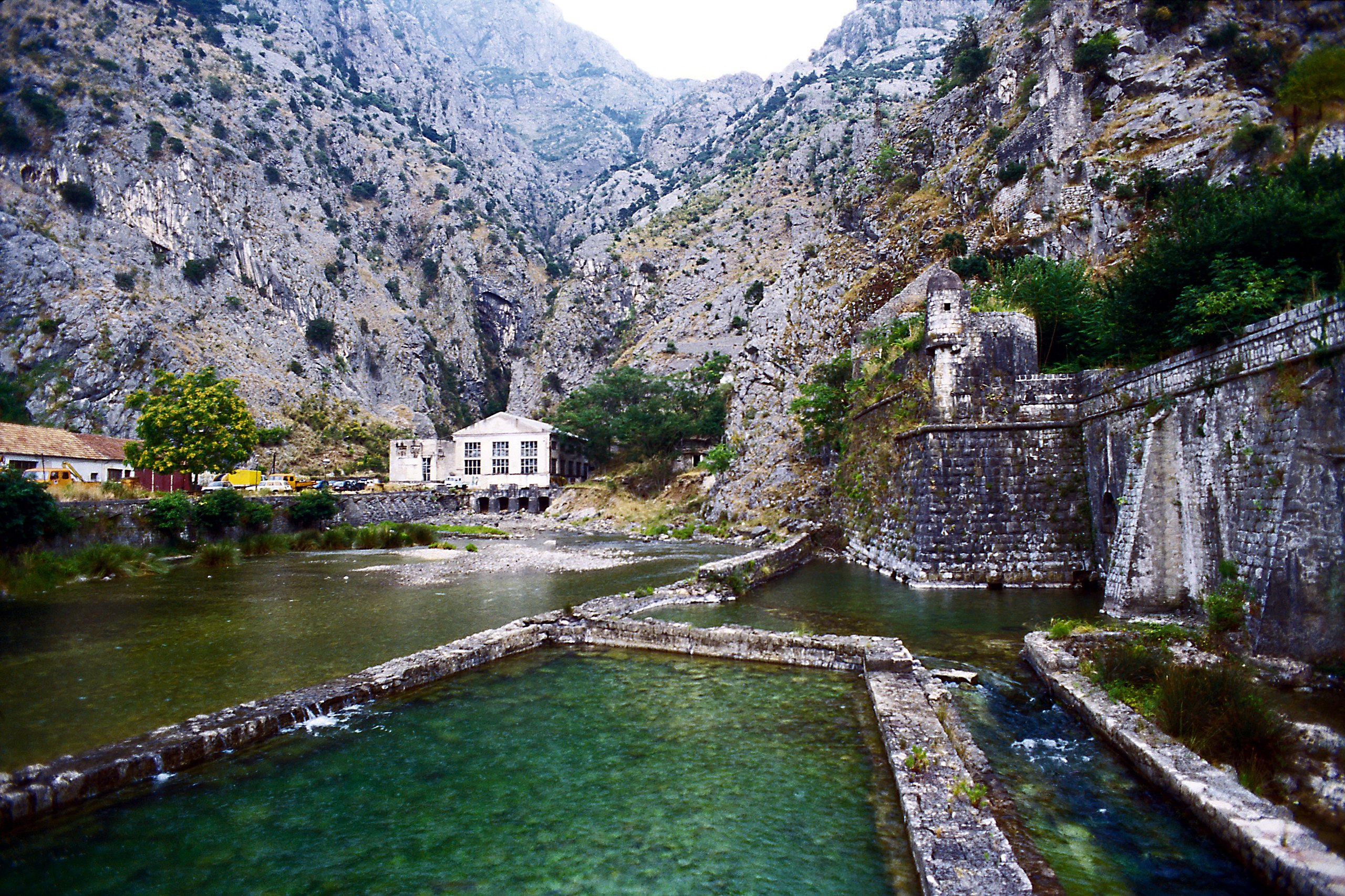
Deutsch: Nördlich der Altstadt von Kotor, das Kraftwerk liegt am Ende der Gefällestrecke des Flusses wenige Meter über Meereshöhe. |
| Date | |
| Source | Own work |
| Author | Falk2 |
Licensing edit
This file is licensed under the Creative Commons Attribution-Share Alike 4.0 International license.
- You are free:
- to share – to copy, distribute and transmit the work
- to remix – to adapt the work
- Under the following conditions:
- attribution – You must give appropriate credit, provide a link to the license, and indicate if changes were made. You may do so in any reasonable manner, but not in any way that suggests the licensor endorses you or your use.
- share alike – If you remix, transform, or build upon the material, you must distribute your contributions under the same or compatible license as the original.
File history
Click on a date/time to view the file as it appeared at that time.
| Date/Time | Thumbnail | Dimensions | User | Comment | |
|---|---|---|---|---|---|
| current | 08:11, 1 January 2023 | | 5,605 × 3,737 (6.47 MB) | Falk2 (talk | contribs) | {{Information |Beschreibung=Nördlich der Altstadt von Kotor, das Kraftwerk liegt am Ende der Gefällestrecke des Flusses wenige Meter über Meereshöhe. |Quelle=eigenes Werk |Urheber=Falk2 |Datum=2006-07-27 |Genehmigung= |Andere Versionen= |Anmerkungen= }} == Lizenz == {{Bild-CC-by-sa/4.0}} {{commonsfähig}} <nowiki> Category:Falk2/2006 Crna Gora Category:Falk2/Crna Gora Category:Škurda River Category:Kotor city wall [[Category:Montenegro photographs taken on 2006-0… |
You cannot overwrite this file.
File usage on Commons
There are no pages that use this file.