File:Yellow River - panoramio.jpg
Size of this preview: 800 × 494 pixels. Other resolutions: 320 × 198 pixels | 640 × 395 pixels | 1,024 × 633 pixels | 1,280 × 791 pixels | 2,560 × 1,582 pixels | 4,947 × 3,057 pixels.
Original file (4,947 × 3,057 pixels, file size: 3.6 MB, MIME type: image/jpeg)
Captions
Captions
Add a one-line explanation of what this file represents
Summary edit
| Description |
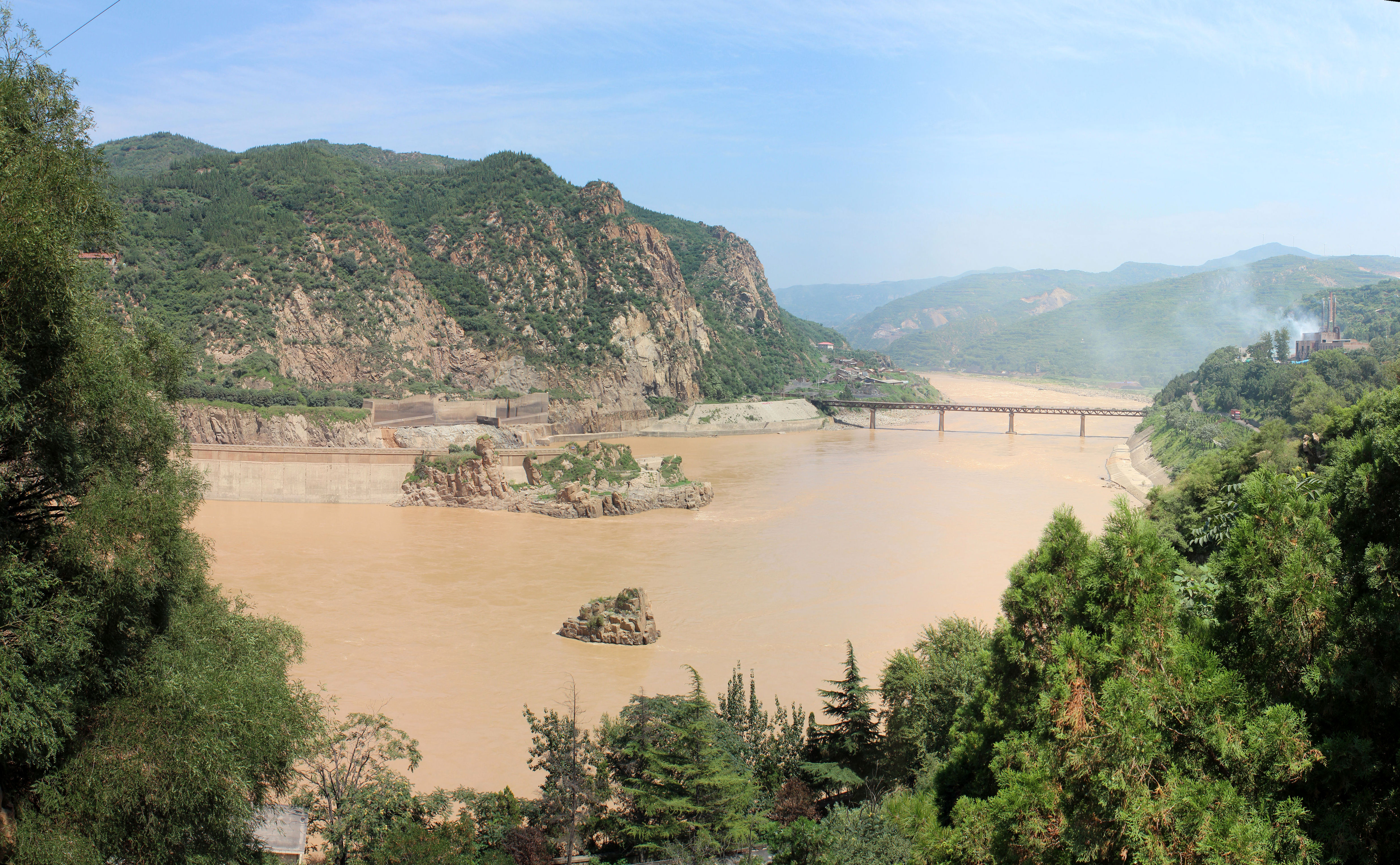
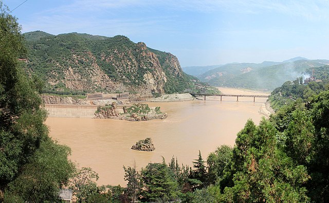
English: Yellow River |
||
| Date | Taken on 22 July 2012 | ||
| Source | https://web.archive.org/web/20161026113822/http://www.panoramio.com/photo/75987059 | ||
| Author | fading | ||
| Permission (Reusing this file) |
This file is licensed under the Creative Commons Attribution-Share Alike 3.0 Unported license. Attribution: fading
|
||
| Tags (from Panoramio photo page) | Sanmenxia, 2012, China, Dam, Henan, Sanmenxia, Yellow River |
| Camera location | | View this and other nearby images on: OpenStreetMap |
|---|
File history
Click on a date/time to view the file as it appeared at that time.
| Date/Time | Thumbnail | Dimensions | User | Comment | |
|---|---|---|---|---|---|
| current | 09:28, 9 January 2017 | | 4,947 × 3,057 (3.6 MB) | Panoramio upload bot (talk | contribs) | == {{int:filedesc}} == {{Information |description=Yellow River |date={{Taken on|2012-07-22}} |source=http://www.panoramio.com/photo/75987059 |author=[http://www.panoramio.com/user/5397823?with_photo_id=75987059 fading] |permission={{cc-by-sa-3.0|fading... |
You cannot overwrite this file.
File usage on Commons
The following 4 pages use this file:
File usage on other wikis
The following other wikis use this file:
- Usage on ary.wikipedia.org
- Usage on arz.wikipedia.org
- Usage on ast.wikipedia.org
- Usage on bat-smg.wikipedia.org
- Usage on ba.wikipedia.org
- Usage on bcl.wikipedia.org
- Usage on bn.wikipedia.org
- Usage on bs.wikipedia.org
- Usage on ca.wikipedia.org
- Usage on ceb.wikipedia.org
- Usage on cy.wikipedia.org
- Usage on diq.wikipedia.org
- Usage on el.wikipedia.org
- Usage on en.wikipedia.org
- Usage on en.wikivoyage.org
- Usage on en.wiktionary.org
- Usage on es.wikipedia.org
- Usage on eu.wikipedia.org
- Usage on fa.wikipedia.org
- Usage on fr.wikipedia.org
- Usage on ga.wikipedia.org
- Usage on ha.wikipedia.org
- Usage on ia.wikipedia.org
- Usage on id.wikipedia.org
- Usage on incubator.wikimedia.org
- Usage on it.wikipedia.org
- Usage on jv.wikipedia.org
- Usage on kl.wikipedia.org
- Usage on ko.wikipedia.org
- Usage on kw.wikipedia.org
- Usage on lb.wikipedia.org
- Usage on lo.wikipedia.org
- Usage on mni.wikipedia.org
- Usage on ms.wikipedia.org
- Usage on mzn.wikipedia.org
- Usage on nds.wikipedia.org
- Usage on oc.wikipedia.org
- Usage on os.wikipedia.org
View more global usage of this file.