File:Ykfairportmap.png
Size of this preview: 598 × 600 pixels. Other resolutions: 239 × 240 pixels | 479 × 480 pixels | 1,000 × 1,003 pixels.
Original file (1,000 × 1,003 pixels, file size: 330 KB, MIME type: image/png)
Captions
Captions
Add a one-line explanation of what this file represents
Summary edit
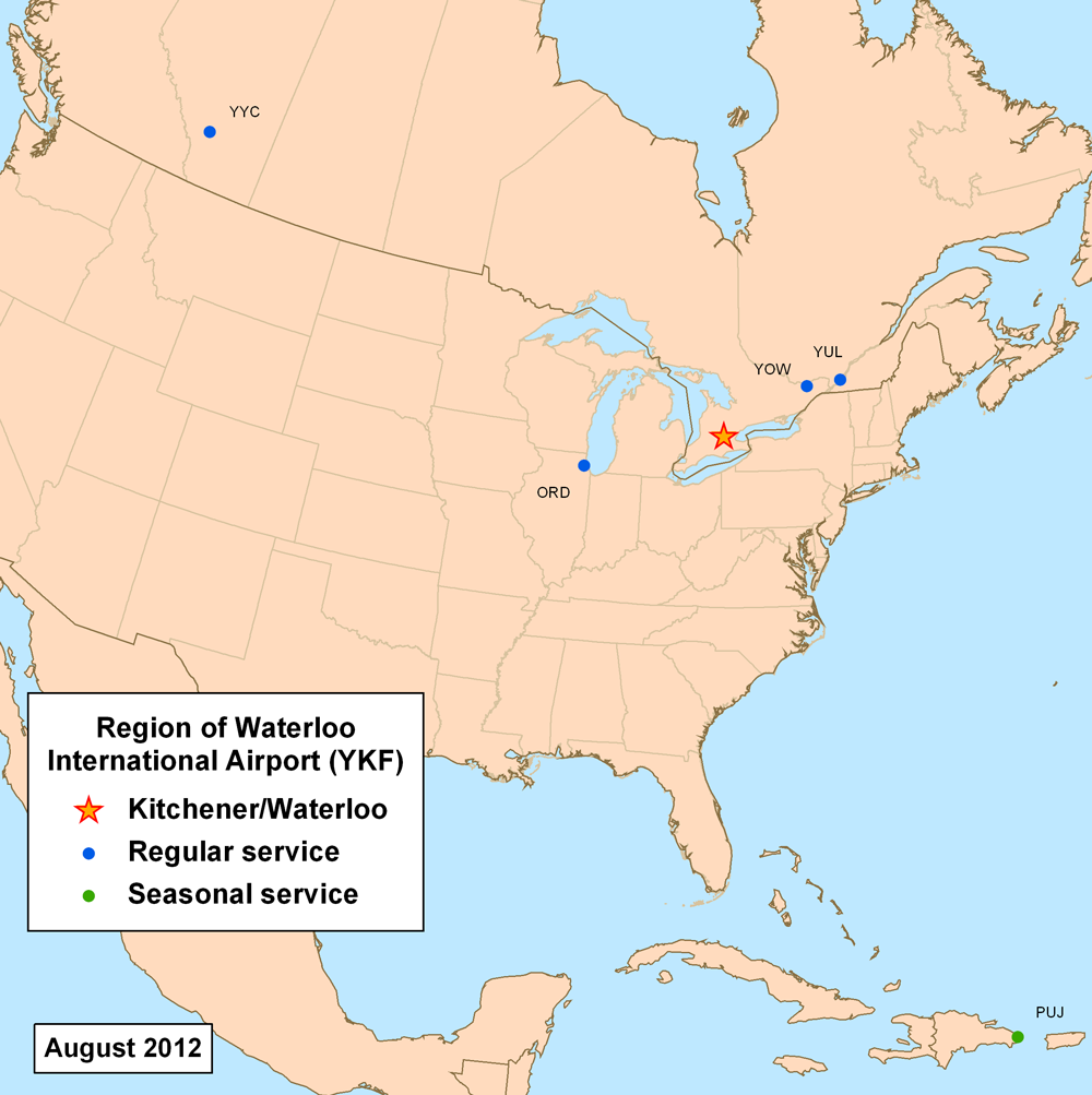
| Description | This is a route map for Region of Waterloo International Airport as of June 2010. Map is an Azimuthal equidistant projection centered on the airport so straight lines are along great circle routes. Source. |
| Date | 27 June 2007 (original upload date) |
| Source | No machine-readable source provided. Own work assumed (based on copyright claims). |
| Author | No machine-readable author provided. Kmusser assumed (based on copyright claims). |
Licensing edit
I, the copyright holder of this work, hereby publish it under the following license:
This file is licensed under the Creative Commons Attribution-Share Alike 3.0 Unported license.
- You are free:
- to share – to copy, distribute and transmit the work
- to remix – to adapt the work
- Under the following conditions:
- attribution – You must give appropriate credit, provide a link to the license, and indicate if changes were made. You may do so in any reasonable manner, but not in any way that suggests the licensor endorses you or your use.
- share alike – If you remix, transform, or build upon the material, you must distribute your contributions under the same or compatible license as the original.
File history
Click on a date/time to view the file as it appeared at that time.
| Date/Time | Thumbnail | Dimensions | User | Comment | |
|---|---|---|---|---|---|
| current | 13:04, 27 June 2012 | | 1,000 × 1,003 (330 KB) | Kmusser (talk | contribs) | updated destinations |
| 21:17, 1 February 2010 |  | 1,000 × 1,002 (379 KB) | Kmusser (talk | contribs) | updated destinations | |
| 13:17, 24 September 2007 |  | 500 × 500 (125 KB) | Kmusser (talk | contribs) | added Ottawa | |
| 13:09, 28 June 2007 |  | 500 × 500 (119 KB) | Kmusser (talk | contribs) | changed Calgary to regular service | |
| 17:53, 27 June 2007 |  | 500 × 500 (126 KB) | Kmusser (talk | contribs) | increased dot size slightly | |
| 17:46, 27 June 2007 |  | 500 × 500 (118 KB) | Kmusser (talk | contribs) | == Summary == This is a route map for Region of Waterloo International Airport as of June 2007. Map is an Azimuthal equidistant projection centered on the airport s |
You cannot overwrite this file.
File usage on Commons
There are no pages that use this file.
File usage on other wikis
The following other wikis use this file:
- Usage on en.wikipedia.org
- Usage on pms.wikipedia.org