File:Zanzibar and Pemba Islands.jpg

Size of this preview: 303 × 599 pixels. Other resolutions: 121 × 240 pixels | 243 × 480 pixels | 849 × 1,677 pixels.
Original file (849 × 1,677 pixels, file size: 322 KB, MIME type: image/jpeg)
Captions
Captions
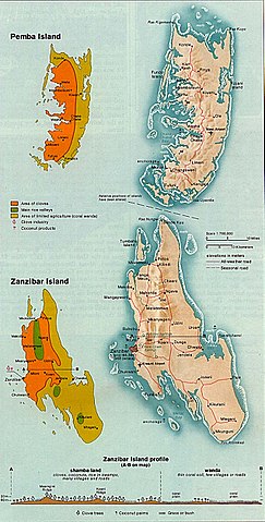
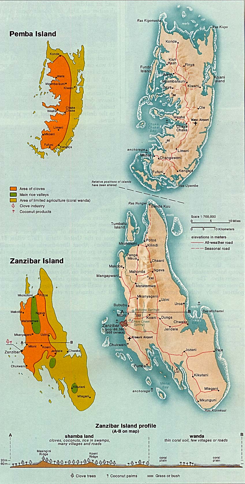
Map of Unguja island (Zanzibar Island) and Pemba Island
Summary edit
- Map of Unguja island (Zanzibar Island) and Pemba Island — two largest islands in the Zanzibar Archipelago of the Indian Ocean, in Tanzania.
- Credits
- This file was transfered from sw.wikipedia.org.
- The original file description page is (was) here.
Original description at sw edit
Kutokana na http://www.lib.utexas.edu/maps/islands_oceans_poles/zanzibar_island_76.jpg
From The Indian Ocean Atlas, published by the Central Intelligence Agency.
| This image is a work of a Central Intelligence Agency employee, taken or made as part of that person's official duties. As a Work of the United States Government, this image or media is in the public domain in the United States.
|

|
Original upload log edit
- http://upload.wikimedia.org/wikipedia/sw/8/8b/Zanzibar and Pemba Islands.jpg (16:59, 26 Februari 2006) . . User:Kipala (Kipala) (User talk:Kipala (Talk) ) . . 849x1677 (329624 bytes) (Kutokana na www.lib.utexas.edu/maps/islands_oceans_poles/zanzibar_island_76.jpg From The Indian Ocean Atlas, published by the Central Intelligence Agency.)
File history
Click on a date/time to view the file as it appeared at that time.
| Date/Time | Thumbnail | Dimensions | User | Comment | |
|---|---|---|---|---|---|
| current | 11:35, 10 April 2006 | | 849 × 1,677 (322 KB) | Matt Crypto (talk | contribs) | '''This file was transfered from [http://sw.wikipedia.org sw.wikipedia.org]. The original file description page is (was) here.''' == Original description at [http://sw.wikipedia.org sw] == Kutokana na http://ww |
You cannot overwrite this file.
File usage on Commons
There are no pages that use this file.
File usage on other wikis
The following other wikis use this file:
- Usage on ast.wikipedia.org
- Usage on es.wikipedia.org
- Usage on gl.wikipedia.org
- Usage on it.wikipedia.org
- Usage on sw.wikipedia.org