File:Zementfabrik Lägern Lagekarte.png
Size of this preview: 800 × 397 pixels. Other resolutions: 320 × 159 pixels | 640 × 318 pixels | 1,024 × 508 pixels | 1,861 × 924 pixels.
Original file (1,861 × 924 pixels, file size: 2.58 MB, MIME type: image/png)
Captions
Captions
Add a one-line explanation of what this file represents
Summary edit
| Description |
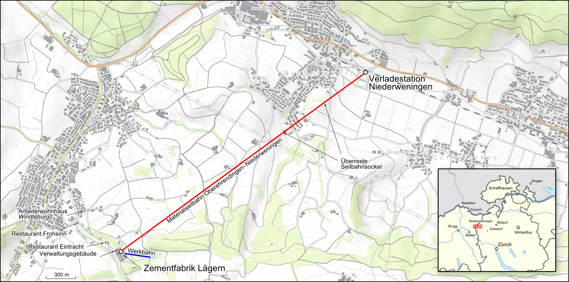
Deutsch: Lagekarte der Zementfabrik Lägern |
|||||||||
| Date | ||||||||||
| Source |
Map was created using:
|
|||||||||
| Creator |
|
|||||||||
| Permission (Reusing this file) |
|
|||||||||
| Geotemporal data | ||||||||||
| Bounding box |
|
|||||||||
| Georeferencing | ||||||||||
Licensing edit
I, the copyright holder of this work, hereby publish it under the following license:
This file is licensed under the Creative Commons Attribution-Share Alike 3.0 Unported license.
Attribution: Peter Christener
- You are free:
- to share – to copy, distribute and transmit the work
- to remix – to adapt the work
- Under the following conditions:
- attribution – You must give appropriate credit, provide a link to the license, and indicate if changes were made. You may do so in any reasonable manner, but not in any way that suggests the licensor endorses you or your use.
- share alike – If you remix, transform, or build upon the material, you must distribute your contributions under the same or compatible license as the original.
| This work is licensed under the Open Database License (summary). |
File history
Click on a date/time to view the file as it appeared at that time.
| Date/Time | Thumbnail | Dimensions | User | Comment | |
|---|---|---|---|---|---|
| current | 19:36, 26 December 2017 | | 1,861 × 924 (2.58 MB) | Pechristener (talk | contribs) | small fix |
| 19:32, 26 December 2017 |  | 1,861 × 924 (2.58 MB) | Pechristener (talk | contribs) | Lagekarte hinzu | |
| 17:36, 26 December 2017 |  | 1,861 × 924 (2.68 MB) | Pechristener (talk | contribs) | {{Map |Description={{de|Lagekarte der {{w|Zementfabrik Lägern||de}}}} |Source= Map was created using: *[http://opentopomap.org/ Open Topo Map] for background *[http://www.ehrendingen.ch/fileadmin/resources/03_Freizeit/o4_Zementfabrik.pdf pdf] |Autho... |
You cannot overwrite this file.
File usage on Commons
There are no pages that use this file.
File usage on other wikis
The following other wikis use this file:
- Usage on de.wikipedia.org