File:Znak IIIC-2 (1975).svg

Size of this PNG preview of this SVG file: 466 × 600 pixels. Other resolutions: 186 × 240 pixels | 373 × 480 pixels | 597 × 768 pixels | 796 × 1,024 pixels | 1,591 × 2,048 pixels | 823 × 1,059 pixels.
Original file (SVG file, nominally 823 × 1,059 pixels, file size: 53 KB)
Captions
Captions
Add a one-line explanation of what this file represents
Summary edit
| Description |
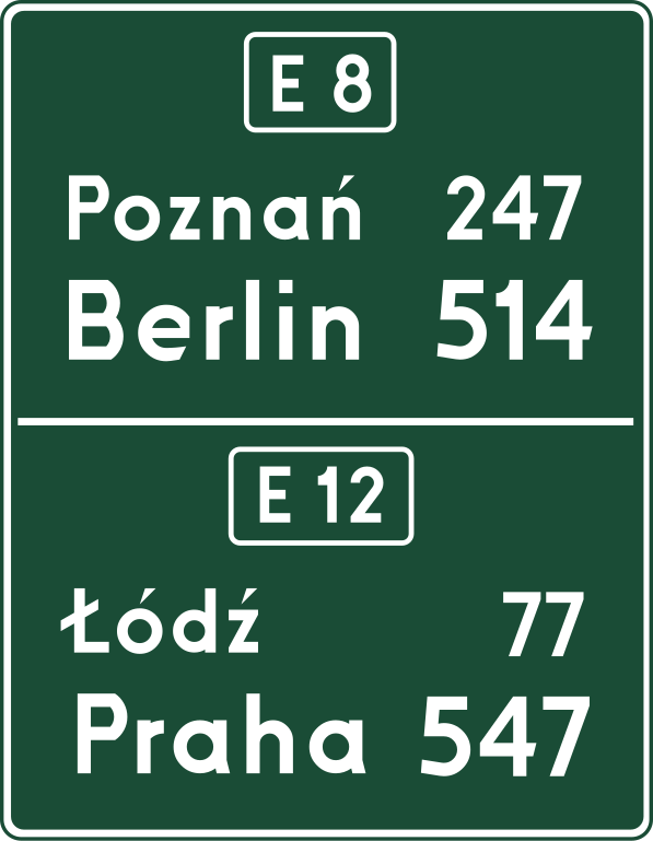
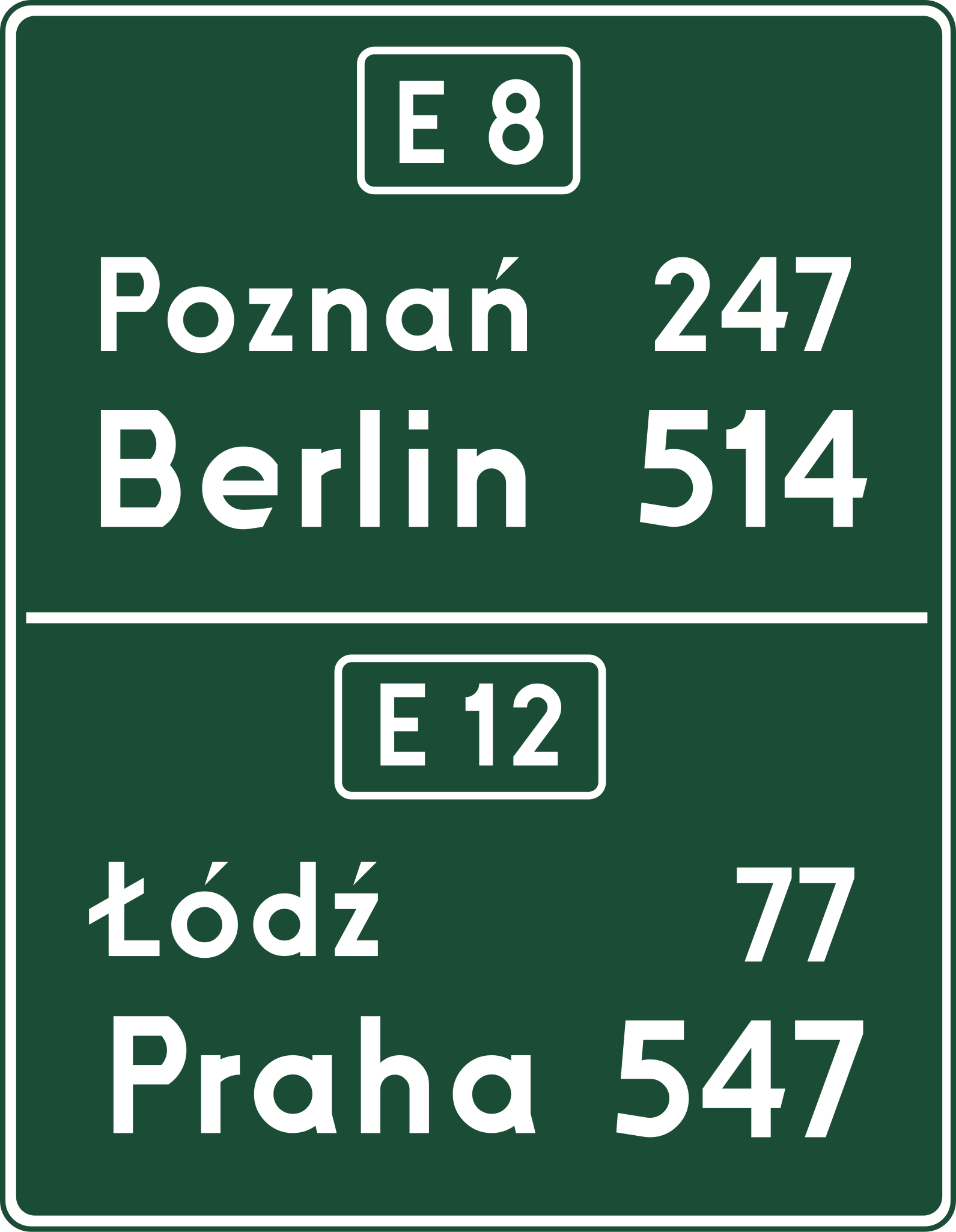
Polski: Znak IIIC-2: „tablica szlaku drogowego”. Wygląd znaku w oparciu o rysunek wzorcowy zawarty w Instrukcji o znakach i sygnałach na drogach z 1975 roku, autorstwa Ministerstwa Komunikacji, wydanej w Warszawie przez Wydawnictwa Komunikacji i Łączności.
Przykład podawania odległości do poszczególnych miejscowości w ciągu wspólnego odcinka dwóch dróg międzynarodowych. Godny dostrzeżenia jest także zapis miejscowości docelowej i związanej z nią odległości większym drukiem – cecha ta występowała na tablicach odległościowych w Polsce praktycznie do początku lat 2000. English: Sign IIIC-2: “route board”. Based on reference drawing in Instrukcja o znakach i sygnałach na drogach (English translation: Instruction about traffic signs and signals), made by Ministry of Communication and released in Warsaw in 1975 by Wydawnictwa Komunikacji i Łączności. Example of showing distances to multiple cities located on concurrency of two international roads in Poland. It is also worth noticing that the final destination and the distance are written in larger font – this feature appeared on kilometre signs in Poland practically until the beginning of the 2000s. |
|||
| Date | ||||
| Source | Own work | |||
| Author | Miko101 | |||
| Permission (Reusing this file) |
|

.svg&action=edit§ion=1)
This W3C-unspecified vector image was created with Inkscape .
File history
Click on a date/time to view the file as it appeared at that time.
| Date/Time | Thumbnail | Dimensions | User | Comment | |
|---|---|---|---|---|---|
| current | 18:44, 10 June 2022 | | 823 × 1,059 (53 KB) | Miko101 (talk | contribs) | {{Information |Description = {{pl|1='''Znak IIIC-2:''' „tablica szlaku drogowego”. Wygląd znaku w oparciu o rysunek wzorcowy zawarty w ''Instrukcji o znakach i sygnałach na drogach z 1975 roku'', autorstwa Ministerstwa Komunikacji, wydanej w Warszawie przez Wydawnictwa Komunikacji i Łączności.<br/> Przykład podawania odległości do poszczególnych miejscowości w ciągu wspólnego odcinka dwóch dróg międzynarodowych. Godny dostrzeżenia jest także zapis miejscowości docelowej i związanej z nią o... |
You cannot overwrite this file.
File usage on Commons
There are no pages that use this file.
.svg&oldid=739747927)