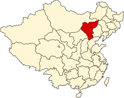
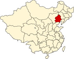
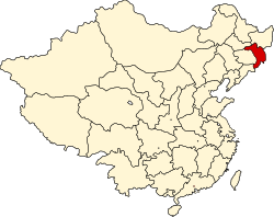
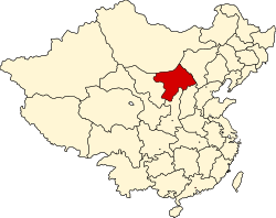
Locator maps of province-level divisions of the Republic of China
English: This is a series of locator maps made by Pryaltonian, based on Image:ROC_Administrative_and_Claims.jpg and Locator maps of province-level divisions of the People's Republic of China created by Ran. Features include:
- Official provincial borders of the Republic of China that have been changed by the administration of the People's Republic of China.
- Disputed areas are given as much NPOV treatment as possible.
- Green-blue areas are those under the administration of the Republic of China. This includes Taiwan, Penghu, Kinmen, Matsu, and Pratas islands.
- Red areas are the 14 central municipalities of the Republic of China.
- Light blue areas are those claimed by the Republic of China but controlled by the People's Republic of China. This includes Mainland China, Hong Kong and Macau.
- Light purple areas are those claimed by the Republic of China but controlled or claimed by other countries. This includes: the Diaoyu Islands/Senkaku Shoto, controlled by Japan; Arunachal Pradesh, controlled by India; Tannu Uriankhai and the 64 villages east of the Amur River, controlled by Russia; Mongolia, controlled by the Republic of Mongolia; parts of Kachin and Sagaing, controlled by Myanmar; parts of Gorno-Badakhshan, controlled by Tajikistan; and areas of Xinjiang controlled by Afghanistan and Pakistan.
- Pink areas are those claimed by other countries but under Chinese control. This includes Aksai Chin, controlled by the People's Republic of China.
- The Paracel, Macclesfield, and Spratly Islands are omitted, because the area covered is too large and the situation too complex to fit into a simple locator map.
中文:這是中華民國部份省級行政區位置圖,由Pryaltonian依據http://en.wikipedia.org/wiki/Image:ROC_Administrative_and_Claims.jpg和Ran的Locator maps of province-level divisions of the People's Republic of China繪製。特徵包括:
- 中華民國官方省界,並不依中華人民共和國重劃
- 有爭議地區盡量以中立方式處理
- 藍綠色地區是中華民國統治區,包括臺灣、澎湖、金門、馬祖、東沙群島
- 紅色地區是中華民國直轄市
- 淺藍色地區是中華民國主張,但被中華人民共和國控制的地區,包括中國大陸、香港、澳門
- 淺紫色地區是中華民國主張,但被其他國家控制的地區,包括釣魚臺列嶼、藏南、唐努烏梁海和江東六十四屯、蒙古、克欽和實皆、戈爾諾—巴達赫尚、部份新疆
- 粉紅色地區是其他國家主張,但被中華人民共和國控制的地區,包括阿克賽欽
- 南沙群島、中沙群島、西沙群島不在地圖列出,因範圍太大
Andong (Antung) 安東省
|
Chahar (Chahar) 察哈爾省
| |
Hejiang (Hokiang) 合江省
|
Liaobei (Liaopeh) 遼北省
| |
Nenjiang (Nunkiang) 嫩江省
|
Rehe (Jehol) 熱河省
| |
Songjiang (Sungkiang) 松江省
|
Suiyuan (Suiyuan) 綏遠省
| |
Xikang (Sikang) 西康省
|
Xing'an (Hiangan) 興安省
|