Long Valley Caldera
depression in California, United States
-

-
 Hot Creek in winter
 -
 Hot Creek in summer
 -
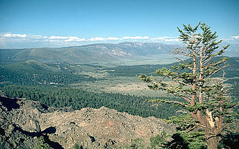 NE rim
 -
 Hot spring in Caldera
 -
 Mammoth Lakes town


Bishop Tuff edit
-
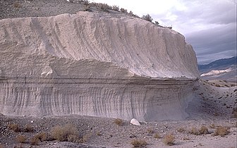 Two layers of the Bishop Tuff: lower layer was from ashfall, upper layer was from the main pyroclastic flow.
 -

-
 Southern margin of the pyroclastic flow looking west towards the Sierra Nevada. The Lower Owens River is seen along the edge of the flow, and the town of Bishop, California at left.


Maps and illustrations edit
-
 Map of Long Valley/Mono area
 -
 Cross section of the Long Valley Caldera
 -
 Cross section of the Long Valley Caldera
 -
 Map of the Long Valley Caldera, with Bishop Tuff outlined.
 -
 Simplified flow map


.png)
