Category:Maps
(Redirected from Mapas)
visual representation of a concept space; symbolic depiction emphasizing relationships between elements of some space, such as objects, regions, or themes _ESA23162625.png)  | |||||
| Upload media | |||||
| Pronunciation audio | |||||
|---|---|---|---|---|---|
| Instance of | |||||
| Subclass of |
| ||||
| Part of |
| ||||
| Different from | |||||
| |||||
- (en) Map
- (an) Mapa
- (ar) خريطة
- (as) মানচিত্র
- (ast) Mapa
- (bg) Карта
- (bn) মানচিত্র
- (bs) Karta
- (ca) Plànol
- (cs) Mapa
- (cy) Map
- (da) Kort (geografi)
- (de) Karte (Kartografie)
- (eo) Mapo
- (es) Mapa
- (et) Kaart (kartograafia)
- (fa) نقشه
- (fi) Kartta
- (fr) Carte géographique
- (gan) 地圖
- (gl) Mapa
- (he) מפה
- (hi) मानचित्र
- (hr) Karta
- (hu) Térkép
- (id) Peta
- (is) Kort
- (it) Mappa
- (ja) 地図
- (ka) გეოგრაფიული რუკა
- (ko) 지도
- (la) Tabula geographica
- (lb) Landkaart
- (lt) Žemėlapis
- (ml) ഭൂപടം
- (ms) Peta
- (nl) Kaart (cartografie)
- (nn) Kart
- (no) Kart
- (oc) Mapa
- (pl) Mapa
- (pt) Mapa
- (ro) Hartă
- (ru) Географическая карта
- (sa) Хаарта
- (sco) Cairt
- (si) ple:Map
- (sk) Mapa
- (sl) Zemljevid
- (sq) Harta
- (sr) Карта (мапа)
- (su) Atlas
- (sv) Karta
- (sw) Ramani
- (ta) நிலப்படம்
- (tg) Харита
- (th) แผนที่
- (tl) Mapa
- (tr) Harita
- (uk) Географічна карта
- (vi) Bản đồ
- (yi) מאפע
- (zh) 地图
- (zh-classical) 地圖
- (zh-yue) 地圖
Before changing or adding maps, please read the brief guideline on the organizational schema About this Category developed during an eight month effort by a working group in 2007–2008.
- See also maps needing categories in Category:Unidentified maps
- See also these related categories: (These categories may contain more maps. Please categorize them in map categories.)
- Category:Cartography – for map symbols, projections, etc.
- Category:Demography
- Category:Geography
- Category:Aerial photographs
- Category:Satellite pictures
- Category:Astronomical maps – maps and star charts
- Category:Cartographic reliefs for models of landscape profiles
Resources:

Subcategories
This category has the following 28 subcategories, out of 28 total.
Pages in category "Maps"
The following 5 pages are in this category, out of 5 total.
Media in category "Maps"
The following 200 files are in this category, out of 755 total.
(previous page) (next page)-
 -JHSCDWFNcw.jpg 603 × 276; 27 KB
-
 1617226050223 Nilópolis.jpg 3,000 × 1,952; 706 KB
-
 1914년 제국주의 식민지.png 1,522 × 628; 44 KB
-
 1990년 지역별 노인 비율.png 1,740 × 786; 575 KB
-
 1991 RWC Test.svg 2,754 × 1,398; 1.13 MB
-
 1a1e391.jpg 2,139 × 1,625; 214 KB
-
 1LaUnionPh.png 900 × 900; 89 KB
-
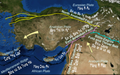
 20231211074619!Map of the Xiongnu, circa 150 BCE.png 3,196 × 1,840; 13.52 MB
-

-
 343 of 'Z českého ráje. Cestopisné Kresby ... Illustroval A. Nejedlý' (11184104636).jpg 2,303 × 2,525; 1.15 MB
-

-

-

-
 345 of 'Deux missions françaises chez les Touareg en 1880-81' (11235067136).jpg 3,222 × 4,598; 2.74 MB
-

-
-

-

-

-

-

-

-
 348 of 'La Penisola di Sirmione sul Lago di Garda illustrata' (11047641295).jpg 2,365 × 3,510; 1.13 MB
-

-

-

-

-
 35 of 'Histoire de la Nation suisse' (11238732276).jpg 2,144 × 1,785; 934 KB
-
 35 of 'Santo Stefano al Quieto. Studio, etc' (11197573045).jpg 2,368 × 1,662; 1.09 MB
-

-

-

-
 351 of 'History of Morgan's Cavalry' (11081914215).jpg 1,343 × 2,320; 385 KB
-
 351 of 'The Ride through Palestine ... Illustrated, etc' (11155179463).jpg 1,245 × 2,011; 703 KB
-

-

-
 352 of 'La Penisola di Sirmione sul Lago di Garda illustrata' (11049674454).jpg 2,406 × 3,510; 809 KB
-
 353 of 'La Penisola di Sirmione sul Lago di Garda illustrata' (11047924226).jpg 2,406 × 3,510; 706 KB
-

-

-

-
 355 of 'Rides and Studies in the Canary Islands ... Illustrated' (11289591334).jpg 1,296 × 1,148; 314 KB
-

-

-

-
 359 of 'Geschiedenis van Dixmude, etc' (11176827076).jpg 2,672 × 1,717; 683 KB
-

-

-
 359 of 'Voyage religieux en Orient ... Deuxième édition' (11042694205).jpg 1,306 × 2,237; 418 KB
-

-
 36 of 'Cité de Carcassonne, Aude' (11056148095).jpg 2,448 × 1,312; 485 KB
-

-

-

-

-

-
 36 of 'Recherches sur Pesmes, etc' (11235488736).jpg 2,706 × 1,632; 781 KB
-

-

-

-
-
 362 of 'Geschichte der Stadt Riga' (11240755675).jpg 1,540 × 2,110; 718 KB
-

-
 363 of 'A Ride through Western Asia ... With illustrations' (11240628393).jpg 2,998 × 3,056; 1.35 MB
-

-

-
 363 of 'Geschichte der Stadt Riga' (11241093654).jpg 1,540 × 2,122; 631 KB
-

-
 363 of 'Old and New London, etc' (11131294355).jpg 2,912 × 1,936; 1.53 MB
-
 363 of 'Servia, the Poor Man's Paradise, etc' (11239729163).jpg 5,328 × 4,838; 5.46 MB
-

-
 363 of 'Voyage religieux en Orient ... Deuxième édition' (11042796535).jpg 1,306 × 2,237; 346 KB
-

-
 365 of '(A Ride through Western Asia ... With illustrations.)' (11243662124).jpg 2,828 × 2,388; 1.02 MB
-

-

-
 365 of 'A Ride through Western Asia ... With illustrations' (11240309914).jpg 3,180 × 2,532; 1.25 MB
-

-

-

-
 365 of 'Voyage religieux en Orient ... Deuxième édition' (11043090545).jpg 1,306 × 2,237; 354 KB
-

-

-
 366 of 'Roma descritta ed illustrata. Seconda edizione' (11000118045).jpg 2,688 × 1,858; 915 KB
-

-
 367 of '(A Ride through Western Asia ... With illustrations.)' (11240452344).jpg 3,148 × 2,550; 1.24 MB
-
 367 of 'A Ride through Western Asia ... With illustrations' (11239580804).jpg 2,892 × 2,467; 1.12 MB
-

-
 367 of 'Geschichte der Stadt Hamburg' (11083912344).jpg 2,498 × 2,373; 1.61 MB
-
 367 of 'Voyage religieux en Orient ... Deuxième édition' (11044710503).jpg 1,306 × 2,237; 374 KB
-

-

-

-

-

-
 369 of 'A Ride through Western Asia ... With illustrations' (11239733486).jpg 4,169 × 3,164; 3.03 MB
-
 369 of 'Die Culturländer des alten America' (11125586826).jpg 4,645 × 3,369; 3.82 MB
-

-
 369 of 'Voyage religieux en Orient ... Deuxième édition' (11043927634).jpg 1,306 × 2,237; 306 KB
-
 37 of 'A Bird's-Eye View of Picturesque India, etc' (11295169244).jpg 1,191 × 1,606; 388 KB
-

-

-
 37 of 'Bramshill- its history & architecture. (With plates.)' (11163400826).jpg 1,505 × 2,195; 355 KB
-

-
 37 of 'Herne Bay Illustrated. Edited by J. W' (11199077804).jpg 3,104 × 2,115; 729 KB
-

-
-
 37 of 'Histoire politique, religieuse et littéraire des Landes, etc' (11025953093).jpg 1,474 × 2,486; 637 KB
-

-

-
 37 of 'Recherches sur Pesmes, etc' (11238273123).jpg 2,653 × 1,632; 533 KB
-

-

-

-

-

-
-

-

-
 370 of 'Cassell's Illustrated History of the Russo-Turkish War' (11236693103).jpg 2,026 × 1,676; 840 KB
-

-
 371 of 'Histoire d'Hesdin' (11234373443).jpg 1,283 × 2,191; 593 KB
-
 371 of 'Les Guerres de la Révolution' (11184406285).jpg 5,604 × 5,033; 5.97 MB
-
 371 of 'Voyage religieux en Orient ... Deuxième édition' (11044917033).jpg 1,306 × 2,237; 316 KB
-
 372 of 'Cassell's Illustrated History of the Russo-Turkish War' (11236781123).jpg 2,031 × 1,660; 901 KB
-

-

-
 373 of 'History of the King's German Legion. (With plates.)' (11008526946).jpg 2,528 × 1,455; 786 KB
-
 373 of 'The Ride through Palestine ... Illustrated, etc' (11279877424).jpg 1,235 × 1,021; 351 KB
-

-
-

-

-
-
 377 of 'Journal et correspondance ... Publiés par W. G. Barttelot' (11212743175).jpg 2,487 × 2,119; 1.05 MB
-

-

-
 378 of 'Histoire de la guerre du Pacifique, 1879-1880 (1880-1881)' (11144615855).jpg 1,341 × 2,464; 592 KB
-
 378 of 'Lands, classical and sacred' (11024055956).jpg 1,247 × 1,959; 749 KB
-

-
 379 of 'Histoire de la ville de Nîmes depuis 1830, etc' (11182315793).jpg 1,976 × 2,880; 653 KB
-
 379 of 'Journal et correspondance ... Publiés par W. G. Barttelot' (11213975673).jpg 4,009 × 2,125; 1.89 MB
-

-
 4 colors.jpg 1,920 × 1,080; 460 KB
-

-
 Adoulis Carte du réseau hydrographique.jpg 1,120 × 882; 364 KB
-
 Ahmar Laglalcha Map - 2021.jpg 1,471 × 1,054; 496 KB
-
 Akim abuakwa north map.png 650 × 338; 22 KB
-
 Algeria extradition treaties-ar.svg 2,754 × 1,398; 1.19 MB
-
 Algeria North Korea Locator.png 1,376 × 708; 51 KB
-
 Alternative.Map.Bryansk.Oblast.png 1,200 × 933; 206 KB
-
 AmericanRevolutionaryWar.png 1,357 × 628; 35 KB
-
 Anatolian Plate - vie.png 1,719 × 1,080; 1.8 MB
-
 Anshan-Stadt.jpg 2,484 × 941; 439 KB
-
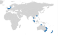 APERA Conference Locations.png 360 × 223; 26 KB
-
 Approximate map of Comancheria (borders in flux).png 359 × 399; 37 KB
-
 Ares Vallis Karte.jpg 1,080 × 1,439; 1.25 MB
-
 Atlas Map Fictional.jpg 400 × 255; 29 KB
-
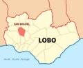 Barangay San Miguel, Lobo Map.png 1,624 × 1,343; 467 KB
-
 Barca map took by me.png 1,024 × 853; 690 KB
-
 Barrios y Comunas de Buenos Aires.jpg 800 × 815; 126 KB
-
 BASALDE MAPA.jpg 1,989 × 3,771; 1.03 MB
-
 Base para preparar mapa - no publicar.png 766 × 732; 518 KB
-
 Bat mappa.gif 430 × 507; 40 KB
-
 BAUNGON BMAP.jpg 582 × 791; 34 KB
-
 Bide berdearen mapa.png 1,022 × 633; 985 KB
-
 Binan Map.jpg 598 × 856; 80 KB
-
 Birobidzhan Agricultural-map.jpg 918 × 650; 121 KB
-
 Black Sea map lld.png 2,006 × 1,541; 748 KB
-
 BlankMap-World 16 April 2024.svg 2,754 × 1,398; 1.1 MB
-
 BlankMap-World-v6pt6 small states.svg 512 × 260; 804 KB
-
 BlankMap-World-with-Circles 17 April 2024.svg 2,754 × 1,398; 1.1 MB
-
 Blue Water Michigan Map.jpg 119 × 164; 30 KB
-
 Borghetto Battle Map 30May1796.JPG 720 × 586; 70 KB
-
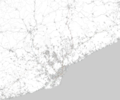
 Boston Massachusetts US map vector svg free.svg 5,806 × 7,434; 7.77 MB
-
 Boudikka1-c6f5e4de5f8e5e9cd8179cc5ec80750b.jpg 837 × 789; 67 KB
-
 Bourgogne-Franche-Comté région.png 280 × 269; 27 KB
-
 Brabantse wouden kaart en legende-022.jpg 3,508 × 2,480; 613 KB
-
 Brain Maps.JPG 1,915 × 1,033; 340 KB
-
 Bristol 3rd District.svg 388 × 210; 59 KB
-
 Britishisles.jpg 690 × 1,073; 65 KB
-
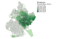 Brooklyn census tracts by percent Black, 2020.svg 619 × 409; 480 KB
-
 BRUMMWAY.png 486 × 623; 110 KB
-
 Bulgaria 1994 CIA map Modifiziert Route.jpg 800 × 791; 1.2 MB
-
 Buxoro shahar hunarmandchilik markazlari.jpg 4,032 × 2,268; 2.35 MB
-
 Bản đồ huyện Xonbuly.png 480 × 300; 6 KB
-
 CapillaDelSauce 123.jpg 400 × 255; 52 KB
-
 Captura de pantalla 2023-10-13 015607.png 1,150 × 778; 1.85 MB
-
 Carte 12 - L’Afrique d’Antalas.jpg 7,172 × 6,312; 3.53 MB
-
 Carte 18.png 962 × 682; 76 KB
-
 CARTE 2024 JP légendé.jpg 930 × 646; 714 KB
-
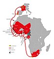
 CARTE ACE FINAL (Récupéré).png 6,520 × 7,087; 1.03 MB
-
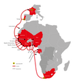
 CARTE ACE FINAL.jpg 6,520 × 7,087; 875 KB
-
 CARTE ACE FINAL.png 6,520 × 7,087; 1.03 MB
-
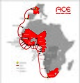 CARTE ACEvecto2.jpg 2,488 × 2,606; 574 KB
-
 Carte Barrage de la Renaissance.jpg 636 × 326; 43 KB
-
 Carte CCTiV Complète.png 7,990 × 4,587; 1.48 MB
-
 Carte de l'Eurafrique de Jean Thiriart.png 18,750 × 9,308; 5.39 MB
-
 Carte de l'Europe des ethnies de Saint-Loup.png 2,576 × 2,576; 516 KB
-
 Carte de l'Europe du monde blanc de Jean Mabire.png 18,750 × 9,308; 5.25 MB


.jpg)
.jpg)
.jpg)
%27_(11074602143).jpg)
%27_(11161265425).jpg)
.jpg)
.jpg)
%27_(11038260416).jpg)
.jpg)
.jpg)
%27_(11073181284).jpg)
.jpg)
.jpg)
%27_(11287304486).jpg)
.jpg)
%27_(11185606153).jpg)
.jpg)
.jpg)
.jpg)
.jpg)
.jpg)
%27_(11109654036).jpg)
%27_(11294440144).jpg)
%27_(11290134515).jpg)
.jpg)
.jpg)
.jpg)
.jpg)
.jpg)
.jpg)
._With_illustrations,_etc%27_(11154283464).jpg)
.jpg)
.jpg)
.jpg)
%27_(11127442874).jpg)
.jpg)
%27_(11286680205).jpg)
.jpg)
.jpg)
.jpg)
.jpg)
%27_(11129149386).jpg)
.jpg)
%27_(11163631903).jpg)
.jpg)
.jpg)
_och_dess_svenska_f%C3%B6reg%C3%A5ngare_j%C3%A4mte_en_kortfattad_framst%C3%A4llning_af_nordostpassagens_historia_och_den_amerikanska_nordpols-expeditionen_under_De_Long,_etc%27_(11202874436).jpg)
.jpg)
.jpg)
.jpg)
%27_(11293769915).jpg)
.jpg)
.jpg)
.jpg)
.jpg)
.jpg)
.jpg)
.jpg)
.jpg)
.jpg)
.jpg)
.jpg)
.jpg)
.jpg)
%27_(11092742984).jpg)
%27_(11243662124).jpg)
.jpg)
.jpg)
.jpg)
.jpg)
.jpg)
.jpg)
.jpg)
%27_(11177395913).jpg)
.jpg)
.jpg)
.jpg)
%27_(11240452344).jpg)
.jpg)
.jpg)
.jpg)
%27_(11204373204).jpg)
.jpg)
.jpg)
.jpg)
)_(With_plates.)%27_(11013225505).jpg)
.jpg)
.jpg)
.jpg)
.jpg)
.jpg)
%27_(11067321736).jpg)
%27_(11225113774).jpg)
%27_(11163400826).jpg)
.jpg)
.jpg)
%27_(11014775775).jpg)
.jpg)
.jpg)
.jpg)
.jpg)
.jpg)
.jpg)
%27_(11203949646).jpg)
.jpg)
.jpg)
.jpg)
.jpg)
%27_(11179151446).jpg)
%27_(11203752594).jpg)
.jpg)
.jpg)
.jpg)
.jpg)
.jpg)
.jpg)
.jpg)
%27_(11059362995).jpg)
%27_(11008526946).jpg)
.jpg)
.jpg)
%27_(11006669015).jpg)
%27_(11007387374).jpg)
.jpg)
.jpg)
.jpg)
.jpg)
%27_(11144615855).jpg)
.jpg)
.jpg)
.jpg)
.jpg)
.jpg)


.png)


.png)


.jpg)
%27_(11012256563).jpg)