User:DanTD/New York gallery/Photographic rampages of 2019
Since I've got so many images from New York, I had to make a separate chapter just for them. And after going on even greater photographic rampages since 2010, I've had to split them off from that chapter as well. But even that was too big for new photographs, so I had to create one for 2015 and 2016. As previously mentioned, I also had to split off a page for 2017, with three chapters, the largest of which was for November. Though it was smaller, it should no surprise that I would make another chapter for 2018 in New York. And this is the one for 2019:
New York; April 2019; edit
April 9, 2019; Bed-Stuy and Culver attacks edit
-
 After stepping off the bus behind Jamaica (LIRR station)...
 -
 .. I not only found this guarded back parking lot for LIRR employees only...
 -
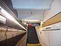
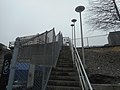 .. but this staircase to the Jamaica LIRR Yard 10 seconds earlier.
 -
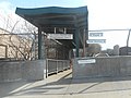
 From there I took the Atlantic Branch to Nostrand Avenue (LIRR station), but I had to use my cell phone.
 -
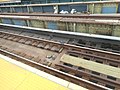
 The LIRR claims they're improving non-stop at this station. The last major renovation took place in the early-2010's.
 -
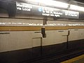
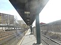
 The platform to Atlantic Terminal was closed at the time, and all trains stopped on the Jamaica-bound platform.
 -
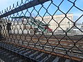
 There was just enough life left in my camera for the tunnel west of Nostrand Avenue LIRR station
 -
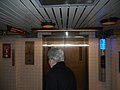
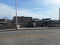
 After getting a new charger at a cell phone shop, I took some of Nostrand Avenue (IND Fulton Street Line) subway station.
 -
 Some of the tiles on the local C Train platform were falling off, but I've seen worse.
 -
 The A Train is the express line here, but I needed a C train to get where I was going.
 -
 I finally got to add some of the Franklin Avenue-Fulton Street (New York City Subway) station.
 -
 Like the Franklin Avenue Shuttle platforms, this station was vandalized with Aretha Franklin memorials.
 -
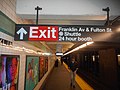 Sign directing commuters to the street and the Franklin Avenue Shuttles.
 -
 Since there were more views of the BMT Franklin Line than IND Fulton Street Line here, I thought I'd try to balance them out.
 -
 Of course they have an obligatory braille sign as any subway station should (and not just in NYC).
 -
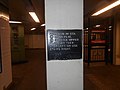
 The sign in the lobby says video surveillance cameras may be used in this station.
 -
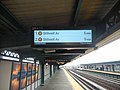
 As the sign says, you can take a staircase either to a C train going the other way, or the street, or the S to Prospect Park.
 -
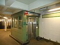 Or you can just take an elevator and do the same thing.
 -
 My real target was some of the stations on both the IND and BMT Culver Lines starting with Avenue I
 -
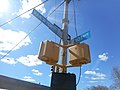
 A sign for six car trains facing the Coney Island-bound platform.
 -
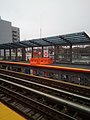
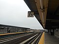
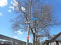
 Looking across the tracks at the platform headed towards the IND Sixth Avenue and Queens Boulevard Lines
 -
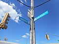
 I've seen a lot of these green arrows around Brooklyn Subway stations. I have no idea why it was under this braille sign.
 -
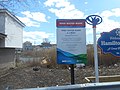
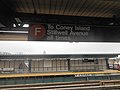 The sign says the F train stops at Coney Island-Stillwell Avenue at all times, but you can catch 9 other station before there.
 -
 The southernmost exit on the platform to Avenue J and McDonald Avenue.
 -
 The same exit looking north
 -
 Two other signs for both the Ten car and Eight car trains.
 -
 Third shot of the Avenue J and McDonald exit with the full station name.
 -
 An older version of the PA-CIS. Either that clock is slow or the clock on my camera was fast.
 -
 Whatever the case may be, the new version of the PA-CIS was more than a few feet away.
 -
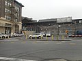
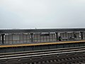
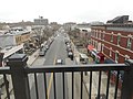
 Looking westbound over the street the station was named for. A new building was being built there.
 -
 Some pigeons on the Manhattan & Queens-bound tracks. I may be one of the few people who doesn't hate pigeons
 -
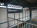
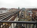
 Now looking eastbound above Avenue I. I wanted the street name sign, but the railing blocked my view.
 -
 Looking north from the northeast corner of the platform. The sign is for 10 car trains.
 -
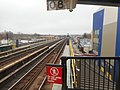
 Another view from the edge of the platform. The sign next to this signal apparently tells train operators to go 25 MPH
 -
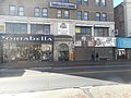
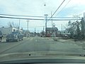
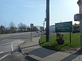
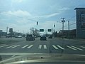
 After a snack near Ditmas Avenue, I walked along 37th Street for the sites of the former BMT Culver Shuttle stations. This one was at 13th Avenue...
 -
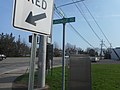
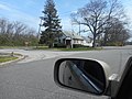
 ... and this was at Fort Hamilton Parkway. I wanted some stuff along the 36th-38th Street Yard too, but my cell phone and regular camera were dead by that time.


;_Sign_on_Manhattan_%26_Queens_Platform.jpg)
;_Coney_Island_Braille_Sign.jpg)

;_Avenue_J_%26_McDonald_Exit-1.jpg)
;_Avenue_J_%26_McDonald_Exit-2.jpg)

;_Avenue_J_%26_McDonald_Exit-3.jpg)
;_1st_Generation_PA-CIS-1.jpg)
;_2nd_Generation_PA-CIS.jpg)

;_Pigeon_on_the_NB_Local_Tracks.jpg)

_Northbound_View-1.jpg)
_Northbound_View-2.jpg)


April 10, 2019; Return to Brooklyn Heights, and the Brooklyn-Queens Line; edit
-
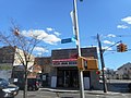
 I didn't think there were any Modell's stores still operating, but here was one in Jamaica, Queens
 -
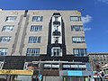
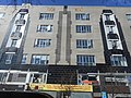
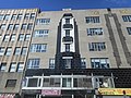
 I'm also not sure what the Stuart Building is, but it looks old, so I took a shot of it.
 -
 In March 2017, I took some pictures of the former J Kurtz and Sons store in Jamaica.
 -
 This time I though I'd get some spring shots of it from Guy R. Brewer Boulevard.
 -
 As you can see, they don't just have a "The Children's Place" clothing store there.
 -
 In fact there's even an NYC Probation Board Office.
 -
 Looking south to Archer Avenue. One right turn, and I could catch a subway towards Brooklyn.
 -
 To get to Jamaica (LIRR station), I had to catch a J train. The trouble was, the MTA sent us an L train.
 -
 Evidently the BMT Archer/Jamaica Lines had to borrow an L train from the BMT Canarsie Line.
 -
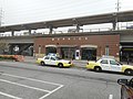
 After leaving the Sutphin Boulevard JFK Subway station, I took an easy walk to the lobby of Jamaica's big LIRR station.
 -
 Which I used to get to Atlantic Terminal. I don't know why, but I suspect this emergency exit used to be a regular staircase.
 -
 The signs above the tracks have the current and former name of the station. Sadly, I didn't get a good pic of the old station name.
 -
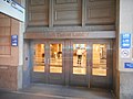
 From there I took a 2 train to Clark Street (IRT Broadway – Seventh Avenue Line), where I headed to the passageway to the elevators.
 -
 All three of these elevators lead to the Hotel St. George, which was my goal for this part of the trip.
 -
 Despite the names, none of them are truly in geographic order.
 -
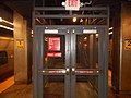
 But this emergency exit still exists next to them.
 -
 The main reason for this was to see if each exit from the hotel had it's own MTA-NYCS Helvetica Sign...
 -
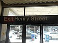 .. and sure enough, they did. One sign was for Clark Street, and this one was for Henry Street.
 -
 After zig-zagging through some lines in Downtown Brooklyn, I was able to catch a G train to Metropolitan Avenue...
 -
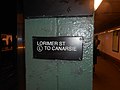
 .. where I walked to the L train at Lorimer Street. I took the tunnel on the right.
 -
 I also realized it'd be a good idea to add some images of Lorimer Street station itself. That mosaic directs commuters to Metropolitan Avenue.
 -
 I didn't need this braille sign to head east along the BMT Canarsie Line.
 -
 One place along the way was the Grand Street (BMT Canarsie Line). The station seems close to street level by this screen.
 -
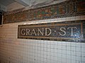 The standard mosaics along the Rockaway Parkway-bound platforms...
 -
 .. and the West Village-bound platforms across the tracks.
 -
 Next to this "G" mosaic is a modern day MTA Help Point device, but I was on my way to the BMT Myrtle Avenue Line.
 -
 After transferring at the Myrtle-Wyckoff Avenues station complex...
 -
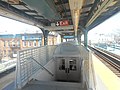
 .. I stopped at Seneca Avenue just for these quasi-futuristic looking entrances to the station house below the platform.
 -
 This view is looking north towards Middle Village–Metropolitan Avenue (BMT Myrtle Avenue Line). Note the original PA/CIS.
 -
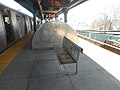 And this is a full shot of the bench behind that entrance.
 -
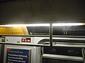
 Southbound view towards Broadway (BMT Myrtle Avenue Line) with a newer PA/CIS saying the train going in the opposite direction is coming in 15 minutes...
 -
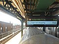 .. but now it says it's not stopping.
 -
 Northbound view again, but this time of the southern platform entrance.
 -
 From July 2017 to April 2018, much of the BMT Myrtle Avenue Line was being reconstructed, and this poster announces the return of full M train service.
 -
 You also have a sign above the platform for the Middle Village-bound tracks...
 -
 .. and one for the Williamsburg, Manhattan and northern Queens-bound tracks.
 -
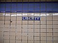 Liberty Avenue (IND Fulton Street Line) needed more images below the ground.
 -
 So I was happy to oblige as the C train left the station
 -
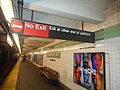
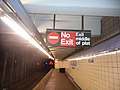 Of course, I had to grab a "No Exit" sign.
 -
 The standard IND Mosaics, with a directional mosaic underneath.
 -
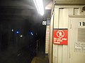
 An emergency exit sign is at the east end of the platform. I wish it turned out better.
 -
 Another 10 car sign at the end of the platform.
 -
 A Euclid Avenue-bound braille sign. Beyond this, you have to catch an A train.
 -
 On top of the crossover you can see the sign to the two staircases back to that platform.
 -
 Beneath that sign, you've got the old-fashioned directional tiles, which somebody seems to want to vandalize.
 -
 This was where a pay phone used to be.
 -
 Across the tracks, you've also got another Helvetica sign and directional mosaics to Brooklyn Boro Hall and Manhattan.
 -
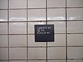
 One more small mosaic with a Manhattan-bound braille sign, and it's back to the eastbound C train.
 -
 The scratch-itti on the map looks like an extension of the IND Concourse Line to Burke Avenue on the IRT White Plains Road Line.
 -
 But that wasn't what the vandal had in mind, and unfortunately I couldn't capture that.
 -
 The aforementioned vandalism was on Subway Car number 3804.
 -
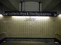
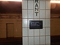 After leaving the C train to Euclid, I took an A train to Grant Avenue. This is a braille sign to either Lefferts Boulevard or the Rockaways.
 -
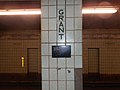 And this one goes to Manhattan.
 -
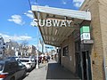
 My main target here though was the headhouse of Grant Avenue Subway Station.
 -
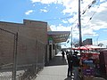 As I tried to capture more angles of it, I spotted some street vendors selling fruit.
 -
 It also has a braille sign at the door... both doors actually.
 -
 An old sign claimed that it was dangerous to be away from here, but no harm came to me.
 -
 This doorway has the little yellow staircase man.
 -
 After a detour to the IND Rockaway Line I stopped at Howard Beach-JFK station and walked around Hamilton Beach
 -
 In 2012, Hurricane Sandy left the intersection of 102nd Street and Russell Street under 8 feet of water.
 -
 Another shot of that intersection before I hoofed it back to the north toward Ramblersville.
 -
 Looking west at the Hawtree Creek from the Ramblersville-Hawtree Memorial Bridge
 -
 This wreath was laid along the west side of the bridge as a memorial to Catherine M. Doxsey, a local resident who had some political pull in the area.
 -
 One thing she did was get this bridge renamed as a memorial for World War II Veterans.
 -
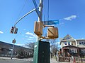
 After my final stop at Ozone Park-Lefferts Boulevard, I thought I'd stroll along Liberty Avenue to the Van Wyck Expressway.
 -
 Of course, I stayed on the service roads, where I spotted many of these unique street name signs.
 -
 While Liberty Avenue honors Roy Eldridge and Lloyd Road honors Chick Corea, the sign at 102nd Avenue honors John Coltrane
 -
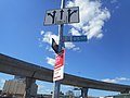
 The Van Wyck Service Roads honor the Unisphere from the 1964-65 World's Fair...
 -
 .. but the at 101st Avenue honors Buck Clayton
 -
 The signs at 97th Avenue honor Jaki Byard
 -
 Count Basie was the northernmost jazz artist on the service roads. After this I had to make a turn east of Atlantic Avenue.
 -
 East of the Van Wyck, I walked along 94th Avenue and spotted this sign at 138th Place.
 -
 This one had a little too much sun glare, though.
 -
 Not this one, but all it had were a series of keyboard, just like Sutphin and Archer.
 -
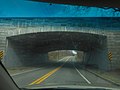
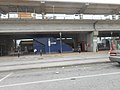
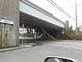
 Narrow little two-lane tunnel for 143rd Street under Jamaica Yard and the LIRR station.
 -
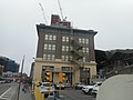
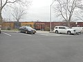
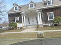
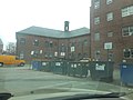
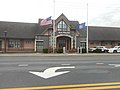
 This old building on Sutphin Boulevard is the LIRR Human Resources Building.
 -
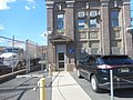 It looks a lot like the station house.
 -
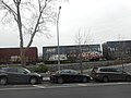
 The administrative building on the other hand looks too modern.


;_Eastbound_Blue_Tiles.jpg)
;_C_Train_heads_for_Euclid_Avenue.jpg)
;_No_Exit_Sign_on_Eastbound_Platform.jpg)
;_Standard_%26_Directions_Mosaics.jpg)
;_EB_Emergency_Exit_Sign.jpg)
;_10_Car_Sign_@_Euclid-bound_Platform.jpg)
;_Braille_Sign_to_Euclid_Avenue.jpg)
;_Lefferts_Boulevard_and_Rockaways_Sign.jpg)
;_Tiles_to_Richmond_Hill_and_Lefferts_Boulevard.jpg)
;_Old_Pay_Phone_Tiles.jpg)
;_Tiles_to_Boro_Hall_and_Manhattan.jpg)
;_Braille_Sign_to_Manhattan.jpg)


_Avenue.jpg)
_Road.jpg)
_Avenue.jpg)
_Avenue-1.jpg)
_Avenue-2.jpg)
_Avenue.jpg)
_Avenue.jpg)
_Sign.jpg)


April 11 2019; Last Crusade on the Subway, plus Astoria and Long Island City: edit
-
 On my way to St. Michael's Cemetery in Northern Woodside,...
 -
 .. I had to get some shot of the 35th Road NYCR crossing at 69th Street in Jackson Heights
 -
 This boxcar for the Angelina and Neches River Railroad...
 -
 .. is pretty far from it's usual territory.
 -
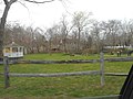
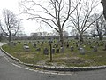 Somewhere in this plot at St. Michael's, distant relatives on my mother's side of the family are buried, but I never found them.
 -
 I did spot the grave of Scott Joplin there.
 -
 After this, I decided to give up and walk across Astoria Blvd and Grand Central Pkwy....
 -
 ... to a diner I knew about from an earlier road trip. I still got some shots of the cemetery, though.
 -
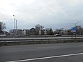
 On the way there, I got to capture these iconic features of the Grand Central Parkway.
 -
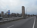 A closer shot leads to signs indicating the road takes motorists to Interstate 278
 -
 And on the opposite side, street name signs indicate these pillars are near 71st Street.
 -
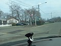
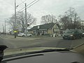
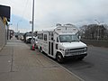 After lunch, I spotted this ex-school bus converted into a food truck.
 -
 The Triborough Bridge wasn't renamed the RFK bridge until 11 years before this sign was posted, and already it has faded.
 -
 I find it ironic that a bridge would've been named after him. The man crusaded against the construction of the Hudson River Expressway.
 -
 Somebody here is restoring a street clock and an old Fort Taurus. From there, I was able to catch a bus.
 -
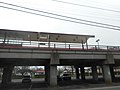
 The driver dropped me off just west of the Astoria Boulevard (BMT Astoria Line) station, but I had no problem walking there.
 -
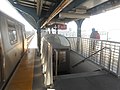
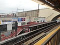
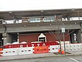
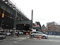 That station was facing construction, but it didn't stop me from getting pictures, including of one of the long pedestrian bridges that used to be at the station.
 -
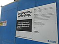 Another MTA poster claiming they're "improving non-stop."
 -
 Service changes poster providing alternate subway and bus routes.
 -
 View of the other former pedestrian bridge along the northbound tracks. From there I walked up 31st Street under the tracks.
 -
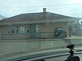
 On the southwest corner of the NYCR bridge is this tiny post office.
 -
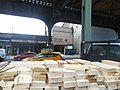
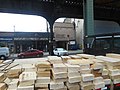 The US Post Office calls it "Woolsey Station." I got those shots from behind a small flatbed truck hauling lumber.
 -
 Somebody wanted pictures of the connecting bridge to a building next to Astoria – Ditmars Boulevard (BMT Astoria Line)
 -
 A de-facto mall is across from this bridge behind that exit sign. Like many malls these days, they're having a lot of trouble keeping their stores running.
 -
 So I took three subway trains to arrive near the Museum of Modern Arts' PS1, but that wasn't what I was hunting for.
 -
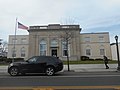
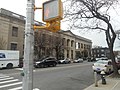 It was actually some extra images of the Long Island City Post Office
 -
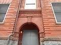
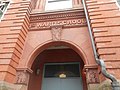 Although, the former "First Ward School" is across 21st Street from the post office, so I had ample opportunity for both sites.
 -
 This post office is on the National Register of Historic Places.
 -
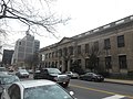 But since there were only two images of the place in the commons gallery, I had to get extra shots.
 -
 I didn't mean for a duplicate though, but the position of the cars and trucks makes a slight difference from the last one.
 -
 When MoMA PS 1 was originally built, it had a girls entrance and boys entrance. The old girls entrance is across the street from the post office.
 -
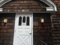
 A close-up of the doorways of the post office. The stickers aren't original, but who cares?
 -
 The swastikas on the ceiling were engraved before the rise of the Third Reich, specifically in 1928.
 -
 I thought there was something old over here besides those blurry shot of the historic framed images.
 -
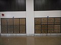 Typical early-to-mid 20th Century-style post boxes along one of the walls.
 -
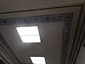
 The entrance and exit tunnel between the front doors and the lobby. I bought a book of stamps after this.
 -
 Two plaques next to the front doors; One honoring postal workers in World Wars I an II, and the other for Geraldine Ferraro.
 -
 Since I already too a shot of the old girls entrance of MoMA PS 1, I had to get the old boys entrance on 46th Road.
 -
 Taking the 7 train back to Flushing, I spotted this pizza joint with a funny name on Roosevelt Avenue.
 -
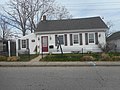
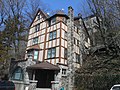
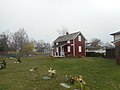
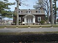
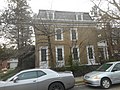 Then it was back to the LIRR to Bayside, where this house is a New York City Landmark.


April 12, 2019; Western and Central Long Island Pursuit; edit
-
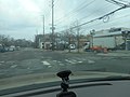
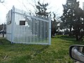
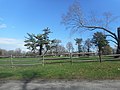
 In North Hills, I was looking for the remains of an old Gold Coast Mansion, but found this gated community instead.
 -
 At least I got a shot of the first reassurance shield of NY 101 in Flower Hill. Too bad I wasn't able to get the sites I wanted in Port Washington, Sands Point, Manorhaven, or the Plandomes.
 -
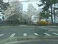
 But at least I've got a few sites across Hempstead Harbor in New York. Unfortunately, this was all I was able to get from the Woolworth Estate.
 -
 And I got a shot of the Welwyn Estate. I considered an extra one for the metal sculpture in the green, but I was concerned it might be a copyright violation.
 -
 I also thought the Webb Institute could use some extra images
 -
 Including this one of the main gate originally for The Braes (Herbert Lee Pratt House)
 -
 There's a chance this park at Prospect Avenue across from Sea Cliff Avenue might've been the top of the Sea Cliff Inclined Cable Railroad Company.
 -
 Unable to get what else I wanted from Glen Cove...
 -
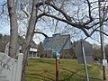
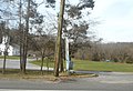
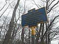
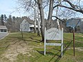 .. I settled on additional pictures of the Matinecock Friends Meetinghouse in Locust Valley.
 -
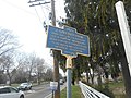
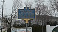
 Here's a closer shot of the historic marker, facing eastbound
 -
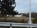
 Two of the three main buildings
 -
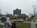
 Though the historic marker was issued by the City of Glen Cove, the site is outside of the city limits.
 -
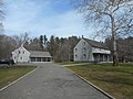 The driveway leading directly to those two main buildings...
 -
 .. and an old barn.
 -
 Across from this is the Friends Academy.
 -
 One of my other failed attempts in 2018 was more successful in 2019; the East Norwich Inn.
 -
 I could swear I saw this in 2018 too. It's the old Woodbury School on the southeast corner of Woodbury Road and NY 25.
 -
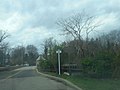
 The gate to Oheka Castle on the northeast corner of NY 25 & Avery Road in southern Cold Spring Hills
 -
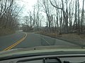
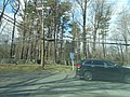
 Then I turned south along Round Swamp Road and passed by the entrance to West Hills County Park. I should've gone in there.
 -
 Round Swamp Road runs under the Northern State Parkway at Exit 39...
 -
 .. and comes out in the western edges of Melville, passing this house hidden in the woods.
 -
 As well as the Thomas School Of Horsemanship, a local horse riding academy and day camp.
 -
 That's a private house next to the academy, but the sign in the yard is still there.
 -
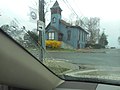
 On Old Country Road, you've also got the Presbyterian Church of Sweet Hollow. I'm not sure, but I kept thinking it was on the NRHP.
 -
 This is the driveway to the parking lot of the church
 -
 On Suffolk CR 35 and Little Plains Road, you've got the historic Henry Smith Farmstead...
 -
 .. which is also known as the J(ohn) Gardiner Farm. NRHP says it's in Huntington Station, but most maps indicate it's in Greenlawn.
 -
 There was a gruesome murder here in 1842. Note the Greenlawn Fire District sign behind it.
 -
 A barn in the back and some apparent outhouses.
 -
 This looks like a carriage house. I don't know if it's for farm equipment or a buggy for a night on the town.
 -
 In 2008, I took pictures of the Greenlawn (LIRR station), but the three I took wasn't enough.
 -
 So besides the entrance to the parking lot from Boulevard Avenue in the previous pic, I thought I'd add some more.
 -
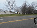
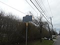
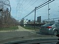 Along this section of the Port Jefferson Branch is a power line, which may or may not have anything to do with the Long Island Rail Road.
 -
 Another shot of the station house, this time from the west side.
 -
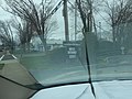
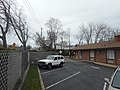
 When you leave the train station, you see the fire station... at least by car.
 -
 This image was of the historic Greenlawn Store. Not as direct as it should've been.
 -
 Broadway-Greenlawn (Suffolk CR 86) crosses the Port Jefferson Branch. Too bad I didn't get that hardware store across the tracks.
 -
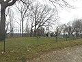
 One thing Greenlawn is noted for is a series of baseball fields on the south side of Pulaski Road (Suffolk CR 11),...
 -
 .. the east side of Cuba Hill Road (Suffolk CR 9),...
 -
 .. and the west side of Broadway-Greenlawn Road, which isn't in this shot.
 -
 Winding Hills Stables is a horse farm across from the NRHP-listed B. Ketchum House in Fort Salonga.
 -
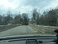
 East of there, Saint Johnland Road runs underneath Sunken Meadow State Parkway in the park the road was named for.
 -
 Since I couldn't get a good shot of it last time,...
 -
 .. I thought I'd add some shots of a soccer field in Nissequogue River State Park.
 -
 East of the former Kings Park State Hospital is a small park in San Remo,...
 -
 .. named Harrison Pond Park. Note the footbridge over the creek leading to the pond.
 -
 Arriving in Smithtown, I caught one of the oldest houses in the state.
 -
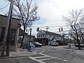
 Thanks to typical Long Island suburban traffic jams, I also got a shot of the old Smithtown Theater,...
 -
 .. and merely second later, the old headquarters of the Bank of Smithtown.
 -
 In The Village of the Branch, Smithtown's first school can be found on Singer Lane. I don't know if they moved the school to The Branch, or if the village just formed around it.
 -
 The Village of the Branch's Village Hall was being renovated as I made a U-Turn back up NY 111.
 -
 The Smithtown Post Office is also in The Branch, and is a popular source for obscure stamp denominations.
 -
 NY 111 is about to end, but not at this bus stop for the Suffolk County Transit S45 bus.
 -
 Here you can go 9 miles ahead Port Jefferson, 29 miles east to Riverhead, or 30 miles west to New York City.
 -
 NY 111 ends at the east end of the overlap of NY 25 and 25A, but you can continue from here and go northeast along NY 25A.
 -
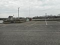
 There's an Islip Town Beach at the southern end of Lake Ronkonkoma and I finally got the proof in the commons.
 -
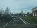
 Southeast of NY 112 and 27 is the North Patchogue Fire Department headquarters.
 -
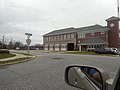
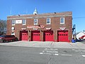
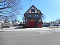
 But the Hagerman Fire Department also exists in Hagerman.
 -
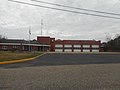 The fire station has five bays
 -
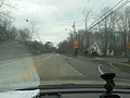
 This intersection is with a paper road now used for training. And from there it was down to South Country Road.
 -
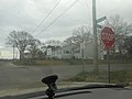
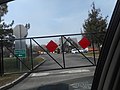
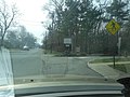
 On Suffolk CR 36 in Brookhaven, this right turn sign is heavily lit up.
 -
 Around the corner from this curve is the historic Brook Store.
 -
 Though I wanted a shot of the War Memorial and park at Valentine's Corner from Suffolk CR 36...
 -
 .. I had to settle for one from Gillespie Path and another from Fireplace Neck Road.
 -
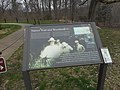
 On Montauk Highway in Mastic, this historic marker honors the Poospatuck Native Americans.
 -
 Also there's the Mastic Ice Cream Cottage.
 -
 I was trying to get a picture of this place for years. The old Mastic Liquor Store is how you know you're getting close to the Moricheses.
 -
 Southeast of that is the LIRR Bridge over the Forge River as seen from Patchogue Avenue and the Mastic Riviera.
 -
 Along the Riviera and Wills Avenue is the Forge River Boat Club...
 -
 .. which is across the street from the Forge River Marina owned by the Town of Brookhaven.
 -
 Overlook Drive and Eleanor Avenue are the east end of the northern border of the Poospatuck Reservation.
 -
 Sign for the Poospatuck Trading Post on Eleanor Avenue. Sadly, their website is dead, and so were other good pictures of the vicinity of the reservation


.jpg)
_Farmstead.jpg)


_Volunteer_Fire_Department.jpg)


-1.jpg)
-2.jpg)
-3.jpg)
.jpg)


;_Smithtown,_NY.jpg)

.jpg)


More to Come
April 13, 2019; Morris Heights and Southwest Yonkers: edit
-
 Since there are already HABS images of this place...
 -
 .. I decided to take some contemporary images of the old Messiah Home for Children...
 -
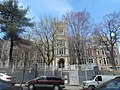 .. which is now the South Bronx Job Corps Academy in the Morris Heights section of The Bronx.
 -
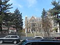 The academy is on Andrews, Tremont and Montgomery Avenues.
 -
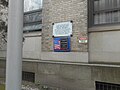
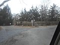
 Brick wall with a sign for the academy on Tremont Avenue. After this I bought lunch at a deli on the corner of Tremont and Montgomery.
 -
 One last shot of the old orphanage, then it's back on the 4 train to Woodlawn before taking a Bee-Line bus to Southwest Yonkers.
 -
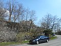
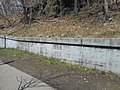 This embankment along McLean Avenue in Yonkers was for a bridge of the Getty Square Branch of the "Old Put."
 -
 There's a possibility I may have lost a charging cable for my camera here as I was changing the SD card for the camera.
 -
 Northwest of the former bridge is a billboard, just before McLean Avenue ends at US 9 (South Broadway)
 -
 While I walked up South Broadway, I found a Portuguese Roman Catholic Church, which I didn't know already had a picture.
 -
 The same went for the "South Yonkers" Post Office.
 -
 Undercliff Street; the way to get to my first intended target in Southwest Yonkers.
 -
 This house built into the hill was once the Lower Station House of the Park Hill Incline Railroad
 -
 And I nearly killed myself getting to Alta Avenue. This mansion at 87 Alta Avenue overlooking Ludlow and the Hudson was mistaken for the upper station house of the PHIR
 -
 However this place at 83 Alta Avenue was the Upper Station House. It's a kindergarten now.
 -
 And yet some websites have said that it was at 82 Alta Avenue, which if that were true, it would be here.
 -
 Looking up at the E.K. Martin Mansion in Park Hill from US 9 and Undercliff Street while walking south.
 -
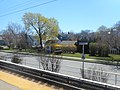
 From there, I walked west along Ludlow Street to the Ludlow Metro-North Station. This staircase goes to the Croton-Harmon and Poughkeepsie-bound platform.
 -
 Looking north from the Ludlow Street Bridge where Metro-North Hudson Line trains and Amtrak trains pass underneath...
 -
 .. as well as this freight siding, which used to have more traffic.
 -
 Ticket vending machines and a bike rack can be found on the south side of the bridge
 -
 This staircase goes to the Grand Central Terminal-bound platform.
 -
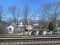
 West of the station is the garage for All-County Bus, a school bus company.
 -
 The plylons where the station house used to rest over the tracks can still be seen here.
 -
 Looking back up the staircase from the GCT-bound platform
 -
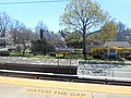
 View of the Poughkeepsie-bound platform and staircase. Note also the Yonkers city parking lot.
 -
 Another shot of the staircase from the GCT-bound platform.
 -
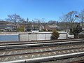
 The old low-level platform of New York Central leads to a high-level platform from the days just before Metro-North.
 -
 ... and one last shot of the freight siding. I used to think those tanks were for a Domino sugar refinery, but I was wrong.
 -
 I took lots of photos of the Post Office at Grand Central Terminal on previous trips...
 -
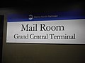 .. however, none of them were from the platforms. Hey, it's not Metro-North Helvetica Italic, but it's something.
 -
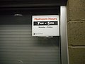 Though I'm pretty sure they don't send mail by Metro-North the way they used to with the New York Central and New Haven Railroads, these are the hours for that post office.


April 14, 2019; 2nd Attempt at the Long Island Gold Coast, and elsewhere; edit
-
 Eastbound on Union Turnpike at the intersection with Lakeville Road in New Hyde Park...
 -
 .. which doesn't seem like a big deal, until you see this old sign for New York State Route 25C, which was decommissioned in 1970.
 -
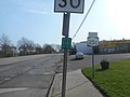 However, somebody in NYSDOT Region 10 wants it back. Here's a slightly more distant view of the sign from the southeast corner.
 -
 The same corner with a locally made welcome sign.
 -
 And the view from Lakeville Road, where the NY 25C sign is barely visible.
 -
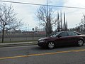
 Merrick (LIRR station) needed some additional shots.
 -
 So I thought I should add some extras.
 -
 What I didn't know at the time was that an MTA Police Precinct was being installed at the station.
 -
 Tryon Hall; Yet another site in Wikimedia Commons that only has HABS images.
 -
 But since only a historic marker remains from the site of the house, I had to capture it.
 -
 Luckily there were more sites in the Massapequa area to capture...
 -
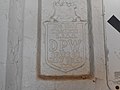
 .. like the Old Grace Church Complex. This is a close-up of the same historical marker on Merrick Road.
 -
 The same message on the opposite side of the plaque.
 -
 Though the Delancey Floyd-Jones Library is part of the same complex, it's listed separately as a Town of Oyster Bay Landmark
 -
 So is the servant cottage at the church.
 -
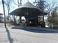
 The gallery at Seaford (LIRR station) needed to grow. So the first thing I spotted along the south side of the station was this gazebo.
 -
 In one shot, I got a bike rack, and a staircase and escalator to the platform above .
 -
 In another shot, I got a canopy above the platform, which was added in a more recent reconstruction project.
 -
 Then I made a U-Turn at Washington Avenue where I saw a maintenance of way along the north side of the tracks.
 -
 And I drove along the north side of the station until I got to Jackson Avenue.
 -
 There are pictures of NY 106 going under Hicksville (LIRR station), so it's about time I added NY 107.
 -
 But this mid-19th century locomotive on display north of the station was even better.
 -
 So I made a U-Turn for this train, and got a white-picket fence in the park where it's on display...
 -
 .. and then I made another U-Turn for another shot of the train.
 -
 Finally, I took another shot of the south end of the NY 106-107 overlap.
 -
 I've been trying to get images from the Village of Brightwaters for a while.
 -
 So I figured one of the sites I'd try was the Village Hall.
 -
 And though it looks like just a house, the Village Hall is also a courthouse.
 -
 In East Islip I had to find a local historic site within a town park.
 -
 The area includes the "East Islip Senior Services Center" off to the right...
 -
 .. but is officially known as Brookwood Hall and the Islip Art Museum.
 -
 Town of Islip Historical Marker in the median.
 -
 Along the entrance to the park is a house that's now the Joyce Fitzpatrick Senior Center
 -
 Brookwood Hall itself. As the historical marker suggests, this was an orphanage at one time.
 -
 Sign directing park goers to various buildings within the park.
 -
 The back door of the Joyce Fitzpatrick Senior Center...
 -
 .. and a broader shot of where that door is.
 -
 The Joyce Fitzpatrick Senior Center again, but this time from the exit to the park.
 -
 My second attempt to capture the Sisters of St. Joseph Motherhouse in Brentwood resulted only in these two tractors on a small farm.
 -
 There were other historical markers and sites I tried to get in Brentwood, but the only one I was able to capture was this one for the Modern Times settlement that the community used to be.
 -
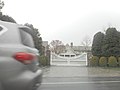
 Crooked Hill Road (Suffolk CR 13) entrance to the Brentwood State Park, which used to be part of Pilgrim State Psychiatric Center.
 -
 No pets are allowed there, or anything else harmful to the artificial turf at the park.
 -
 Close-up shot of the sign at the park shown earlier.
 -
 Back on CR 13, I got ready to approach the western terminus of Community College Road (CR 106) and eastern terminus of "G" Road
 -
 "G Road" is one of the Pilgrim State roads, and part of a convoluted way to get to the southbound Sagtikos interchange. The northbound on ramp to Sagtikos was up ahead.
 -
 Just as I was making the turn onto CR 106, I managed to get a shot of CR 13 north of this intersection.
 -
 A former section of "G Road" which dates back to the time this land was also part of Pilgrim State.
 -
 The entrance to SCCC Michael J. Grant Campus from Suffolk CR 106. Another entrance to Brentwood State Park exists across from it, but I didn't get the chance to capture it.
 -
 In Commack, New York I was able to find info on the NRHP listed Carl Burr House...
 -
 .. and I also got a driveway shot.
 -
 But then I looped around north of NY 25 and doubled-back to something I really wanted...
 -
 .. the historic, but not preserved Commack Motor Inn.
 -
 If you think these shots are bad, I had one or two which were worse.
 -
 There were sites along the vicinity of Asharoken and Eaton's Neck I wanted to capture, but all I was able to get was the Eaton's Neck Fire Department.
 -
 The only Eaton's Neck-related that I was able to get was this Historical Marker on the Northport-Fort Salonga border.
 -
 Which is specifically on Eaton's Neck Road.
 -
 That marker is next door to the Scidmore Cemetery in Northport
 -
 The cemetery from across Eaton's Neck Road.
 -
 My first good shot of the NRHP-listed Daniel Smith House in Huntington.
 -
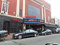 Then to downtown along NY 110, where I got another shot of the Paramount Theater.
 -
 Turning from NY 110 I was able to capture the first sign along southbound Suffolk CR 92. Too bad I wasn't able to capture the turn south from High Street.
 -
 But at least I got the south end of the road at NY 25 in West Hills.
 -
 Unable to get the James Alfred Roosevelt Estate, because it's on a private road, I had to settle for another Roosevelt mansion, Sagamore Hill
 -
 So, I parked at the parking lot and decided to visit the mansion and grounds belonging to the 26th President of the United States.
 -
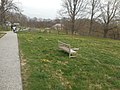 A wooden bench along the asphalt walkway between the home of Teddy Roosevelt, and his son the Brigadier General.
 -
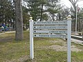
 The trail has one sign for housing the staff and another for working the fields.
 -
 In the distance to the right is Old Orchard and to the left Foreman's Cottage & Garage.
 -
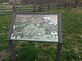
 The sign for Old Orchard along the path. I also had another image of the QR code placard on the side, but I thought I'd leave that to visitors at the museum.
 -
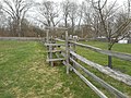 This old-fashioned wooden fence separates the Foreman's Cottage and a garage from the 26th President's House.
 -
 The end of the footpath has a small road sign directing tourist to the Old Orchard Hall Museum.
 -
 Standard NPS sign for Old Orchard between the staff parking lot and the end of the driveway.
 -
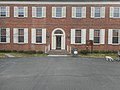 The front door to Old Orchard Hall Museum.
 -
 Guided house tours were sold out at the time. So I took an independent tour around the back
 -
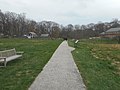
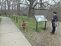 But before I did that, I passed by a nature trail that runs behind the house.
 -
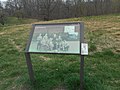
 A sign at the beginning of the trail, which had it's own QR placard just like the sign along the trail to Old Orchard itself.
 -
 The trail runs to the bottom of the hill behind the house, has a loop section and ends on the west bank of Cold Spring Harbor.
 -
 The back of the Oyster Bay Town Hall....
 -
 .. and the Eastern Town Hall Annex.
 -
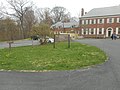
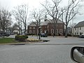 The Town Hall is identical to the Post Office, and is across the triangle from it.
 -
 North of both of them is the temporary HQ for the Oyster Bay Railroad Museum
_%26_Lakeville_Rd;_New_Hyde_Park,_NY-1.jpg)
_%26_Lakeville_Rd;_New_Hyde_Park,_NY-4.jpg)
_%26_Lakeville_Rd;_New_Hyde_Park,_NY-5.jpg)
_%26_Lakeville_Rd;_New_Hyde_Park,_NY-6.jpg)
_%26_Lakeville_Rd;_New_Hyde_Park,_NY-7.jpg)


_HM;_Facing_East.jpg)
_HM;_Facing_West.jpg)
.jpg)
.jpg)
.jpg)
.jpg)
.jpg)


_and_Foreman%27s_Cottage_%26_Garage_(left).jpg)


April 15, 2019; 3rd Attempt at the Long Island Gold Coast, and elsewhere; edit
-
 One of the targets I wanted in Glen Cove was John Teele and Ruth Baker Pratt mansion...
 -
 .. but instead I had to settle for the John Teele Pratt House, also known as Beechwood.
 -
 From there I made a U-turn and tried to capture the mansion again.
 -
 The west end of Old Tappan Road at Dosoris Lane...
 -
 .. close up of a local directional tourist sign at the end of that intersection.
 -
 On East Island, I tried to get The Shell House and failed, so I had to settle for this historic marker on East Island
 -
 Not to mention the bridge between East Island and Dosoris Island.
 -
 After this I tried to head east to Bayville, New York for historic and not so historic sites. I got a lot of rain instead.
 -
 The rain got worse when I tried to get this shot of Bayville Avenue along the beach.
 -
 Further east in Centerport, I captured the NRHP listed N. Velzer House. Other old houses remain hard to get.
 -
 This was the only shot of the NJ Felix House in Asharoken that I was able to get, and the only site in Asharoken and Eaton's Neck that I was able to get at the time.
 -
 The entrance to the Carll Burr Jr. House in Commack, New York
 -
 Also in Commack, the mid-century modern sign at the entrance to the Mayfair Shopping Center on NY 25.
 -
 On the other hand after years of trying, I finally got the MTA Police's 1st Precinct in Central Islip.

;_Glen_Cove,_New_York.jpg)


April 16, 2019; The Reconquest of Floral Park; edit
-
 I wasn't looking for anything from Queens Village on my last day, but that firehouse looked worth capturing.
 -
 The things that I was looking for were in Floral Park and Bellerose. Maybe not this local bar next to the Floral Park LIRR station....
 -
 .. but another shot of the Floral Park Fire Department at the Village Hall was needed.
 -
 None of them were the Floral Park Centennial Hall, but I captured it anyway.
 -
 From there I walked westbound along NY 25 into Bellerose and found this car in a garage
 -
 A mid-1970's Ford Mustang II Cobra II. True it's a product of the Malaise era, and sub-standard for a Mustang, but still collectible.
 -
 However, I had to make a U-turn to capture what I was truly looking for, which was the firehouses of Floral Park. This is station number 2.
 -
 On the way back though, I walked past a building known as Floral Terrace, a former movie theater converted into a catering hall.
 -
 Returning to Bellerose (LIRR station) where I spotted this old marker from the New York State Department of Public Works,..
 -
 .. which is inside the tunnel from the Bellerose side of the station.
 -
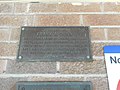 Outside of the entrance to the tunnel is a plaque memorializing Frank A. Dunn...
 -
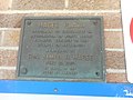 .. and below that a plaque honoring James H, Magee.
 -
 The Village of Floral Park is actually on the south side of this station.
 -
 So is Floral Park Fire Station #3
 -
 Both are on Atlantic Avenue and can be seen from the Bellerose LIRR station platform.
 -
 There's even a pocket park on the southwest corner of Atlantic and Walnut Avenues.
 -
 Looking north towards Bellerose again, where a small sign can be seen along the Main Line tracks.
 -
 Another shot of Floral Park, but the real target was this sign on the platform.
 -
 Looking east towards the canopy over the platforms where two staircases lead to the tunnel between Bellerose and Floral Park.
 -
 One last shot of Floral Park, where a sign along the Hempstead-bound tracks directs commuters either to New York or "Points East."
 -
 An M3 train approaches the station, but it's not stopping here.
 -
 It's passing by on the Main Line towards Hicksville. And from there it could either go to Huntington or Ronkonoma,
 -
 Under the canopy the canopy between where the two staircases lead to the tunnel between Bellerose and Floral Park just west of the waiting room.
 -
 Another sign directing commuters either to New York or "Points East." but this time it's along the Jamaica and NYC-bound tracks/
 -
 Also the NRHP-listed fire department in Magee Plaza.
 -
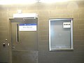
 The western door of the waiting room. Note the alarm keyboard, the braille sign and Police and Fire Department emergency phone,
 -
 This used to be the ticket window until the LIRR made it so you could only get tickets with vending machines or paying more money on the train. I did the former of the two.

_in_Floral_Park,_NY.jpg)


New York; Autumn 2019; edit
November 21, 2019; Rockaway Pursuit: edit
-
 As I walked from 165th Street Bus Terminal to Jamaica Center subway station, I though I get a shot of two neighboring NRHP sites on Jamaica Avenue.
 -
 From Jamaica (LIRR station), I tried to get other stations on the LIRR Far Rockaway Branch.
 -
 Unfortunately, the only two I got were Valley Stream (LIRR station)...
 -
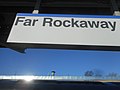 .. and Far Rockaway (LIRR station) itself.
 -
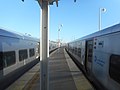 But two M7s at the end are still good.
 -
 My first intended target was the Far Rockaway Post Office
 -
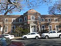 I already created a gallery that only contained two images, so I might as well have added more.
 -
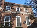 The ZIP+4 Code on the southern end of the building.
 -
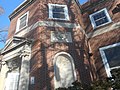 I could've only got so much of the "United States Post Office" engraving standing this close.
 -
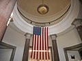 How many post offices do you know of that have rotundas like this?
 -
 Standard early-to-mid 20th Century post boxes,...
 -
 .. and service windows, of course.
 -
 As you can see if you zoom in, this is a Henry Morgenthau Jr.-era post office.
 -
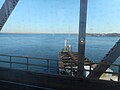 Since the IND Rockaway Line forced me to Broad Channel on my way to Beach 90th Street, I got to see this view from the South Channel Bridge...
 -
 .. and the old LIRR Sub-station #5 at the top of Hammels Wye.
 -
 Walking from Beach 90th Street (IND Rockaway Line) I discovered a September 11 Memorial Plaque...
 -
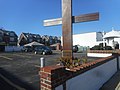 .. on steel beams cut from the twin towers and placed at a Knights of Columbus meeting hall.
 -
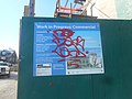 Finally, I got to my second intended target...
 -
 .. the NRHP-listed Rockaway Courthouse
 -
 Unfortunately, this building was under reconstruction, and had been for a long time.
 -
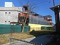 .. and the "V" shape of the building appears to be in the process of being covered up.
 -
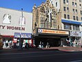 Back in Jamaica, I decided on an additional image of the former Loew's Valencia Theatre...
 -
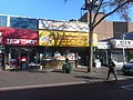 .. before grabbing a little late lunch at a deli inside the 165th Street Pedestrian Mall


November 22, 2019; The Great Queens Historic Post Office Crusade: edit
-
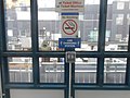 I didn't think I'd bother with another pic from Flushing-Main Street (LIRR station), but these USB chargers in one of the shelters was worth capturing.
 -
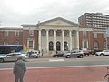 My real reason for going to Flushing was to capture the NRHP-listed Main Flushing Post Office
 -
 Though I never really intended to duplicate and older pic, I still wanted to get other parts of the building. This WWII Memorial Rock was a good start.
 -
 A revolving door at the post office.
 -
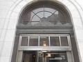 These brass decorations are above all the doors.
 -
 This brass gate on the inside separates the post office boxes from other parts of the lobby.
 -
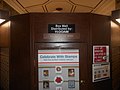 Behnd this fence is a kiosk of additional post office boxes.
 -
 The signature for one of the murals in the post office. I considered the actual mural, but you know... copyright issues and all that.
 -
 The service windows in the post office.
 -
 In 1986, this post office was renamed for former Congressman Benjamin S. Rosenthal.
 -
 Next it was on to the 7 train to Jackson Heights for the Jackson Heights Post Office
 -
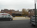 This too is on the NRHP, though you wouldn't know it by the loading bay on 78th Street.
 -
 The front doors of the post office. The ZIP code (11372) was added in the early-1960's.
 -
 Like larger post offices such as Long Island City, there's a separate corridor between the front door and main lobby.
 -
 To my surprise, I was able to capture the mural here.
 -
 That and the old-fashioned postal boxes.
 -
 Another shot of the post office from 37th Avenue and 79th Street.
 -
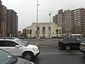 And down on the R train where I headed to Forest Hills and caught a unique shot of the NYCL-listed Ridgewood Savings Bank branch
 -
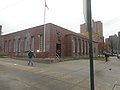 But that wasn't my goal for Forest Hills. As you can guess by the title, it was the Forest Hills Post Office.
 -
 Yet another cornerstone indicating that it's a Henry Morgenthau Jr.-era post office.
 -
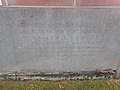 A closer view of the cornerstone.
 -
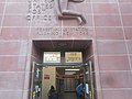 The gold-painted lettering over the doors seems to be as old as the post office itself.
 -
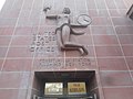 The figure above the doorway is supposed to be a female Olympic athlete.
 -
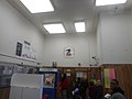 That post office logo above the PO boxes hasn't changed since the 1970's. Two of these people thought it was amusing that I was taking pictures of the place.
 -
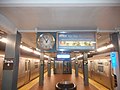 Finally, I got back on the Subway to Jamaica, where I suddenly became fixated on clocks like this.


November 23, 2019; From College Point to Montauk Point: edit
-
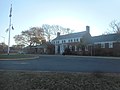 Despite the title, my first image was of the Clearview Park Golf Course clubhouse in the Clearview section of Queens...
 -
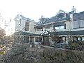 .. which is next door to this restaurant, that happened to be the former home of Rudolph Valentino.
 -
 It was numerous restaurants for a long time, but today it's the Vivo Mediterranean Grille & Catering, an upscale Italian Restaurant.
 -
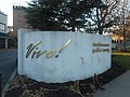 Before Vivo, it was Vivaldi’s Ristorante, Patrizia’s, Valentino’s on the Green, and Caffé on the Green.
 -
 After this, I headed west to College Point.
 -
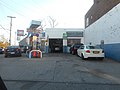 This Gulf Gas station in College Point is the oldest garage in New York State. I also wanted to get more shots of the Schleicher House, but they all turned out terrible.
 -
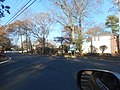 So then I headed out east towards Exit 31 on the Northern State Parkway, which is I.U. Willets Road
 -
 There are sites I passed up in Albertson, but I decided on their fire department.
 -
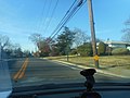 Continuing westbound on I.U. Willets as it goes from Searingtown to North Hills.
 -
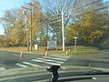 I wanted an image of Buckley Country Day School, but since it's on a private section of I.U. Willets, I was only able to get the sign on the southwest corner of that and Shelter Rock Road.
 -
 Another site with only HABS images was the American Legion Post 390 in Hempstead, New York.
 -
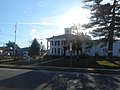 Originally this place was a local mansion known as the Carman-Irish House.
 -
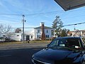 View of the mansion from the gas station across Baldwin Road.
 -
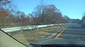 The wide tree-lined median of Southern State Parkway west of Belmont Lake State Park was a must.
 -
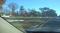 Of course, I had to capture this old U-Turn in the median.
 -
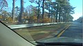 All kinds of trees are here, but these pine trees are the star of the show.
 -
 The slightly smaller pine trees are good too. They mark the gateway to Belmont Lake State Park.
 -
 Shot of the former Brookhaven Memorial Hospital from Hospital Road
 -
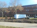 The hospital is now known as the LI Community Hospital. My family has quite a bit of history there.
 -
 I also wanted something from Mastic...
 -
 .. but I ended up settling on this historic marker on Montauk Highway and Mastic Road.
 -
 Yet I still crossed the Forge River into Moriches...
 -
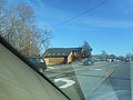 .. where I spotted this restaurant...
 -
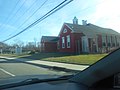 .. this old red schoolhouse, and after a couple of U-Turns,...
 -
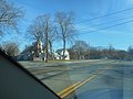 .. a church across the street from it, which was next to a paper road I couldn't capture.
 -
 This shot of Main Street in Center Moriches is something I've wanted for a long time.
 -
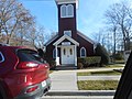 I also wanted the Sea Cove Restaurant and Fire Department, but no such luck. So I settled on the Episcopal Church on Railroad Avenue.
 -
 The post office is right next door.
 -
 Then I made a U-Turn to Chichester Avenue back to Main Street...
 -
 .. where the Center Moriches United Methodist Church can be seen across the street.
 -
 This was the only part of East Moriches I was able to get; the Soldiers and Sailors Memorial Park.
 -
 I did capture the declining downtown Eastport, though. This empty mini-mall is an example.
 -
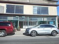 The former Lloyd's Antiques wasn't originally an antique shop, but I don't know what it originally was.
 -
 As far as I could tell though, this one was still active.
 -
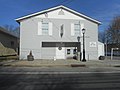 Also, there's an American Legion post on the west bank of Seatuck Creek.
 -
 In what is today part of Hampton Bays I got a couple of shots of the NRHP listed Ellis Squires Junior House...
 -
 .. though I'm not really sure I got all of it.
 -
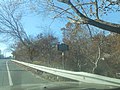 In 2018 I took pictures of the Reverend Paul Cuffee Gravesite, but missed the New York State Historical Marker. Not this time.
 -
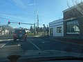 One of two incorrect road signs for New York State Route 27 in Southampton, New York. Another one exists at Windmill Lane and Nugent Street.
 -
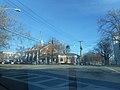 At Main Street and South Main Street, I decided to turn south...
 -
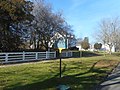 .. where I encountered the Dr. David H. Hallock House.
 -
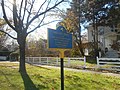 According to the historic marker in front of the house, Dr. Hallock was Southampton's first horse and buggy doctor.
 -
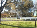 Quite a modest dwelling by Hamptons standards, but still a nice little Victorian-era structure.
 -
 The William Rogers Mansion off of Meetinghouse Lane.
 -
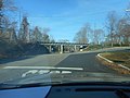 North Main Street runs under this low, narrow bridge for the LIRR Montauk Branch.
 -
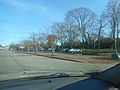 I needed more shots of Southampton (LIRR station) and...
 -
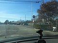 .. the North Main Street Historic District. Too bad I didn't go north of the North Sea Road bridge for more of the latter.
 -
 Instead on the way back downtown, I got a shot of the historic North End Burying Ground.
 -
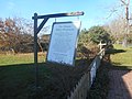 Sign for the Old Halsey House back on South Main Street.
 -
 Which is said to be one of the oldest houses in New York State.
 -
 And though many have said the house was built in 1683, this historical marker suggests it was built 35-40 years earlier.
 -
 Failing to find a historic house on Southampton Beach, I decided to return to Hill Road for this old gas station...
 -
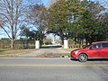 .. then got a couple of others of the James L. Breese House…
 -
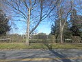 .. including this one behind the shrubbery. I also tried to get images of a nearby church, but there was way too much sun glare.
 -
 So before leaving the Village of Southampton, I grabbed one shot of the Old Town Hall, and headed for Bridgehampton, New York.
 -
 Where I found the NRHP-listed William Corwith House.
 -
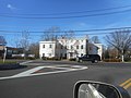 The site of the former Wick's Tavern, replaced by a replica office building.
 -
 Another NRHP site in Bridgehampton is the Presbyterian Church...
 -
 .. although this is a better shot of the church.
 -
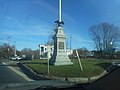 I'm glad I got a shot of the Bridgehampton Monument on Montauk Highway and Ocean Avenue, but I really wanted other sites there.
 -
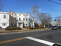 Wick's Tavern only has HABS images. At least I can get some contemporary images of the replica.
 -
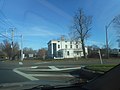 And though the commons already has images of the Nathaniel Rogers House...
 -
 .. I thought I'd get a few extras.
 -
 During the period when it was a hotel, it was also called the Hampton House.
 -
 The Bridgehampton Historical Society was trying to raise money to restore it.
 -
 I'm not sure how well they did. Perhaps you should go to their website and find out.
 -
 This is Stephen Talkhouse, a famous nightclub in Amagansett named for a legendary Montaukett Native American.
 -
 There are images for the Amagansett (LIRR station) and the Amagansett Coast Guard Life Saving Station, so I thought I'd add one of the Amagansett Fire Station.
 -
 Driving along the Montauk Point State Parkway gave me another chance for shots of the West Overlook at Hither Hills State Park.
 -
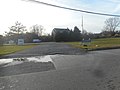 But once I entered Montauk, I had to get images of the older LIRR station...
 -
 .. which is both the Town of East Hampton Shellfish Hatchery and Montauk Marine Science Institute.
 -
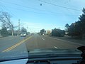 From there I drove up Suffolk CR 49 toward Montauk Harbor.
 -
 Which ends at a loop on the north end of Suffolk CR 77, although there's no "End CR 49" sign here.
 -
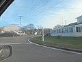 The first southbound reassurance sign for CR 77 is south of the intersection. Montauk's street name signs are still sticks in the ground with the street names painted on them
 -
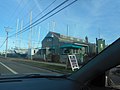 One of the restaurants within the loop, which has no Suffolk County Route shields whatsoever.
 -
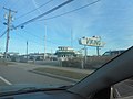 The Viking Fleet is one of numerous marinas in the harbor...
 -
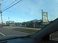 .. but it's the only one that includes passenger ferries to New London or Block Island.
 -
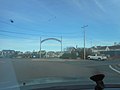 Gosman's Dock is where the road turns north, then west, then south.
 -
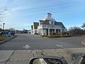 After some bad shots along the top of the loop, I thought I'd try this strip mall which includes a bike shop. Then I drove back to CR 77 along the west side of Montauk Lake.
 -
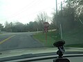 The intersection of Fairview Avenue and South Fairview Avenue has this unusual supplemental sign beneath this stop sign.
 -
 This can be found along the east side of the Montauk Downs State Park, and this is a view of the entrance at South Fairview Avenue.
 -
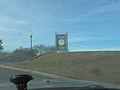 For some reason, the Land and Water Conservation Fund approves of this park.
 -
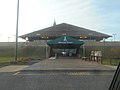 The doorways to the clubhouse. Sorry that I don't have any shots of the golf course.
 -
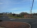 The exit from the park, right next to the entrance.
 -
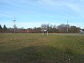 At the south end of Suffolk CR 77 is an at-grade interchange with Montauk Point State Parkway with traditional wooden directional arrows.
 -
 This faded sign along the parkway tries to tell motorists that a scenic overlook is 1000 feet away. It's the MPS Parkway East Overlook.
 -
 This one also tried to tell them that the overlook is at the right. NYSDOT really should replace both signs.
 -
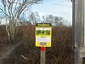 A tick warning sign can be found along the south side of the overlook,...
 -
 .. next to the Oyster Pond Overlook Trail. Oyster Pond itself is on the opposite side of NY 27 in Montauk Point State Park just east of the border with the county park.
 -
 A sign on the northeast corner of the overlook about the wonders and dangers of Oyster Pond.
 -
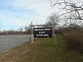 Another traditional wooden park sign. The overlook was here before it became part of Camp Hero State Park.
 -
 Which can be found across from this view of the entrance to that overlook.
 -
 The Montauk Point State Parkway is also part of NYS Bike Route 27 .
 -
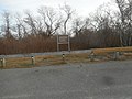 Regulation sign for the overlook, as well as the rest of Camp Hero State Park.
 -
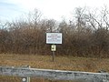 Archery season runs from November 1 to December 31. That means anyone could be hit by an arrow or crossbow.
 -
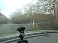 Camp Hero Road leads to a small residential area first before the service entrance to the park the street was named after.
 -
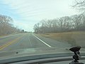 NY 27 finally enters Montauk Point State Park,...
 -
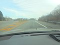 .. and then divides and split just over the hill.
 -
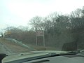 This sign for the rules of the park can be found between two U-Turns at the end of the loop which I couldn't capture...
 -
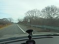 .. and this 15 MPH speed limit sign can be seen after both U-Turns
 -
 So is this old NYS Reference Route sign.
 -
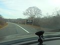 But suddenly a wooden sign for the upcoming entrance to Camp Hero State Park appears.
 -
 Followed by a more contemporary Reference Route sign.
 -
 The entrance to Camp Hero park is at the east end of Old Montauk Highway. The exit is just after this.
 -
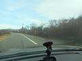 The loop is still New York State Bicycle Route 27
 -
 And the Montauk Point Lighthouse has a Christmas wreath on it. I'm not entirely sure when they put it up, though.
 -
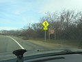 Sign for a pedestrian crossing up ahead, and another sign for the rules of the park as you get closer to the lighthouse.
 -
 A "Bike in Lane" sign and a "Path Through History" sign just before the intersection with Lighthouse Road.
 -
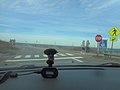 This crosswalk actually leads from an extra parking lot to the visitor's center and gift shop, but there's also an extra trail to the beach.
 -
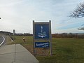 A cross from the parking fields is a sign for George's Lighthouse Café, the canteen of the park, and the second such sign for the canteen.
 -
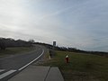 Right after this, westbound NY 27 begins, heading back into town through The Hampton, the rest of the South Shore, and into Brooklyn.
 -
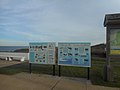 This sign at the restaurant is designed to educate parkgoers about the various fish and other wildlife in waterways of New York.
 -
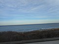 Block Island Sound can be seen from the back deck of the restaurant. There used to be a half-circle map sign of the sound on this deck.
 -
 I went to this restaurant in May 2008. Sadly, they were closed for either the weekend or the autumn.
 -
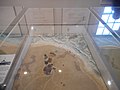 After a little coaxing from the employees at the Montauk Point Lighthouse gift shop, I returned to the Lighthouse Museum.
 -
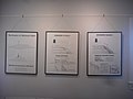 That week, there was an exhibit about the erosion of Turtle Cove, the land surrounding the lighthouse.
 -
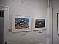 Two aerial photographs of the lighthouse; One from 1968 and the other from 2000. A good chunk of the land was washed away in the late-1970's.
 -
 Climbing up the lighthouse, I saw an old brick window chamber I had to skip getting photos of the previous time.
 -
 The Montauk Point Lighthouse was rebuilt in 1860, and the railing along the observation deck indicates this.
 -
 Another shot of the NY 27 Montauk Point State Park loop. This time focused more towards the restaurant.
 -
 And again, a shot of Camp Hero State Park. This and the previous picture were from the observation deck around the lighthouse.
 -
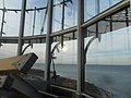 This one on the other had was directly from the lantern room. No life raft here this time.
 -
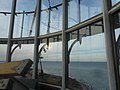 The lantern room is off-limits, but they do let you peer into it from two steps up a ladder.
 -
 Thankfully, since I'm close enough to 6 feet tall, I can get shots from there that most people couldn't.
 -
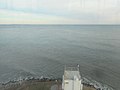 Like the top of the fog horn station in front of the lighthouse.
 -
 And another one of the Block Island Sound.
 -
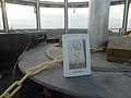 This digital thermometer is at the base of the lamp. Anyone can get one of those things anywhere though.
 -
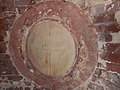 The inside of the lighthouse has seals engraved in it, and this one is barely legible.
 -
 The lighthouse has been a National Historic Landmark since March 2, 2012.
 -
 It has also been on the National Register of Historic Places since July 7, 1969
 -
 The fog horn station is apparently also a fire station. One with a narrow bay, but a fire station nevertheless.
 -
 Another historic plaque on a rock, this time from the Town of East Hampton.
 -
 Along the south side of "Lighthouse Road" is an old-fashioned 3 car garage, and a barn with two big doors.
 -
 Leaving Montauk Point State Park gave me the opportunity to catch more signs leading to the East Overlook.
 -
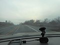 Unlike the ones going eastbound, the lettering was still visible.
 -
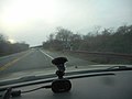 Another sign just before the intersection with Suffolk CR 77 directing motorists to Montauk Downs State Park. You could also get there from Suffolk CR 70, but there's no sign like this there.
 -
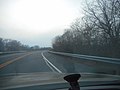 I was already at the East Overlook of Montauk Point State Parkway that day,...
 -
 .. so I decided to get some shots of the West Overlook. Here is yet another traditional wooden park sign.
 -
 This one has a trail to the woods too, called the "Serpent's Back" Trail.
 -
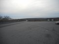 Looking west towards the Hamptons, the rest of southern Long Island, southern Queens, and Brooklyn.
 -
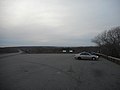 These overlooks are more for the parkway than the parks that surround them.
 -
 In the Village of East Hampton, I decided to grab some pics of NY 114, starting with NY Bike Route 114
 -
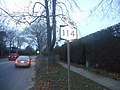 I wasn't able to get as good of a shot of the first state route sign, so I had to settle for the second.
 -
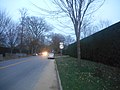 Then I crossed the street and took a picture of the Junction NY 27 sign. At some point afterwards, I started having car trouble.
 -
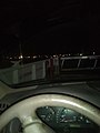 Nevertheless, I was able to catch two ferries through Shelter Island. This is what the Shelter Island-Greenport Ferry looks like at night in November.


_H%26_L;_Engine_%26_Hose_One.jpg)


.jpg)


_Town_Hall.jpg)


_Presbyterian_Church_Entrance.jpg)


.jpg)


_27.jpg)


.jpg)


November 24, 2019; Weary Retreat from Long Island: edit
-
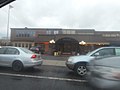 After my car broke down on the way back, I tried to get more sites. This is the Bonwit Inn in Commack.
 -
 Another shot of the Bonwit Inn, which was originally the site of another Long Island Motor Parkway toll booth.
 -
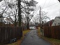 In Half Hollow Hills, I snapped some pictures of the driveway to the NRHP-listed Carll House...
 -
 .. but then I reached over the fence and snapped one of the house itself.
 -
 As the fence indicates, this house is at 380 Deer Park Avenue
 -
 370 Deer Park Avenue looks pretty historic as well, but not as much as their neighbor.
 -
 Ater this, I decided to head northwest towards Manor Farm in Elwood...
 -
 .. which is part of the Berkeley-Jackson County Park.
 -
 Another shot of The Greenlawn Store in Greenlawn, though there are other buildings in Greenlawn I wanted... and should've captured.
 -
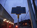 At dusk in Halesite, I tried to capture this historical marker for the Huntington Cross-Island Trolley next to the firehouse...
 -
 .. but it was too dark, so I had to settle for a close-up shot from the other side.


_FD-1.jpg)
_FD-2.jpg)
November 25, 2019; Brooklyn, Lower Manhattan and Jamaica Attack: edit
-
 A pedestrian traffic signal in Jamaica, Queens that has malfunctioned. I don't know why I still haven't reported this to NYCDOT.
 -
 At Jamaica Center - Parsons/Archer Subway station, I spotted this fairly new Ford F-750...
 -
 .. owned by the MTA.
 -
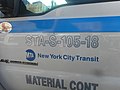 As you can see by the last two numbers on the door, it was made in 2018.
 -
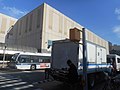 The truck was across from the northeast corner of Parsons Boulevard and Archer Avenue.
 -
 Another MTA Ford F-750, but this one is a crew cab.
 -
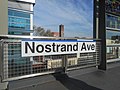 Finally! A sign at Nostrand Avenue (LIRR station) that doesn't look more like it's for a New York City Subway station.
 -
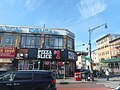 Even more of a surprise is this leftover street name sign installed on a building at Nostrand Avenue and Fulton Street.
 -
 But my intended target in Brooklyn was the NRHP-listed Flatbush Post Office.
 -
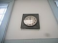 Of course, I had to go inside. I didn't find that much, besides this old clock on the wall.
 -
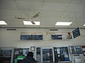 I reiterate that much because there was still some other things inside. Though listed on the NRHP, the ticket windows were modified.
 -
 So were the post boxes.
 -
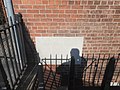 This post office is another Morgenthau-era building. There are at least 3 others I want, but didn't capture at the time.
 -
 After the post office, I walked to Church Avenue subway station on the BMT Brighton Line.
 -
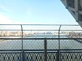 Then took a B train across the Manhattan Bridge. Off in the distance you can see Wallabout Bay to the right and the Williamsburg Bridge to the left.
 -
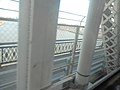 The northern bike path along the bridge is closer, though.
 -
 Piers 35 through 42 can be seen along the FDR Drive.
 -
 But there was a reason I took the B train to into Union Square, and it had nothing to do with shopping at Food Emporium.
 -
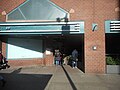 It did however involve covering where this elevator went down to...
 -
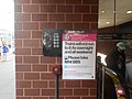 .. specifically capturing a little more of the Zeckendorf Building's entrance to the Union Square Subway Station.
 -
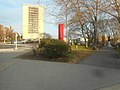 Back in Jamaica, I had to get more shots of Major Mark Park.
 -
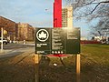 Something which didn't include the Soldiers and Sailors Monument
 -
 This required walking along Warwick Crescent.
 -
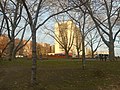 Behind the park is The Camelot Apartment Building on NY 25 and Wexford Terrace.
 -
 Street-name sign for 173rd Street and Warwick Crescent...
 -
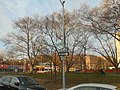 The same signs, but from the street rather than the park.
 -
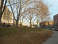 To the right of the park is a building now named Aftab Park,
 -
 Another shot of the Camelot Apartments through the park, but closer to 175th Street.
 -
 The footpath that goes straight through the park towards the northwest.
 -
 Sailor's style flagpole in the park, along Hillside Avenue west of 175th Street..


_Post_Office;_2019-11-25.jpg)
_Post_Office;_2019-11-25.jpg)
_Post_Office;_2019-11-25.jpg)
_Post_Office;_2019-11-25.jpg)
_Post_Office;_2019-11-25.jpg)


November 26, 2019; Another Long Island Raid: edit
-
 For the first time, I was able to get some shots of the NRHP listed Church of Our Lady of Kazan...
 -
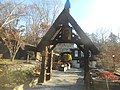 This is on some minor road in Sea Cliff, New York. The arch leads to the church, and what looks like a former garage.
 -
 Non-standard NRHP plaque on the archway.
 -
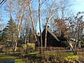 Another shot of the church, this time without a car in front of it.
 -
 On East Island in Glen Cove is the NRHP listed Shell House, which was being modified during my previous attempt to capture it.
 -
 My second shot of the non-MUTCD sign and NYS Historic Marker at the east end of the bridge to Dosoris Island
 -
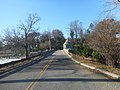 This shot of the East Island-Dosoris Island Bridge was taken on foot.
 -
 A shot of the welcome sign on East Island
 -
 This is the closest shot I'll ever be able to get of The Manor at Glen Cove.
 -
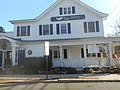 In Locust Valley, I sought the Cock-Cornelius House, but it was attached to another structure, and owned by Southerby's Auction.
 -
 Since the Benjamin Moore Estate needed more contemporary images...
 -
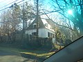 .. I thought I'd try to get the former guard tower at the driveway off of NY 25A. I almost missed it.
 -
 The only other part of the Muttontown Preserve that's not part of the Chelsea Mansion... at least in the commons.
 -
 The Cold Spring Harbor post office, which as far as I know, is not part of the Main Street Historic District.
 -
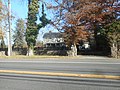 Another site that took me years to capture; the Harry Wood House in Huntington, New York.
 -
 Parking in the Old Town Hall Historic District once again, I got this historical marker for the former site of the Huntington Fire Department.
 -
 The marker is in front of what is now part of an antique furniture store.
 -
 As Main Street approaches New York Avenue though, there's a problem with the NY 110 signs
 -
 The South NY 110 one is fine.
 -
 But the North NY 100 one isn't even a New York State Route sign. It looks more like a poorly drawn New England square.
 -
 The old Bank of Huntington building, now a branch of the Bank of America.
 -
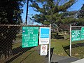 Finally, I captured that side opening of Heckscher Park along NY 25A.
 -
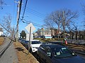 Also on Suffolk CR 35, I got one of my first shots of the long-standing Huntington Hospital...
 -
 .. which is diagonally across from the Bethel AME Church and Manse. Close-up pic of the first historical marker here.
 -
 Evidently, the former St. John's Episcopal Church was here, and the cemetery still is.
 -
 The current church's own historical marker...
 -
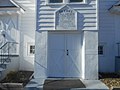 .. and a close-up shot of the front doors.
 -
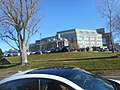 The old and newer Huntington Hospital buildings. I wanted a historic house nearby, but I'm convinced a parking garage for the hospital may have replaced it.
 -
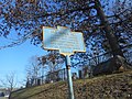 On the way back, I thought I'd get some more shots of parts of the Old Burial Hill Cemetery. The historical marker is visible, but the plaque on the rock behind the fence isn't.
 -
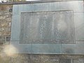 One plaque that is visible though, is this World War One Memorial between a pair of stone staircases.
 -
 Outside of the western staircase is this NRHP plaque.
 -
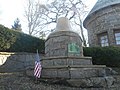 And just east of Fort Golgotha itself is this memorial bell for dead firefighters.
 -
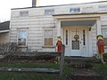 West Hills County Park is scattered with historic houses, like the Jacob Smith House,
 -
 I was looking for some others I've read about, but never found them.
 -
 I did find the house built by Walt Whitman's father, though.
 -

-
 Driveway to the NRHP-listed Michael Remp House in Greenlawn, New York.
 -
 The only shot I was able to get of the Remp House itself.
 -
 More mid-century modern architecture from Eastern Commack, New York. This time at a dry cleaner.
 -
 And here's a shot of Caleb Smith State Park that I wanted from an earlier trip.
 -
 This is the NRHP-listed Fred and Nancy Wagner House in Smithtown, New York...
 -
 ... however the address I was given is behind the American Legion Post.
 -
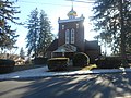 I also wanted the NRHP-listed St. Patrick's Roman Catholic Church,, but I couldn't find it...
 -
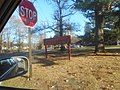 .. because it became The Byzantine Catholic Church of the Resurrection in 1967.
 -
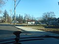 The church was planning a Gilbert & Sullivan Christmas Carol next month,
 -
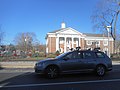 I missed the chance to capture the Smithtown Town Hall in my previous excursions,... but not this time.
 -
 Outside of "Downtown" Smithtown, I also tried to get the Smithtown Landing Golf Club...
 -
 .. unfortunately, the only parts of it I was able to capture was the clubhouse.
 -
 North of this though, was a sign for the Arthur Kunz County Park.
 -
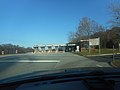 This was the time I decided I should head for the Sunken Meadow State Park
 -
 However, since this was in late November 2019, I didn't have to pay the toll.
 -
 To my surprise, Parking Field 5 was taken over by BOCES,
 -
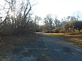 It also used to lead to a wye entrance and exit to NY 25A
 -
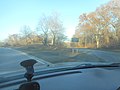 Back on the Sunken Meadow State Parkway, there's an on and off ramp to a maintenance yard.
 -
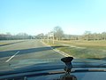 Then after passing over St. Johnsland Road, the entrance and exit to Parking Field 4
 -
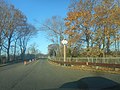 Immediately after this is the two-lane bridge over Sunken Meadow Creek, with the old, outdated "Slow" sign.
 -
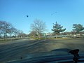 North of the bridge is the intersection with Naples Avenue, which spans from the Sunken Meadow Golf Course to Parking Field Number 3.
 -
 Naples Avenue only goes to the Golf Course, but at one time it was proposed to be upgraded into the never-built Sound Shore Parkway.
 -
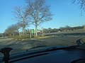 North of Naples, the parkway has an entrance to Parking Field Number One.,,
 -
 .. and Parking Field Number 2.
 -
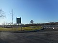 Parking Field #2 was undergoing a reconstruction project, that involved restoring an old creek. Get the details here.
 -
 The official northern terminus of Sunken Meadow State Parkway is this traffic circle...
 -
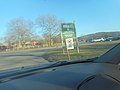 .. which also had entrances to Parking Field #1...
 -
 .. and a footpath to the boardwalk behind Parking Field #2.
 -
 The main bathhouse of the park between the traffic circle and the northwest corner of Parking Field #1.
 -
 On the way to the bathhouse, you've got this bicycle rack...
 -
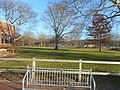 .. and a view of the playground for the kids.
 -
 Like Wildwood State Park, the New York State Parks Department gives them park-specific trucks.
 -
 What they don't get are their own sparsely equipped ambulances, which seem much more like ambulettes.
 -
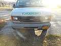 They're not registered as ambulances, though. Just as State Park vehicles.
 -
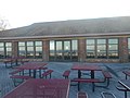 Canteen behind the main bathhouse with picnic tables.
 -
 Looking east along the Sunken Meadow Boardwalk towards the East Bathhouse.
 -
 A recent addition, but the Department of Environmental Protection, and Parks Department tells divers where they can find sunken treasure around Long Island.
 -
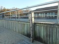 Not so recent though is this beach shower along the side of the boardwalk.
 -
 West of the bathhouse is a quarter-mile maker sign telling beachgoers that the boardwalk is three-quarters of a mile from end to end.
 -
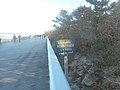 An eastbound view of the same sign on the opposite side of the westbound one. Honestly, it seems longer than three-quarters of a mile.
 -
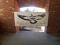 So how does my "wingspan" measure up? About 2 ½ less than my height, and 3½ less than an Osprey.
 -
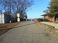 East of the Parkway, Naples Avenue goes to the East Bathhouse of Sunken Meadow, and this is the sidewalk on the west side of that bathhouse...
 -
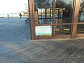 .. where you'll find this ad for "The Pavilion" restaurant in Parking Lot #2 at the Golf Course.
 -
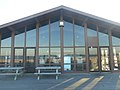 Maybe it's just me, but there's something disturbing about the design of the canteen at the east bathhouse.
 -
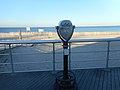 On the bright side, there's this pair of coin-operated binoculars behind the canteen.
 -
 Made in Norwalk, Connecticut. It's not free but at a paltry 25¢ it's exceptionally cheap! Why didn't I give it a try?
 -
 Lifeguard shack just east of the boardwalk. Like the toll booth, it's closed for the fall, winter, and early spring.
 -
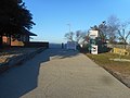 The east sidewalk of the East Bathhouse, which also has a bike rack and a portable sign warning of slippery conditions.
 -
 Before leaving the beach, the sun blocked my view of a sign on Sunken Meadow State Parkway telling me that NY 25A was a half mile from the bridge over St. Johnland Road.
 -
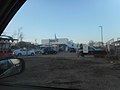 On the way back to Queens, I passed by this longtime fixture on New York State Route 24.
 -
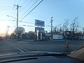 It's Zorn's Poultry Farm, which used to have an actual farm on the premises before Nassau County was suburbanized. This was obviously the pre-Thanksgiving crowd,


;_Glen_Cove,_NY.jpg)


_NY_110_in_Huntington.jpg)

_Side_Opening.jpg)


_Galaxie_Hotel.jpg)


_Town_Hall.jpg)


.jpg)
.jpg)


November 27, 2019; Another failed Great Neck Pursuit: edit
-
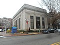 I looked for all kinds of sites on the Great Neck Peninsula, but all I was able to capture that day was the former Great Neck Trust Company building in Great Neck Plaza.

November 28, 2019: edit
NO PICTURES; THANKSGIVING
November 29, 2019; Return to Northern Long Island: edit
-
 The old gas station along Northern State Parkway between Exits 42 and 43. I've wanted this for so long.
 -
 In Kings Park the former LIRR spur to Kings Park Psychiatric Center is now a Hike & Bike trail.
 -
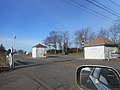 The toll gate to Short Beach in Nissequogue, New York, which was closed for the winter.
 -
 .. as well as the pavilion and concession stand.
 -
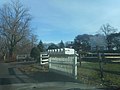 Driveway to the NRHP-listed "Land of Clover" now a private boarding school.
 -
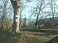 Another driveway to a former historic house named "Rassapeague,"
 -
 Earlier I was in Short Beach, but now this is Long Beach (not to be confused with the City in Nassau County)
 -
 As you enter the beach, you pass by this small novelty lighthouse next to the sign.
 -
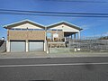 Long Beach has a concession stand too, but it's below the dunes.
 -
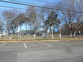 Long Beach contains three facilities; the Smithtown Bay Yacht Club...
 -
 .. the Otto Schubert Beach...
 -
 .. and the Town of Smithtown Marina.
 -
 The docks for the Smithtown Bay Yacht Club.
 -
 Back on Moriches Road, you'll find the Nissequogue Fire Department,...
 -
 ,, and the Village Hall and Police Department.
 -
 As with many NRHP-listed houses, I couldn't get "Harbor House," so I had to settle for the driveway.
 -
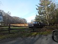 I was looking for sites in Head of the Harbor, but had to settle on more pics of the Archibald M. Brown Estate.
 -
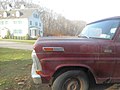 They have a 1970 Ford F-100 on display that was sold at Lyons Ford.
 -
 It's a 6 foot Styleliner and has stake frames and wine barrels in the bed.
 -
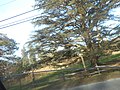 Not only that, there are vineyards in the back yard and the east side.
 -
 When I got to Stony Brook, I had to capture the Stony Brook Village Center on Main Street (CR 68)
 -
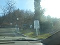 I was briefly diverted into the inner court of the center, but I returned to where I wanted to go later.
 -
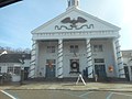 And of course, I had to get the legendary post office.
 -
 Believe it or not, the north end of the shopping center is the Stony Brook Fire Station
 -
 The fire department was established in 1909, before the Village Center existed,
 -
 All the bays for the fire station are in the back.
 -
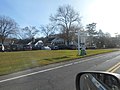 A notable feature of the Village Center is this colonial gas station and garage.
 -
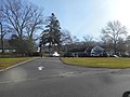 This is the entrance to the gas station. You have to cross northeast-bound traffic to get there. (
 -
 This is a storage tank for oil cans shaped like a Gulf gas station. For a long time, this gas station sold Gulf gas. Today it's Citgo.
 -
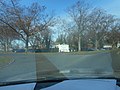 Across from the gas station and village green is the Three Village Inn.
 -
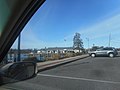 For some reason, I felt I had to get some shots of the Stony Brook Yacht Club,
 -
 This one is closer to the clubhouse.
 -
 The Three Village Inn also has country cottages north of the restaurant along Shore Road
 -
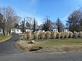 The cottages are more accurately tourist cabins, but that's alright.
 -
 North of the exit from the Village Center is a local street called Knoll Top Road. Suffolk CR 68 becomes Christian Avenue somewhere this point.
 -
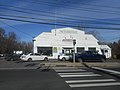 I wanted to get a shot of the East Setauket Automotive garage for a long time, and I finally grabbed it.
 -
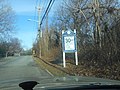 I was also looking for a certain type of road sign tree at the entrances to Poquott...
 -
 .. but they were replaced with these non-MUTCD-compliant wooden signs instead.
 -
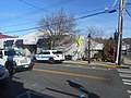 In Port Jefferson, New York, the constable of Belle Terre was paying a visit,
 -
 Though I was more interested in taking photographs of the end of the Washington Spy Trail Tourist Route...
 -
 ,, and the beginning of it.
 -
 Since I took a pic of the British Telephone Booth on Main Street and Arden Place in 2010, I decided to see how it was in 2019, and it wasn't doing that good.
 -
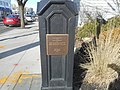 I also decided to capture a plaque commemorating the 35th Anniversary of Port Jeff as a village. I should've captured the clock it was mounted under too.
 -
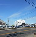 The P.T. Barnum ferry boat was dropping off passengers and vehicles from Bridgeport, Connecticut.
 -
 Same shot, but not cropped. The cropped image of the ferry was posted before this one.
 -
 The west side of the ferry terminal. At some point this day, a very pretty girl was talking on a cell phone,
 -
 Fares for the ferry in 2019.
 -
 After this I slugged my car up the hills of East Broadway and captured a shot of the gateway to the Village of Belle Terre.
 -
 In Rocky Point, I learned about this New York State Historical Marker along NY 25A.
 -
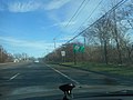 A sign telling motorists on the road to keep right in order to use the Rocky Point Bypass.
 -
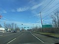 And my best shot of an overhead sign gantry for the split between NY 25A Business (left) and NY 25A Bypass (right).
 -
 After more failed attempts at the Benjamin King Woodhull House, I decided to return to Wildwood State Park.
 -
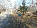 East of the parking lot is a sign encouraging ski trail etiquette.
 -
 Looking back at the parking lot, where a sign prohibits picnicking and campfires.
 -
 Just before the footpath to the beach is the caretaker's house on the right.
 -
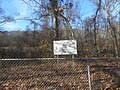 On the left is a sign reminding beachgoers to use adequate sun protection.
 -
 Certain items prohibited in the park, before you take the footpath to the beach.
 -
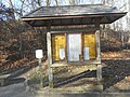 A billboard of fishing regulations...
 -
 .. right next to another sign for "Long Island's Sunken Treasures."
 -
 Just a few more feet and the former North Wading River Road ends at the boardwalk.
 -
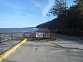 On the east side of this boardwalk is a dirt ramp leading to a fishing area, which is about 600 feet from there.
 -
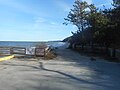 A more direct shot of the dirt ramp.
 -
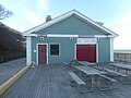 This is the canteen and beach house on the Beach.
 -
 The Long Island Sound is doing it's usual job of eroding the beaches in the fall.
 -
 The Lifeguard office is in the front of this pic. Behind this is the First Aid department and bathrooms.
 -
 Smoking is prohibited on the beach, and so is dumping a lit cigarette on the boardwalk.
 -
 The New York State Parks Department stores all their portable signs and picnic tables in the canteen during the winter.,,
 -
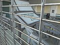 ,, and it's my duty to make sure you can read all of the signs ...
 -
 .. no matter how many obstructions there are.
 -
 The western staircase from the boardwalk...
 -
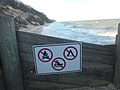 .. with yet another sign that forbids campfires, camping, and boating.
 -
 Storm drain on the footpath, which leads to the culvert.
 -
 And why, pray tell is this area closed to the public?
 -
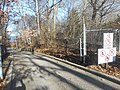 Correction; It's just a sign on the gate when they want to close the footpath.
 -
 After all this, I almost forgot the bike rack at the southeast end of Parking Field #1.
 -
 This parking space was only for Archery Hunters. No, I didn't park there.
 -
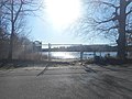 Driving through Lake Panamoka in Ridge gave me a big surprise...
 -
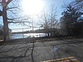 .. specifcally a third of the three private beaches at the lake.
 -
 After Lake Panamoka, I spotted the Long Island Shooting Range and Fireman's Memorial Park along NY 25.
 -
 West of William Floyd Parkway is a sign for a Wildlife Viewing Area...
 -
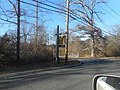 .. which is located at the Ridge Conservation Area.
 -
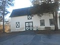 The Ridge Conservation Area was known as the Middle Island Game Farm.
 -
 The sign at Ridge Veterans Memorial Park contains a sign claiming the community is the Gateway to the Pine Barrens.
 -
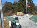 It also contains a memorial rock with a plaque and some flags.
 -
 Speaking of Middle Island, I had to capture more images of the Spring Lake Golf Course.
 -
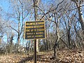 Harold Malkmes has been dead since 2011, and out of power since 2000, but the No Littering sign across Bartlett Road still bears his name.
 -
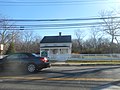 Along the Gordon Heights-Coram border on the south side of NY 25 is the historic Issac Smith Mott House.
 -
 This sign is on the western extension of Long Island Avenue west of Holbrook...
 -
 ,, for a fog zone between two former LILCO Power Plants on Union Avenue in Holtsville.
 -
 There's also the big chicken at a poultry farm closer to downtown, but it's not that big of a deal.


_Automotive.jpg)


.jpg)
.jpg)


.jpg)


MORE TO COME
November 30, 2019; Danbury Railway Museum Invasion: edit
COMING SOON
December 1-2, 2019: edit
NO PICTURES; BACK INJURY