User:Nilfanion/Maps/Elections
< User:Nilfanion | Maps
This page contains all the blank maps that are suitable for the current election cycle in the UK. These can be adapted to any number of tasks, primarily to show the results after the election is held.
UK general elections edit
England edit
Northern Ireland edit
Scotland edit
Wales edit
Northern Ireland Assembly elections edit
Scottish Parliament elections edit
Welsh Assembly elections edit
Local elections edit
England edit
District councils edit
All districts, whether a single tier unitary authority, London Borough or two-tier district:
-
 Adur
Adur -
 Allerdale
 -
 Amber Valley
 -
 Arun
Arun -
 Ashfield
 -
 Ashford
 -
 Aylesbury Vale
 -
 Babergh
 -
 Barking and Dagenham
 -
 Barnet
 -
 Barnsley
 -
 Barrow-in-Furness
 -
 Basildon
 -
 Basingstoke and Deane
 -
 Bassetlaw
 -
 Bath and North East Somerset
 -
 Bedford
 -
 Bexley
 -
 Birmingham
 -
 Blaby
Blaby -
 Blackburn with Darwen
 -
 Blackpool
 -
 Bolsover
 -
 Bolton
 -
 Boston
 -
 Bournemouth
 -
 Bracknell Forest
 -
 Bradford
 -
 Braintree
 -
 Breckland
 -
 Brent
Brent -
 Brentwood
 -
 Brighton and Hove
 -
 Bristol
 -
 Broadland
 -
 Bromley
 -
 Bromsgrove
 -
 Broxbourne
 -
 Broxtowe
 -
 Burnley
 -
 Bury
Bury -
 Calderdale
 -
 Cambridge
 -
 Camden
 -
 Cannock Chase
 -
 Canterbury
 -
 Carlisle
 -
 Castle Point
 -
 Central Bedfordshire
 -
 Charnwood
 -
 Chelmsford
 -
 Cheltenham
 -
 Cherwell
 -
 Cheshire East
 -
 Cheshire West and Chester
 -
 Chesterfield
 -
 Chichester
 -
 Chiltern
 -
 Chorley
 -
 Christchurch
 -
 Colchester
 -
 Copeland
 -
 Corby
Corby -
 Cornwall
 -
 Cotswold
 -
 Coventry
 -
 Craven
 -
 Crawley
 -
 Croydon
 -
 Dacorum
 -
 Darlington
 -
 Dartford
 -
 Daventry
 -
 Derby
Derby -
 Derbyshire Dales
 -
 Doncaster
 -
 Dover
Dover -
 Dudley
 -
 County Durham
 -
 Ealing
 -
 East Cambridgeshire
 -
 East Devon
 -
 East Dorset
 -
 East Hampshire
 -
 East Hertfordshire
 -
 East Lindsey
 -
 East Northamptonshire
 -
 East Riding of Yorkshire
 -
 East Staffordshire
 -
 Eastbourne
 -
 Eastleigh
 -
 Eden
Eden -
 Elmbridge
 -
 Enfield
 -
 Epping Forest
 -
 Epsom and Ewell
 -
 Erewash
 -
 Exeter
 -
 Fareham
 -
 Fenland
 -
 Forest Heath
 -
 Forest of Dean
 -
 Fylde
Fylde -
 Gateshead
 -
 Gedling
 -
 Gloucester
 -
 Gosport
 -
 Gravesham
 -
 Great Yarmouth
 -
 Greenwich
 -
 Guildford
 -
 Hackney
 -
 Halton
 -
 Hambleton
 -
 Hammersmith and Fulham
 -
 Harborough
 -
 Haringey
 -
 Harlow
 -
 Harrogate
 -
 Harrow
 -
 Hart
Hart -
 Hartlepool
 -
 Hastings
 -
 Havant
 -
 Havering
 -
 Herefordshire
 -
 Hertsmere
 -
 High Peak
 -
 Hillingdon
 -
 Hinckley and Bosworth
 -
 Horsham
 -
 Hounslow
 -
 Hull
Hull -
 Huntingdonshire
 -
 Hyndburn
 -
 Ipswich
 -
 Isle of Wight
 -
 Islington
 -
 Kensington and Chelsea
 -
 Kettering
 -
 King's Lynn and West Norfolk
 -
 Kingston upon Thames
 -
 Kirklees
 -
 Knowsley
 -
 Lambeth
 -
 Lancaster
 -
 Leeds
Leeds -
 Leicester
 -
 Lewes
Lewes -
 Lewisham
 -
 Lichfield
 -
 Lincoln
 -
 Liverpool
 -
 City of London
 -
 Luton
Luton -
 Maidstone
 -
 Maldon
 -
 Malvern Hills
 -
 Manchester
 -
 Mansfield
 -
 Medway
 -
 Melton
 -
 Mendip
 -
 Merton
 -
 Mid Devon
 -
 Mid Suffolk
 -
 Mid Sussex
 -
 Middlesbrough
 -
 Milton Keynes
 -
 Mole Valley
 -
 New Forest
 -
 Newark and Sherwood
 -
 Newcastle upon Tyne
 -
 Newcastle-under-Lyme
 -
 Newham
 -
 North Devon
 -
 North Dorset
 -
 North East Derbyshire
 -
 North East Lincolnshire
 -
 North Hertfordshire
 -
 North Kesteven
 -
 North Lincolnshire
 -
 North Norfolk
 -
 North Somerset
 -
 North Tyneside
 -
 North Warwickshire
 -
 North West Leicestershire
 -
 Northampton
 -
 Northumberland
 -
 Norwich
 -
 Nottingham
 -
 Nuneaton and Bedworth
 -
 Oadby and Wigston
 -
 Oldham
 -
 Oxford
 -
 Pendle
 -
 Peterborough
 -
 Plymouth
 -
 Poole
Poole -
 Portsmouth
 -
 Preston
 -
 Purbeck
 -
 Reading
 -
 Redbridge
 -
 Redcar and Cleveland
 -
 Redditch
 -
 Reigate and Banstead
 -
 Ribble Valley
 -
 Richmond upon Thames
 -
 Richmondshire
 -
 Rochdale
 -
 Rochford
 -
 Rossendale
 -
 Rother
 -
 Rotherham
 -
 Rugby
Rugby -
 Runnymede
 -
 Rushcliffe
 -
 Rushmoor
 -
 Rutland
 -
 Ryedale
 -
 Salford
 -
 Sandwell
 -
 Scarborough
 -
 Sedgemoor
 -
 Sefton
 -
 Selby
Selby -
 Sevenoaks
 -
 Sheffield
 -
 Shepway
 -
 Shropshire
 -
 Slough
 -
 Solihull
 -
 South Bucks
 -
 South Cambridgeshire
 -
 South Derbyshire
 -
 South Gloucestershire
 -
 South Hams
 -
 South Holland
 -
 South Kesteven
 -
 South Lakeland
 -
 South Norfolk
 -
 South Northamptonshire
 -
 South Oxfordshire
 -
 South Ribble
 -
 South Somerset
 -
 South Staffordshire
 -
 South Tyneside
 -
 Southampton
 -
 Southend-on-Sea
 -
 Southwark
 -
 Spelthorne
 -
 St Albans
 -
 St Edmundsbury
 -
 St Helens
 -
 Stafford
 -
 Staffordshire Moorlands
 -
 Stevenage
 -
 Stockport
 -
 Stockton-on-Tees
 -
 Stoke-on-Trent
 -
 Stratford-on-Avon
 -
 Stroud
 -
 Suffolk Coastal
 -
 Sunderland
 -
 Surrey Heath
 -
 Sutton
 -
 Swale
Swale -
 Swindon
 -
 Tameside
 -
 Tamworth
 -
 Tandridge
 -
 Taunton Deane
 -
 Teignbridge
 -
 Telford and Wrekin
 -
 Tendring
 -
 Test Valley
 -
 Tewkesbury
 -
 Thanet
 -
 Three Rivers
 -
 Thurrock
 -
 Tonbridge and Malling
 -
 Torbay
 -
 Torridge
 -
 Tower Hamlets
 -
 Trafford
 -
 Tunbridge Wells
 -
 Uttlesford
 -
 Vale of White Horse
 -
 Wakefield
 -
 Walsall
 -
 Waltham Forest
 -
 Wandsworth
 -
 Warrington
 -
 Warwick
 -
 Watford
 -
 Waveney
 -
 Waverley
 -
 Wealden
 -
 Wellingborough
 -
 Welwyn Hatfield
 -
 West Berkshire
 -
 West Devon
 -
 West Dorset
 -
 West Lancashire
 -
 West Lindsey
 -
 West Oxfordshire
 -
 West Somerset
 -
 Westminster
 -
 Weymouth and Portland
 -
 Wigan
Wigan -
 Wiltshire
 -
 Winchester
 -
 Windsor and Maidenhead
 -
 Wirral
 -
 Woking
 -
 Wokingham
 -
 Wolverhampton
 -
 Worcester
 -
 Worthing
 -
 Wychavon
 -
 Wycombe
 -
 Wyre
Wyre -
 Wyre Forest
 -
 York
York
.svg)
.svg)
.svg)
.svg)
.svg)
.svg)


.svg)
.svg)
.svg)
.svg)
.svg)
.svg)
.svg)

.svg)
.svg)
.svg)
.svg)
.svg)
.svg)
.svg)
.svg)
.svg)
.svg)
.svg)
.svg)

.svg)
.svg)
.svg)
.svg)

.svg)
.svg)
.svg)
.svg)
.svg)
.svg)

.svg)
.svg)
.svg)
.svg)
.svg)
.svg)
.svg)
.svg)
.svg)
.svg)
.svg)
.svg)
.svg)
.svg)
.svg)
.svg)
.svg)
.svg)
.svg)
.svg)
.svg)
.svg)
.svg)
.svg)

.svg)
.svg)
.svg)
.svg)
.svg)
.svg)
.svg)
.svg)
.svg)
.svg)

.svg)
.svg)
.svg)
.svg)
.svg)
.svg)
.svg)
.svg)
.svg)
.svg)
.svg)
.svg)

.svg)
.svg)
.svg)
.svg)
.svg)
.svg)
.svg)
.svg)
.svg)
.svg)
.svg)
.svg)
.svg)
.svg)
.svg)

.svg)

.svg)
.svg)

.svg)

.svg)
.svg)

.svg)
.svg)
.svg)

.svg)
.svg)
.svg)

.svg)
.svg)

.svg)
.svg)
.svg)
.svg)


.svg)
.svg)

.svg)
.svg)

.svg)
.svg)
.svg)
.svg)

.svg)
.svg)
.svg)

.svg)
.svg)
.svg)
.svg)
.svg)
.svg)
.svg)
.svg)
.svg)

.svg)
.svg)
.svg)
.svg)
.svg)
.svg)
.svg)
.svg)
.svg)
.svg)

.svg)
.svg)
.svg)
.svg)
.svg)
.svg)
.svg)
.svg)
.svg)
.svg)
.svg)
.svg)
.svg)
.svg)
.svg)
.svg)
.svg)
.svg)
.svg)
.svg)
.svg)
.svg)
.svg)
.svg)
.svg)
.svg)
.svg)
.svg)

.svg)
.svg)
.svg)
.svg)

.svg)
.svg)
.svg)
.svg)
.svg)
.svg)
.svg)
.svg)
.svg)
.svg)
.svg)
.svg)
.svg)
.svg)
.svg)
.svg)
.svg)
.svg)
.svg)
.svg)
.svg)
.svg)
.svg)
.svg)
.svg)
.svg)
.svg)
.svg)
.svg)
.svg)
.svg)
.svg)
.svg)
.svg)
.svg)
.svg)
.svg)
.svg)
.svg)
.svg)
.svg)

.svg)
.svg)
.svg)
.svg)
.svg)
.svg)
.svg)
.svg)
.svg)
.svg)
.svg)
.svg)
.svg)
.svg)
.svg)

.svg)
.svg)
.svg)
.svg)
.svg)
.svg)
.svg)
.svg)
.svg)
.svg)
.svg)
.svg)
.svg)
.svg)
.svg)
.svg)
.svg)

.svg)
.svg)
.svg)
.svg)
.svg)
.svg)


.svg)
.svg)
.svg)
.svg)
.svg)
.svg)
.svg)
.svg)
.svg)
.svg)
.svg)
.svg)
.svg)
.svg)
.svg)

.svg)
.svg)
.svg)
.svg)
.svg)
.svg)
.svg)
.svg)
.svg)
.svg)
.svg)
.svg)
.svg)
.svg)
County councils edit
Only counties with a two-tier structure:
Combined authorities edit
All current combined authorities:
-
 Cambridgeshire and Peterborough
 -
 Greater Manchester
 -
 Liverpool City Region
 -
 North East
 -
 Sheffield City Region
 -
 Tees Valley
 -
 West Midlands
 -
 West of England
 -
 West Yorkshire
.svg)
.svg)


.svg)

.svg)

.svg)
London Assembly and mayoral elections edit
-
 Assembly constituencies
 -
 Boroughs for mayoral elections
.svg)
.svg)
Northern Ireland edit
Scotland edit
All council areas in Scotland:
-
 Aberdeen
 -
 Aberdeenshire
 -
 Angus
Angus -
 Argyll and Bute
 -
 Clackmannanshire
 -
 Dumfries and Galloway
 -
 Dundee
 -
 East Ayrshire
 -
 East Dunbartonshire
 -
 East Lothian
 -
 East Renfrewshire
 -
 Edinburgh
 -
 Falkirk
 -
 Fife
Fife -
 Glasgow
 -
 Highland
 -
 Inverclyde
 -
 Midlothian
 -
 Moray
Moray -
 North Ayrshire
 -
 North Lanarkshire
 -
 Orkney
 -
 Outer Hebrides
 -
 Perth and Kinross
 -
 Renfrewshire
 -
 Scottish Borders
 -
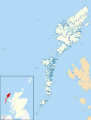
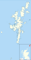 Shetland
 -
 South Ayrshire
 -
 South Lanarkshire
 -
 Stirling
 -
 West Dunbartonshire
 -
 West Lothian
.svg)
.svg)
.svg)
.svg)
.svg)
.svg)
.svg)
.svg)
.svg)
.svg)
.svg)
.svg)
.svg)
.svg)
.svg)
.svg)
.svg)
.svg)
.svg)
.svg)
.svg)
.svg)
.svg)
.svg)
.svg)
.svg)
.svg)
.svg)
.svg)
.svg)
.svg)
Wales edit
All principal areas in Wales:
-
 Blaenau Gwent
 -
 Bridgend
 -
 Caerphilly
 -
 Cardiff
 -
 Carmarthenshire
 -
 Ceredigion
 -
 Conwy
Conwy -
 Denbighshire
 -
 Flintshire
 -
 Gwynedd
 -
 Isle of Anglesey
 -
 Merthyr Tydfil
 -
 Monmouthshire
 -
 Neath Port Talbot
 -
 Newport
 -
 Pembrokeshire
 -
 Powys
Powys -
 Rhondda Cynon Taf
 -
 Swansea
 -
 Torfaen
 -
 Vale of Glamorgan
 -
 Wrexham
.svg)
.svg)
.svg)
.svg)
.svg)
.svg)
.svg)
.svg)
.svg)
.svg)
.svg)
.svg)
.svg)
.svg)
.svg)
.svg)
.svg)
.svg)
.svg)
.svg)
.svg)
.svg)