User:Orderinchaos/gallery/Adelaide
< User:Orderinchaos | gallery
Adelaide CBD photos edit
-
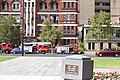
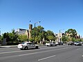
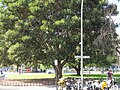
 Ambulance in Adelaide, South Australia, located at the intersection of Pirie Street and Frome Road.
 -
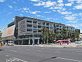
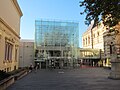
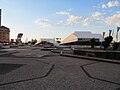
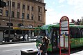
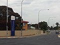
 Adelaide Central Bus Station in Franklin Street, Adelaide.
 -
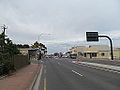
 Adelaide Central Bus Station in Franklin Street, Adelaide.
 -
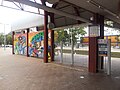
 Inside the bus area of Adelaide Central Bus Station in Franklin Street, Adelaide.
 -
 Inside the main terminal of Adelaide Central Bus Station in Franklin Street, Adelaide.
 -
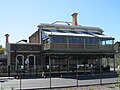
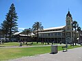
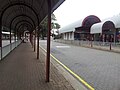
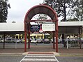
 Interior of the Adelaide Railway Station.
 -
 Interior of Adelaide Railway Station
 -
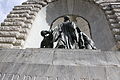
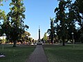
 Adelaide's National War Memorial seen at night.
 -
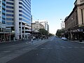
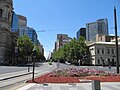
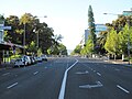
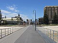
 Currie Street looking west from near King William Street, Adelaide.
 -
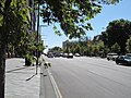
 North end of w:East Terrace, Adelaide, between Rundle Street and Grenfell Street, looking south.
 -
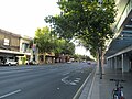
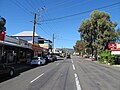
 Hindley Street, Adelaide, looking west from Leigh Street.
 -
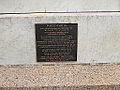
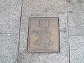 Don Dunstan plaque on the Jubilee 150 Walkway in Adelaide, South Australia.
 -
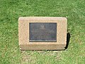 Plaque commemorating the redesign of Light Square in Adelaide in 1988.
 -
 Adelaide Advertiser building on Waymouth Street, Adelaide.
 -
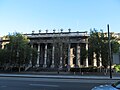
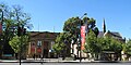 w:Art Gallery of South Australia, (and the University of Adelaide's Mitchell Building), w:North Terrace, Adelaide
 -
 Blyth Street at its intersection with Hindley Street, Adelaide.
 -
 Building on North Terrace, Adelaide.
 -
 Publishers office in Franklin Street, Adelaide, near the bus station.
 -
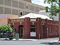
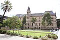
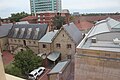
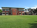
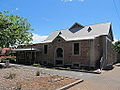
 Christian Brothers College, Adelaide.
 -
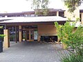
 Christian Brothers College, Adelaide.
 -
 Central Market Arcade in Adelaide.
 -
 Plaque on the Central Market Arcade (formerly Victoria Square Arcade) in Adelaide.
 -
 Chinatown as seen from Grote Street, Adelaide.
 -
 The Colonial Mutual Life Building in Adelaide, South Australia
 -
 The Federation Trading building in Waymouth Street, Adelaide.
 -

-

-

-

-

-
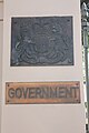
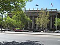
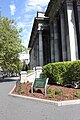
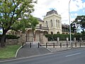
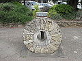
 Part of the front entrance at Parliament House, Adelaide, South Australia
 -
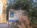
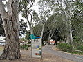
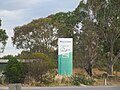
 Information sign outside Parliament House, Adelaide, South Australia
 -

-

-

-

-
-

-

-

-
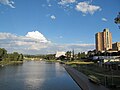
 Adelaide College of the Arts building as seen from the Morphett Street bridge.
 -

-

-

-

-

-

-

-

-
-

-

-

-

-
-

-

-

-

-
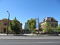
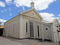
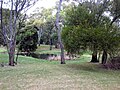
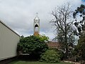
 Holy Trinity Church, North Terrace, Adelaide.
 -

-

-

-

-
-
-
-

-

-

-

-

-

-

-

-

-

-

-

-

-
-
-
-
-

-
-

-

-

-

-

-

-

-

-

-
-
-

-

-

-

-
-

-

-

-

-
-

-

-

-

-

-

-

-

-

-
-

-

-
-

-

-

-

-
-

-

-

-

-

-

-

-

-

-

-

-

-

-

-

-
-

-

-
-

-
-

-

-

-

-

-

-
-

-

-

-

-

-

-

-

-

-

-
-
-
 Looking down from the third floor of the Myer Centre in Rundle Mall, Adelaide
 -
 Sign inside the State Library of South Australia
 -
 Victoria Square looking northeast from Grote Street.


_S_from_Rundle.jpg)


Adelaide - Inner NW edit
-

-

-

-
-

-

-

-

-

-

-

-

-
-
-

-

-

-
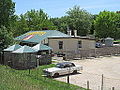
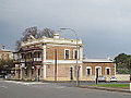
 Building in Gibson Street and Sixth Street, Bowden, South Australia
 -
 Bowden Business Park in Bowden, South Australia.
 -
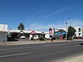
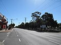
 Chief Street, Brompton, South Australia
 -
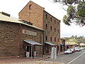
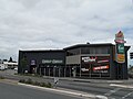
 Conroys Meats and Smallgoods in Bowden, South Australia
 -
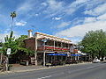
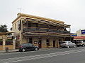
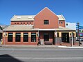
 Gaslight Tavern in Chief Street, Brompton, South Australia
 -
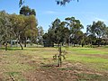
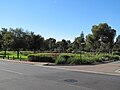
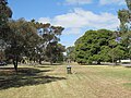
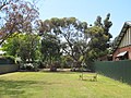
 Gibson Street Park in Bowden, South Australia
 -
 Gibson Street Park in Bowden, South Australia
 -
 Emu sculptures at Gibson Street Park in Bowden, South Australia
 -
-

-

-

-

-

-

-
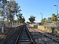
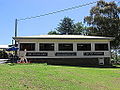
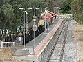
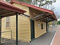
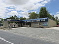
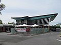
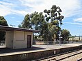 Bowden railway station, Bowden, South Australia
 -
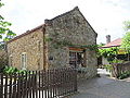
 SA Gas Company building (since demolished) in Chief Street, Brompton, South Australia
 -
 SA Gas Company building (since demolished) in Chief Street, Brompton, South Australia
 -
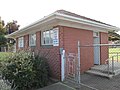
 Telephone exchange in Bowden, South Australia (near the railway station)
 -
 Terraced houses on 8th Street near Drayton Street, Bowden, South Australia
 -
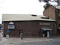
 Transfield bus depot in Gibson Street, Bowden, South Australia
 -
 Transfield bus depot in Gibson Street, Bowden, South Australia
 -

-

-

-

-

-

-
-
-

-

-

-
-

-

-

-

-

-

-

-
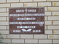
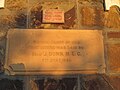
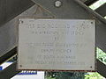
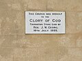
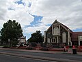
 Brompton Wesley Church foundation stone in Brompton, South Australia
 -

-

-

-

-

-
-

-

-

-

-

-

-

-

-
-

-
-

-

-
-

-

-

-

-

-
-

-

-

-
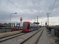
 Tram at the Adelaide Entertainment Centre tram stop, Adelaide, South Australia
 -

-

-

-

-

-

-

-

-

-

-
-

-

-

-

-
 Lady Daly Hotel in Port Road, Hindmarsh, South Australia
 -
 Land of Promise Hotel in Hindmarsh, South Australia
 -
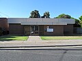
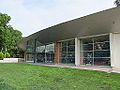
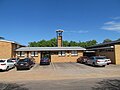
 Hindmarsh Library in Port Road, Hindmarsh, operated by the City of Charles Sturt.
 -
 The Loose Caboose Café in Hindmarsh, South Australia
 -

-
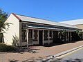
 The old Post Office building (now used as commercial premises) in Port Road, Hindmarsh.
 -
 Pavilion in the median strip of Port Road, near Chief Street, Hindmarsh.
 -
 Pavilion in the median strip of Port Road, near Chief Street, Hindmarsh.
 -

-

-

-

-

-
-

-

-

-

-

-
 Town hall in Hindmarsh, South Australia
 -
 War memorial dedicated to Korea and South East Asia seen from West Street, Hindmarsh, in the Port Road median.
 -

-

-
-

-
-
-
-

-
-

-

-

-

-

-

-
-

-

-

-

-

-
-
-

-

-

-

-
-

-

-

-

-

-

-

-

-

-
-

-

-

-

-
-
-

-

-

-

-

-
-

-

-

-

-

-
-

-

-

-
-

-

-

-

-

-

-
-


Adelaide - Inner East edit


.jpg)


Adelaide - Inner South East edit


_71.jpg)


Adelaide - Inner North edit


Outer North edit


Adelaide Hills edit
-
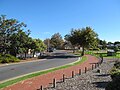
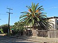
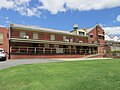
 Adelaide Hills Council - welcome sign - Mount Barker Road near Taminga Grove, Verdun.
 -
 The Olde Apple Shed on Onkaparinga Valley Road in Balhannah, South Australia
 -
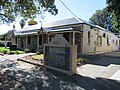
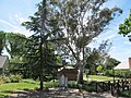
 Civic Centre at Gumeracha, South Australia
 -
 Civic Centre at Gumeracha, South Australia
 -
 Plaque adorning Civic Centre at Gumeracha, South Australia
 -

-
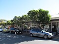
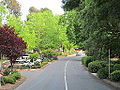
 Main street of Gumeracha, South Australia
 -
 Post office in Gumeracha, South Australia
 -
 Post office in Gumeracha, South Australia
 -
 The Big Rocking Horse, Gumeracha, South Australia
 -
 The Big Rocking Horse, Gumeracha, South Australia, with a small rocking horse in front for size comparison.
 -
 The Big Rocking Horse, Gumeracha, South Australia
 -
 Cafe at the Big Rocking Horse attraction in Gumeracha, South Australia
 -
 Cafe at the Big Rocking Horse attraction in Gumeracha, South Australia
 -
 Plaque on the Big Rocking Horse, Gumeracha, South Australia
 -
 Town hall at Gumeracha, South Australia
 -
 Plaque on the Town hall at Gumeracha, South Australia
 -
 Toy factory at Gumeracha, South Australia.
 -
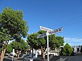
 Views north from Gumeracha, South Australia, near the post office.
 -
 Views north from Gumeracha, South Australia, near the post office.
 -
 No. 5 Chocolate Cafe at 5 Main Street, Hahndorf, South Australia
 -
 Rockbare Cellar Door at 102 Main Street, Hahndorf, South Australia (just north of the main town).
 -
 Mitre 10 store at 106 Main Street, Hahndorf, South Australia just north of the main town (since sold and now used by a hairdresser).
 -
 IGA at 13 Main Street, Hahndorf, South Australia (at the southern end of town).
 -
 Ye Olde Icecreamery and Café at 27 Main Street, Hahndorf, South Australia.
 -
 Hahndorf Inn, 35 Main Street, Hahndorf, South Australia
 -
 Hahndorf Inn, 35 Main Street, Hahndorf, South Australia
 -
 "Taste in Hahndorf" shop at 35 Main Street, Hahndorf, South Australia.
 -
 Bamfurlong Arts and Crafts shop in 36 Main Street, Hahndorf, South Australia
 -
 Arts and crafts shop at 41 Main Street, Hahndorf, South Australia
 -
 RSL in Hahndorf, South Australia
 -
 Leathersmith at 46 Main Street, Hahndorf, South Australia
 -
 The German Village Shop in Hahndorf, South Australia, originally opened in 1866 as Bom's Monumental Marble Works
 -
 Plaque for the German Village Shop in Hahndorf, South Australia, originally opened in 1866 as Bom's Monumental Marble Works
 -
 1839 Café at 56 Main Street, Hahndorf, South Australia
 -
 Breakfast at 1839 Café at 56 Main Street, Hahndorf, South Australia
 -
 1839 Café at 56 Main Street, Hahndorf, South Australia
 -
 Alec Johnston Park in Hahndorf, South Australia
 -
 Alec Johnston Park in Hahndorf, South Australia
 -
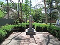 Pioneer memorial at Alec Johnston Park in Hahndorf, South Australia
 -
 German Arms Hotel in 69 Main Street, Hahndorf, South Australia
 -
 Pioneer Gardens, Hahndorf, South Australia
 -
 Women's monument at Pioneer Gardens, Hahndorf, South Australia
 -
 Birkenstock shop in 73 Main Street, Hahndorf, South Australia.
 -
 Old Mill Hotel, Hahndorf, South Australia
 -
 Old Mill Hotel, Hahndorf, South Australia
 -
 Old Mill Hotel, Hahndorf, South Australia
 -
 Old Mill Hotel, Hahndorf, South Australia
 -
 Beerenberg Farm buildings south of Hahndorf, South Australia
 -
 Beerenberg Farm buildings south of Hahndorf, South Australia
 -
 Carl Nitschke Park north of Hahndorf, South Australia
 -
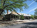
 Glen Vimy Orchards roadside apple store on Mount Barker Road, Hahndorf, South Australia
 -
 Main street of Hahndorf, South Australia.
 -
 Hahndorf Vegetable Garden, a market just north of Hahndorf, South Australia
 -
 Hahndorf Vegetable Garden, a market just north of Hahndorf, South Australia
 -
 Hahndorf Vegetable Garden, a market just north of Hahndorf, South Australia
 -
 Hahndorf Resort just north of Hahndorf, South Australia
 -
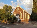
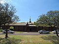
 St Paul's Lutheran Church, Hahndorf
 -
 St Paul's Lutheran Church, Hahndorf
 -
 Historic cemetery at St Paul's Lutheran Church, Hahndorf
 -
 Plaque on St Paul's Lutheran Church, Hahndorf.
 -
 Telephone exchange on Auricht Road, Hahndorf, South Australia
 -
 Tree avenue commemorating the pioneering women of Hahndorf, South Australia, alongside Mount Barker Road leaving Hahndorf to the north.
 -
 Plaque next to tree avenue in Hahndorf, South Australia
 -
 View from Auricht Road eastwards in Hahndorf, South Australia
 -
 Southern entrance to Hahndorf, South Australia on Mount Barker Road.
 -
 Wooden sign at northern entrance to Hahndorf, South Australia on Mount Barker Road
 -
 South East Freeway, Adelaide heading west into the Heysen Tunnels.
 -

-

-

-

-

-

-
-
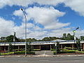
 Western entrance to Nairne, South Australia on the Princes Highway
 -
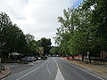
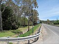
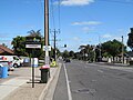
 Princes Highway looking west from the entrance to Nairne, South Australia
 -
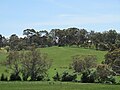
 View from southern end of Nairne, South Australia.
 -
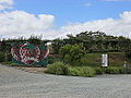
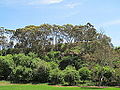
 Views of Nairne, South Australia from western entrance
 -
 Views of Nairne, South Australia from western entrance
 -
-

-

-

-

-
-

-

-

-

-
-
-

-

-

-

-

-

-

-
 Car restoration shop at Verdun, South Australia
 -
 Views from Verdun, South Australia
 -
 Views from Verdun, South Australia
 -
 Grumpy's Brewhaus in Verdun, South Australia
 -
 Cheese factory next to Melba's Chocolate Factory, Woodside, South Australia
 -
 Melba's Chocolate Factory, Woodside, South Australia
 -
 Melba's Chocolate Factory, Woodside, South Australia
 -
 Melba's Chocolate Factory, Woodside, South Australia
 -
 Garden outside Melba's Chocolate Factory, Woodside, South Australia
 -
 Inside the shop at Melba's Chocolate Factory, Woodside, South Australia
 -
 Machinery at Melba's Chocolate Factory, Woodside, South Australia
 -
 Entrance on Montacute Road to part of the Black Hill Conservation Park in Montacute, South Australia.
 -
 Sign for Black Hill Conservation Park in the Adelaide Hills.
 -
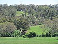 Views from Mount Barker Road about 2 km north of Hahndorf, South Australia
 -
 Views from Mount Barker Road about 2 km north of Hahndorf, South Australia
 -
 Views from Mount Barker Road about 2 km north of Hahndorf, South Australia
 -
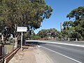
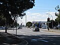
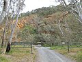
 Mount Barker Road looking north-west from Taminga Grove, Verdun, in the Adelaide Hills.
 -
 Mount Barker Road looking north-west from Taminga Grove, Verdun, in the Adelaide Hills.
 -
 Mount Barker Road looking south-east from the Onkaparinga River near Hahndorf in the Adelaide Hills.
 -
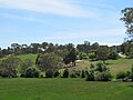
 Views north from the town of Hahndorf, South Australia
 -
 Views north from the town of Hahndorf, South Australia
 -
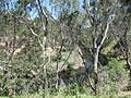
 Black Hill Conservation Park in the Adelaide Hills at Montacute, South Australia
 -
 Black Hill Conservation Park in the Adelaide Hills at Montacute, South Australia
 -
 Black Hill Conservation Park in the Adelaide Hills at Montacute, South Australia
 -
 Black Hill Conservation Park in the Adelaide Hills at Montacute, South Australia
 -
 Black Hill Conservation Park in the Adelaide Hills at Montacute, South Australia
 -
 Black Hill Conservation Park in the Adelaide Hills at Montacute, South Australia
 -
 Black Hill Conservation Park in the Adelaide Hills at Montacute, South Australia
 -
 Black Hill Conservation Park in the Adelaide Hills at Montacute, South Australia
 -
 Black Hill Conservation Park in the Adelaide Hills at Montacute, South Australia
 -
 Koala on tree at Black Hill Conservation Park in the Adelaide Hills at Montacute, South Australia
 -

-

-
-

-

-

-

-

-

-

-

-

-

-

-

-

-

-
-
-

-

-

-
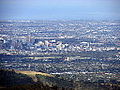
 South East Freeway near Mount Barker, looking in the direction of Adelaide with Mount Lofty's TV towers visible in the distance.
 -
 South East Freeway leaving Mount Barker towards Adelaide.


Gawler edit
-
 Plaque adorning statue of James Martin, a historically important figure in Gawler, South Australia, at Apex Park.
 -
 Statue of James Martin, a historically important figure in Gawler, South Australia, at Apex Park.
 -
 Apex Park, Gawler, South Australia
 -
 Bushman Hotel in Cowan Street, Gawler, South Australia
 -
 Gawler Arms Hotel in 102 Murray Street, Gawler, South Australia
 -
 Prince Albert Hotel in 109 Murray Street, Gawler, South Australia
 -
 Old Mill at the southern entrance to Gawler, South Australia.
 -
 Old Mill at the southern entrance to Gawler, South Australia.
 -
 Southern Hotel (23 Murray Street) near the Old Mill at the southern entrance to Gawler, South Australia.
 -
 Kingsford Hotel in 32 Murray Street, Gawler, South Australia.
 -
 Bank SA building in 33 Murray Street, Gawler, South Australia.
 -
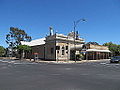
 Old Telegraph Station Museum at 59-61 Murray Street, Gawler
 -
 Old Telegraph Station Museum at 59-61 Murray Street, Gawler
 -
 Old Spot Hotel at 77 Murray Street, Gawler, South Australia.
 -
 ANZ Bank at 93 Murray Street, Gawler, South Australia
 -
 Gawler Town Hall at 89 Murray Street, Gawler, South Australia
 -
 Gawler Institute at 91 Murray Street, Gawler, South Australia
 -
 Victoria Court in Tod Street, Gawler, South Australia
 -
 Gawler Central railway station in Gawler, South Australia
 -
 Gawler Central railway station in Gawler, South Australia
 -
 Station master's house near Gawler Central railway station in Gawler, South Australia
 -
 Light Square, Gawler, South Australia
 -
 Light Square, Gawler, South Australia
 -
 Light Square, Gawler, South Australia
 -
 Gawler police station in Gawler, South Australia.
 -
 Gawler Uniting Church in Tod Street, Gawler, South Australia
 -
 Gawler Uniting Church in Tod Street, Gawler, South Australia
 -
 Gawler Uniting Church in Tod Street, Gawler, South Australia
 -
 Congregational church in Gawler, South Australia
 -
 Congregational church in Gawler, South Australia
 -
 Court house in Gawler, South Australia
 -
 Post office in Gawler, South Australia
 -
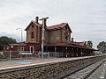 Gawler railway station in Gawler South, South Australia
 -
 Gawler railway station in Gawler South, South Australia
 -
 Gawler railway station in Gawler South, South Australia
 -
 Gawler railway station in Gawler South, South Australia
 -
 The F-245 (Class F) locomotive (1915) outside the Gawler railway station, South Australia.
 -
 Plaque in the Gawler railway station foyer, South Australia
 -
 Foyer of the Gawler railway station, South Australia
 -
 Gawler railway station, South Australia
 -
 Murray Street, Gawler, looking north near the Prince Albert Hotel.
 -
 Murray Street, Gawler, looking north near the Prince Albert Hotel.
 -
 Plaque commemorating the first singing of Song of Australia at Gawler in 1859.
 -
 Houses in Eighth Street, Gawler South, South Australia
 -
 Building at 12th/10th Streets, Gawler South.
 -
 Overway Hotel in Gawler South, South Australia (opposite Gawler railway station)
 -
 View from near Apex Park towards the main street of Gawler, South Australia
 -
 Reserve in Tod Street, Gawler, South Australia
 -
 Town of Gawler - welcome monument - Main North Road (at Dalkeith Road), Kudla
 -
 Town of Gawler - welcome monument - Main North Road (near Kestrel Dr), Hewett.
 -
 Town of Gawler - welcome monument - Redbanks Road (near Dawkins Ave), Willaston.
 -
 Light Regional Council - welcome sign - Main North Road (at Kingfisher Dr), Hewett.
 -
 Light Regional Council - welcome sign - Mallala Road, Gawler Belt
 -
 South Para River flowing through Apex Park, Gawler, South Australia
 -
 South Para River near Gawler Bridge in Gawler, South Australia
 -
 South Para River near Gawler Bridge in Gawler, South Australia


Barossa Valley edit
-

-

-
-

-

-

-

-

-
-

-

-
-

-

-

-
-

-

-

-

-

-

-
-

-
-

-

-

-

-

-

-

-

-

-

-

-

-

-

-

-

-
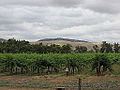
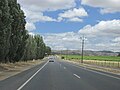
 Sturt Highway looking west near Nuriootpa, South Australia.


Major roads edit
-

-
-

-

-
-

-

-
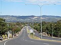
 Montacute Road climbing into the Adelaide Hills near Montacute, South Australia.


Street signs edit


Other edit
-

-

-
-

-

-

-

-

-
 Sunrise over the clouds above Spencer Gulf in South Australia, about 20 minutes into an Adelaide-Perth flight.
 -

-

-

-

-

-

-

-

-

-

-
-

-
-

-
-

-

-

-

-
-

-

-

-
-

-


Sat Dec 13 20:07:25 WST 2014 edit
-
 View of Adelaide CBD from the Adelaide Airport.
 -
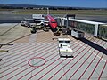
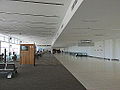 Gates at Adelaide Airport.
 -
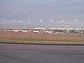
 Views across the Adelaide Airport towards the city from Harbourtown in West Beach.
 -
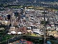 View of Adelaide CBD from the air.
 -
 View of Adelaide CBD from the air.
 -
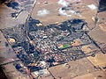 Aerial photo of Corrigin, Western Australia
 -
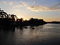
 Aerial photo of Goolwa, South Australia
 -
 Aerial photo of Maslin Beach (front), Port Willunga and Aldinga Beach (centre) in southern Adelaide.
 -
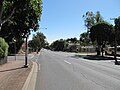
 Anzac Highway looking north-east from Morphett Road, Camden Park, South Australia
 -
 City of Burnside - welcome sign - Portrush Road & Chapel St, Glen Osmond
 -
 City of Burnside - welcome sign - Portrush Road & Chapel St, Glen Osmond
 -
 City of Burnside - welcome sign - Glen Osmond Road near Portrush Road, Glen Osmond
 -
 City of Campbelltown offices in Rostrevor, South Australia.
 -
 City of Campbelltown offices in Rostrevor, South Australia.
 -
 Gardens of the City of Campbelltown offices in Rostrevor, South Australia.
 -
 Plaque outside the City of Campbelltown offices in Rostrevor, South Australia.
 -
 Campbelltown Public Library in Montacute Road, Newton, South Australia
 -
 Campbelltown Public Library in Montacute Road, Newton, South Australia
 -
 Campbelltown Public Library in Montacute Road, Newton, South Australia
 -
 City of Campbelltown (SA) - welcome sign - Lower North East Road near Amadio Crescent, Campbelltown.
 -
 City of Campbelltown (SA) - welcome sign - Lower North East Road near Amadio Crescent, Campbelltown.
 -
 City of Campbelltown (SA) - welcome monument - Montacute Road / Lower North East Road, Campbelltown.
 -
 City of Campbelltown (SA) - welcome monument - Montacute Road near Maynard Avenue, Campbelltown.
 -
 Roof of Centro Arndale shopping centre in Kilkenny, South Australia, during a period when the centre was under construction in October 2012.
 -
 City of Charles Sturt - welcome monument - Port Road, Hindmarsh.
 -
 All Saints Anglican Church in Colonel Light Gardens, South Australia
 -
 Plaque on All Saints Anglican Church in Colonel Light Gardens, South Australia
 -
 Church of Christ on Goodwood Road, Colonel Light Gardens, South Australia
 -
 Church of Christ on Goodwood Road, Colonel Light Gardens, South Australia
 -
 Trinity Baptist Church in Colonel Light Gardens, South Australia
 -
 Trinity Baptist Church in Colonel Light Gardens, South Australia
 -
 Hall of Trinity Baptist Church in Colonel Light Gardens, South Australia
 -
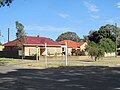
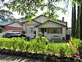 House at 51 West Parkway, Colonel Light Gardens, South Australia
 -
 House on The Strand, Colonel Light Gardens, South Australia
 -
 House on Salisbury Crescent at Lincoln Avenue, Colonel Light Gardens, South Australia
 -
 Houses on Doncaster Avenue east from Eton Street, Colonel Light Gardens, South Australia.
 -
 Houses on Broadway, Colonel Light Gardens, South Australia.
 -
 Houses on Broadway, Colonel Light Gardens, South Australia.
 -
 Houses on East Parkway, Colonel Light Gardens, South Australia.
 -
 The Institute at 53 West Parkway, Colonel Light Gardens, South Australia
 -
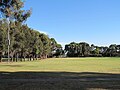
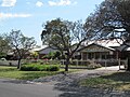
 Mortlock Park, Colonel Light Gardens, South Australia
 -
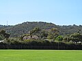
 View towards the hills from Mortlock Park, Colonel Light Gardens, South Australia
 -
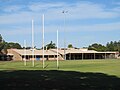
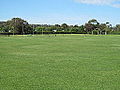 Australian Rules football ground at Mortlock Park, Colonel Light Gardens, South Australia
 -
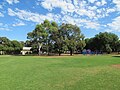 Mortlock Park, Colonel Light Gardens, South Australia
 -
 Mortlock Park, Colonel Light Gardens, South Australia
 -
 Location of Mitcham Army Camp at Mortlock Park, Colonel Light Gardens, South Australia
 -
 Scout group at Mortlock Park, Colonel Light Gardens, South Australia
 -
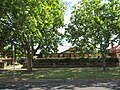
 Colonel Light Gardens Primary School in Colonel Light Gardens, South Australia
 -
 Colonel Light Gardens Primary School in Colonel Light Gardens, South Australia
 -
 Colonel Light Gardens Primary School in Colonel Light Gardens, South Australia
 -
 Colonel Light Gardens Primary School in Colonel Light Gardens, South Australia
 -
 Colonel Light Gardens Primary School in Colonel Light Gardens, South Australia
 -
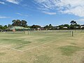 Reade Park tennis courts in Colonel Light Gardens, South Australia
 -
 Reade Park tennis courts in Colonel Light Gardens, South Australia
 -
 Roundabout at the intersection of Doncaster Avenue and West Parkway, Colonel Light Gardens, South Australia.
 -
 Colonel Light Gardens World of Learning, a child care centre in Salisbury Crescent, Colonel Light Gardens, South Australia.
 -
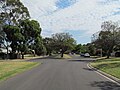 Broadway, Colonel Light Gardens, South Australia, looking north from Doncaster Avenue.
 -
 Doncaster Avenue, Colonel Light Gardens, South Australia, at Piccadilly Circuit.
 -
 East Parkway, Colonel Light Gardens, South Australia, looking north from Manchester Road.
 -
 The Strand, Colonel Light Gardens, South Australia, looking west from Freeling Crescent.
 -
 West Parkway, Colonel Light Gardens, South Australia, looking north from Doncaster Avenue.
 -
 War memorial in the small park at Doncaster and Broadway, Colonel Light Gardens, South Australia.
 -
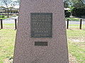 War memorial in the small park at Doncaster and Broadway, Colonel Light Gardens, South Australia.
 -
 Welcome sign on Doncaster Avenue, Colonel Light Gardens.
 -
 "Drive on left in Australia" sign at Mengler Hill in the Barossa Valley. These signs are common near tourist attractions in Australia.
 -
 East Waste disposal truck in eastern Adelaide.
 -
 Tram in Adelaide heading towards Hindmarsh at the Morphett Road stop.
 -
 Hanson Road looking south in the suburb of Woodville Gardens, South Australia
 -
 Harbourtown Adelaide in West Beach, South Australia.
 -
 Harbourtown Adelaide in West Beach, South Australia.
 -
 City of Holdfast Bay - welcome sign - Anzac Highway, Glenelg.
 -
 Sign for Klemzig Interchange on the Adelaide O-Bahn, and a view to the station.
 -
 Kudla railway station between Munno Para and Gawler, facing south.
 -
 Kudla railway station between Munno Para and Gawler, facing north.
 -
 Main North Road looking south from Barker Street, Prospect, South Australia
 -
 Plaque recording the original location of the Mitcham Army Camp, now located within Mortlock Park in the Adelaide suburb of Colonel Light Gardens.
 -
 Montacute Road looking east from Maryvale Road where it departs into the Adelaide Hills.
 -
 Montacute Road as seen from near the Newton Village shops in Athelstone, South Australia
 -
 Line of trees along Montacute Road in Athelstone, South Australia
 -
 Line of trees along Montacute Road in Athelstone, South Australia
 -
 Montacute Road west from Maryvale Road, dividing the suburbs of Rostrevor (left) and Athelstone (right), South Australia.
 -
 Morphett Road, Morphettville, looking south from the racecourse.
 -
 Outside of Morphettville Racecourse in Morphettville (near Glenelg), South Australia.
 -
 Tram depot on Morphett Road, Morphettville, South Australia
 -
 North East Road, Adelaide, looking towards the city with the ABC facility in Collinswood visible on the right.
 -
 North East Road looking south west from Hewer St, Hampstead Gardens.
 -
 City of Norwood Payneham & St Peters - welcome sign - OG Road, Felixstow.
 -
 Buildings associated with the Black Hill rangers station and flora centre in eastern Athelstone, South Australia.
 -
 Maryvale Farm gates in eastern Athelstone, South Australia
 -
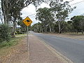 Maryvale Road, Athelstone, South Australia, with a warning sign about kangaroos.
 -
 View north-west from Maryvale Road (near Montacute Road), Athelstone, South Australia
 -
 Wayville Baptist Church in Black Forest, South Australia
 -
 Broadview Baptist Church in Broadview, South Australia
 -
 Broadview Baptist Church in Broadview, South Australia
 -
 Foundation stone of Broadview Baptist Church in Broadview, South Australia
 -
 Broadview Croquet Club in Broadview, South Australia
 -
 Galway Avenue looking south from Collingrove Avenue, Broadview, South Australia
 -
 St Philip's Anglican Church, Broadview, South Australia
 -
 Inside St Philip's Anglican Church, Broadview, South Australia
 -
 Foundation stone of St Philip's Anglican Church, Broadview, South Australia
 -
 Broadview Uniting Church, Broadview, South Australia
 -
 Broadview Uniting Church, Broadview, South Australia
 -
 Broadview Uniting Church, Broadview, South Australia
 -
 Foundation stone of Broadview Uniting Church, Broadview, South Australia
 -
 Fourth Creek Reserve in Campbelltown, South Australia, near the intersection of Montacute Road and Maynard Avenue.
 -
 ABC Adelaide sign on North East Road, Collinswood, outside the Adelaide studios.
 -
 Hampstead Hotel in Collinswood, South Australia.
 -
 Glynde Corner in Felixstow, South Australia.
 -
 Pooch Park in Flinders Park, South Australia
 -
 Park in Ashburn Avenue, Fulham, South Australia
 -
 Buckingham Arms Hotel at Northcote and Walkerville Terraces, Gilberton.
 -
 Gilberton House at 128 Stephen Terrace, Gilberton, South Australia
 -
 House on River Street, Gilberton, South Australia
 -
 Houses on Tyne Street (near Thames Street), Gilberton, South Australia.
 -
 Highlander Hotel in Gilles Plains, South Australia
 -
 Shopping centre at Gilles Plains in north east Adelaide, South Australia.
 -
 Glynde Hotel at Glynde Corner, Glynde, South Australia
 -
 East Torrens Primary School off Montacute Road, Hectorville, South Australia
 -
 Unusual house at the corner of Montacute Road and Hectorville Road, Hectorville, South Australia
 -
 HMAS Australia Road in Henley Beach, South Australia
 -
 HMAS Australia Road in Henley Beach, South Australia
 -
 Church of Christ in Mile End, South Australia
 -
 St James' Anglican Church in Mile End, Adelaide, South Australia
 -
 St James' Anglican Church in Mile End, Adelaide, South Australia
 -
 House on Buchanan Street, Nailsworth, South Australia
 -
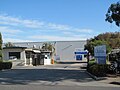
 Library at Nailsworth, South Australia
 -
 Library at Nailsworth, South Australia
 -
 Prospect Gardens / Narnu Wirra Park in Nailsworth, South Australia
 -
 Prospect Gardens / Narnu Wirra Park in Nailsworth, South Australia
 -
 Nailsworth Primary School in Nailsworth, South Australia
 -
 Nailsworth Primary School in Nailsworth, South Australia
 -
 Nailsworth Primary School in Nailsworth, South Australia including the historic original building
 -
 Newton Village Shopping Centre in Newton, South Australia
 -
 Newton Village Shopping Centre in Newton, South Australia
 -
 House in Barker Street, Prospect, South Australia
 -
 Our Lady of the Rosary Catholic Church, Prospect, South Australia
 -
 Our Lady of the Rosary Catholic Church, Prospect, South Australia
 -
 Our Lady of the Rosary Catholic Church, Prospect, South Australia
 -
 Our Lady of the Rosary Catholic Church, Prospect, South Australia
 -
 Foundation stone of Our Lady of the Rosary Catholic Church, Prospect, South Australia
 -
 Sign outside Our Lady of the Rosary Catholic Church, Prospect, South Australia
 -
 Peppermint Gums Park in Prospect, South Australia (Barker near Main North)
 -
 Peppermint Gums Park in Prospect, South Australia (Barker near Main North)
 -
 Prospect Road Uniting Church in Prospect, South Australia
 -
 Baptist church in Rostrevor, South Australia
 -
 Fourth Creek in Rostrevor, South Australia
 -
 Uniting Church at Rostrevor, South Australia
 -
 City of Salisbury council chambers, Salisbury, South Australia
 -
 City of Salisbury council chambers, Salisbury, South Australia
 -
 City of Salisbury council chambers, Salisbury, South Australia
 -
 Parabanks Shopping Centre in Salisbury, South Australia
 -
 Pitman Park near the centre of Salisbury, South Australia.
 -
 Pitman Park near the centre of Salisbury, South Australia.
 -
 Pitman Park near the centre of Salisbury, South Australia.
 -
 Stockade Hotel in Salisbury, South Australia
 -
 Bus stops adjacent to the Smithfield Interchange and nearby shops on Anderson Walk.
 -
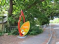
 "Tusks" by Antonio Colangelo (1989), near the Smithfield Interchange in Smithfield, South Australia.
 -
 Plaque accompanying "Tusks" by Antonio Colangelo (1989), near the Smithfield Interchange in Smithfield, South Australia.
 -
 St Peters Town Hall, South Australia, November 2012, before its May 2013 re-opening.
 -
 The Trudgen Memorial at St Peters Town Hall, South Australia, November 2012
 -
 The Trudgen Memorial at St Peters Town Hall, South Australia, November 2012
 -
 The Avenues shopping centre in Stepney, South Australia
 -
 Holy Name Catholic Church in Payneham Road, Stepney, South Australia
 -
 View of clock tower of Holy Name Catholic Church in Payneham Road, Stepney, South Australia
 -
 Co-ordinating Italian Committee near the Holy Name Catholic Church on Payneham Road, Stepney, South Australia
 -
 Telephone exchange at Payneham Road, Stepney, South Australia
 -
 City of Adelaide street sign in North Terrace, Adelaide.
 -
 City of Adelaide street sign in Waymouth Street, Adelaide.
 -
 Street sign in the suburb of Colonel Light Gardens, Adelaide. While in the City of Mitcham, it was once separately administered.
 -
 Street sign in the suburb of Colonel Light Gardens, Adelaide. While in the City of Mitcham, it was once separately administered.
 -
 Street sign in the City of Mitcham, located at Angas Road, Westbourne Park
 -
 Street sign in the City of Mitcham, located at Leslie Avenue, Westbourne Park
 -
 Street sign in the City of Port Adelaide Enfield at Lynton Avenue, Gilles Plains
 -
 Street sign in the City of Port Adelaide Enfield at North East Road, Gilles Plains
 -
 City of Tea Tree Gully sign in Padbury Road, Holden Hill
 -
 Street sign in Vale Park in the Town of Walkerville, South Australia.
 -
 City of West Torrens street sign at Falcon Avenue, Mile End
 -
 City of West Torrens street sign at Northcote Street, Torrensville
 -
 Ascot Avenue in Vale Park, South Australia
 -
 Walkerville Recreation Ground in Walkerville, South Australia
 -
 Walkerville Recreation Ground in Walkerville, South Australia
 -
 Sign at Walkerville Recreation Ground in Walkerville, South Australia
 -
 St Andrew's Anglican Church in Walkerville, South Australia
 -
 St Monica's Church in Walkerville, South Australia
 -
 Sussex Hotel in Walkerville, South Australia
 -
 Walkers Arms Hotel in Walkerville, South Australia
 -
 Walkers Arms Hotekl in Walkerville, South Australia
 -
 Finsbury Hotel on Hanson Road, Woodville North, South Australia.
 -
 Finsbury Hotel on Hanson Road, Woodville North, South Australia.
 -
 Old Telecom Australia cable post on Montacute Road, Athelstone, South Australia.
 -
 Info board at Paradise Interchange on the Adelaide O-Bahn.
 -
 Bus platform at Paradise Interchange on the Adelaide O-Bahn.
 -
 Bus platform at Paradise Interchange on the Adelaide O-Bahn.
 -
 City of Playford - welcome monument - Main North Road at Dalkeith Road, Munno Para.
 -
 Prospect Road looking north from Victoria Street, Prospect, South Australia
 -
 City of Prospect - welcome sign - North East Road at Nottage Terrace, Collinswood.
 -
 Salisbury Highway looking north from Bridge Street, Salisbury, South Australia
 -
 Salisbury Highway looking south from Bridge Street, Salisbury, South Australia
 -
 Salisbury Interchange in Salisbury, South Australia - bus-train interface with artwork
 -
 Salisbury Interchange in Salisbury, South Australia
 -
 Salisbury Interchange in Salisbury, South Australia - bus station
 -
 Salisbury Interchange in Salisbury, South Australia - bus station
 -
 Salisbury Interchange in Salisbury, South Australia - bus station
 -
 Entrance of Salisbury Interchange in Salisbury, South Australia
 -
 Plaque at Salisbury Interchange in Salisbury, South Australia
 -
 Salisbury Interchange in Salisbury, South Australia - railway station
 -
 Salisbury Interchange in Salisbury, South Australia - railway station viewed from south.
 -
 City of Salisbury - welcome monument - Salisbury Highway at Commercial Road, Salisbury
 -
 Smithfield railway station in northern Adelaide, South Australia
 -
 Smithfield railway station in northern Adelaide, South Australia
 -
 Smithfield railway station in northern Adelaide, South Australia
 -
 South Road, Adelaide, looking north from Forest Avenue, Black Forest.
 -
 South Road, Adelaide, looking south from Forest Avenue, Black Forest.
 -
 City of Tea Tree Gully - welcome monument - North East Road (near Tarton Road), Gilles Plains.
 -
 River Torrens at Rowells Road, Lockleys, South Australia.
 -
 Torrens River as it travels through Gilberton, South Australia, near the Walkerville council office.
 -
 Walkerville Town Hall at the intersection of Walkerville Terrace and Stephen Terrace.
 -
 Foundation stone of Walkerville Town Hall at the intersection of Walkerville Terrace and Stephen Terrace.
 -
 Walkerville Town Hall at the intersection of Walkerville Terrace and Stephen Terrace.
 -
 Walkerville Library (since demolished) as seen in November 2012 in Walkerville Terrace, Gilberton.
 -
 Town of Walkerville - welcome sign - Ascot Avenue at North East Road, Vale Park.
 -
 Town of Walkerville - welcome sign - Walkerville Terrace, Gilberton.
 -
 Town of Walkerville - welcome sign - North East Road (near Fife), Vale Park.
 -
 Town of Walkerville - welcome monument - Stephen Tce at Northcote Tce, Walkerville.
 -
 Town of Walkerville - welcome monument - Stephen Tce at Northcote Tce, Walkerville.
 -
 City of West Torrens - welcome sign - Henley Beach Road, Fulham.
 -
 City of West Torrens - welcome sign - Rowells Road, Lockleys.
 -
 Keith W. Simpson Reserve in Westbourne Park, South Australia
 -
 Keith W. Simpson Reserve in Westbourne Park, South Australia
 -
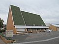
 Westbourne Park Uniting Church in southern Adelaide.
 -
 Fellowship hall at Westbourne Park Uniting Church in southern Adelaide.
 -
 Plaque on Westbourne Park Uniting Church in southern Adelaide.
 -
 Dedication plaque for the school hall at Westbourne Park Uniting Church in southern Adelaide.


