User:Orderinchaos/gallery/Perth
< User:Orderinchaos | gallery
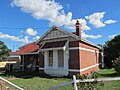
Perth edit
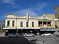
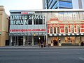
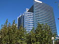
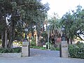
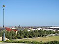
City centre edit
-

-

-

-

-

-

-

-

-

-

-

-

-

-

-

-

-

-
-

-
-

-

-

-

-

-
-

-

-
-

-

-

-

-

-

-
-
-

-

-

-

-
-

-

-

-

-
-

-

-
-

-

-
-

-

-

-

-

-

-

-

-

-

-

-

-

-
-

-

-

-

-

-

-
-
-
-
-

-

-

-

-

-

-

-

-

-

-

-

-

-

-

-

-
-
-

-

-

-
-

-

-

-
-

-

-

-

-

-
-

-

-

-
-

-
-
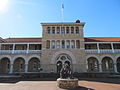
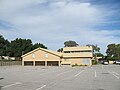
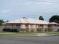
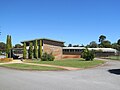
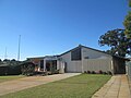
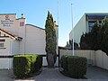
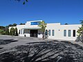
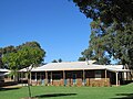
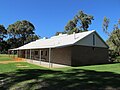
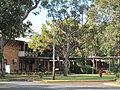
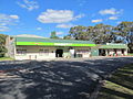
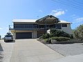
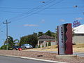
 51 Ord Street, West Perth, Western Australia, from the front.
 -

-
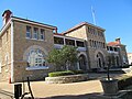
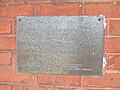
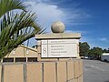
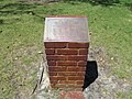
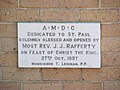
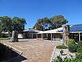
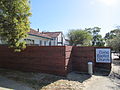
 Sign at 51 Ord Street, West Perth, Western Australia, indicating the building's current purpose as the offices of Senator Chris Evans.
 -

-

-

-

-

-

-

-

-

-
-

-

-
-

-


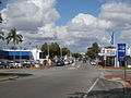
Western suburbs edit


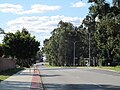
Northern suburbs edit
-
-

-

-

-

-

-

-

-

-

-

-

-

-

-

-

-
-
-

-

-
-

-

-

-

-

-

-

-
-
-

-

-

-

-

-

-

-

-
-
-

-

-

-

-
-

-

-

-

-

-

-

-

-
-
-

-

-
-

-

-

-
-

-
-

-
-

-

-

-

-

-

-

-

-

-

-

-

-

-
-
-

-
-

-

-

-

-

-

-

-

-

-

-

-
-

-

-

-

-

-

-

-

-

-

-

-

-

-

-

-

-

-
-

-

-

-

-
-

-

-

-

-

-

-

-

-

-

-

-
-

-
-

-

-

-

-

-

-

-

-

-

-

-

-

-

-

-

-
-
-

-
-

-

-

-

-
-

-

-

-

-

-

-

-

-

-

-

-
-
-
-

-

-

-

-

-

-

-

-

-

-
-

-

-

-

-

-

-

-

-

-

-

-

-

-
-

-
-

-

-
-

-

-

-

-

-

-

-

-

-

-

-

-

-

-

-

-

-

-

-
-

-

-
-

-

-

-

-
-

-

-

-

-

-

-

-
-

-

-

-
-

-

-

-

-

-

-

-

-

-
-

-
-
-

-

-

-

-

-

-
-

-

-
-

-

-
-

-

-

-

-

-

-

-

-

-

-
-

-

-
-

-

-

-

-

-

-

-

-

-

-

-

-

-
-
-

-

-

-

-
-

-

-

-

-

-

-

-

-

-
-

-

-

-
-

-
-

-
-

-

-

-

-

-

-

-

-
-

-
-

-

-

-
-

-
-

-

-
-

-

-

-

-

-

-
-

-

-

-

-
-

-
-

-

-

-

-
-

-

-

-

-

-
-
-

-

-

-

-
-
-

-

-

-
-

-
-

-

-

-

-
-

-
-

-

-

-

-
-

-

-

-

-

-

-

-

-

-

-

-

-

-

-

-

-

-

-

-

-

-

-
-

-

-

-

-

-

-

-

-

-

-

-

-

-

-

-

-

-

-

-

-

-

-

-

-

-

-

-

-
-

-

-

-

-

-
-

-

-

-

-

-
-

-
-

-

-

-

-

-

-

-

-

-

-

-
-
-

-

-

-

-
-

-

-

-

-

-

-

-

-

-

-

-
-

-

-

-

-

-
-

-

-

-

-
-
-

-
-
-
-

-

-

-

-

-

-

-

-
-
-

-

-

-

-

-
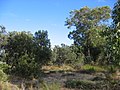
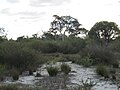
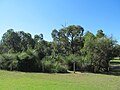
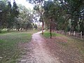
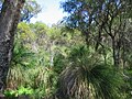
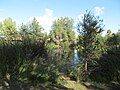
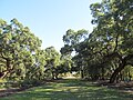
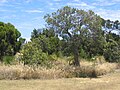
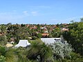
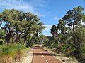
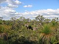
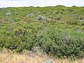
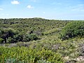
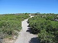
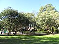
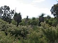
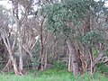
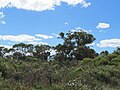
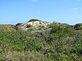
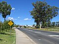
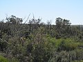
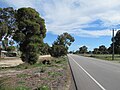
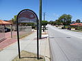
 Bushland in Koondoola, Western Australia, seen from a bus stop on Alexander Drive, Malaga, on a wet day. The haze is characteristic of Australian eucalypt forests in these conditions.
 -

-

-

-

-

-

-

-

-
-

-
-

-

-

-

-

-

-

-

-
-

-

-

-

-

-

-

-

-

-

-
-

-

-

-
-

-
-

-
-

-

-

-

-

-

-

-

-

-

-

-
-

-

-

-
-

-

-

-

-

-

-

-

-

-
-

-

-

-

-

-

-
-

-

-

-

-

-

-

-

-

-

-

-
-

-

-

-

-

-
-

-

-

-

-

-

-

-

-

-

-

-

-

-

-

-

-
-

-
-

-

-
-
-

-

-

-
-

-

-

-
-

-

-

-

-
-

-

-
-

-
-

-

-

-

-

-

-

-

-

-

-
-

-

-

-

-

-

-

-
-

-

-

-

-

-

-
-

-

-

-

-

-

-

-

-

-
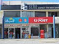
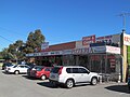
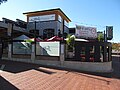
 Shops on Flora Terrace, North Beach, Western Australia, by night.
 -
-

-
-

-
-

-

-
-
-

-

-

-
-
-

-

-

-
-
-

-

-

-
-

-

-
-

-

-
-
-

-
-
-
-

-

-

-

-

-

-

-

-

-

-

-

-

-

-

-

-

-
-

-

-
-

-

-

-

-

-

-

-

-
-

-

-

-

-

-

-

-

-

-

-
-

-

-

-

-

-

-

-

-

-

-

-

-

-

-

-

-

-

-

-

-
-

-

-
-

-

-

-

-

-

-

-

-
-

-
-

-

-

-

-

-

-

-

-

-

-

-

-

-

-

-

-
-

-

-

-
-

-

-

-

-

-

-

-

-

-
-
-
-

-

-

-

-

-

-

-

-

-
-

-
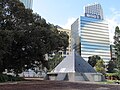
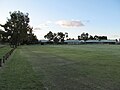
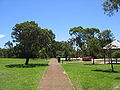
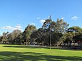
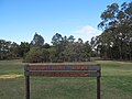
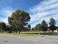
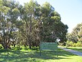
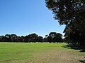
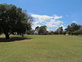
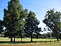
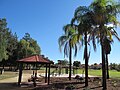
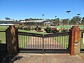
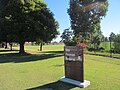
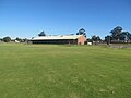
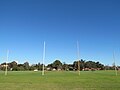
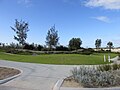
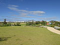
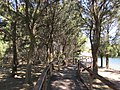
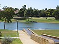
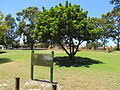
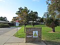
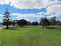
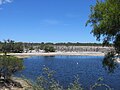
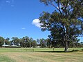
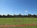
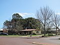
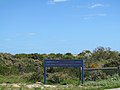
 Springvale Park (with sign) in Warwick, Perth, Western Australia.
 -
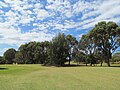
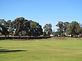
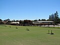
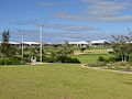
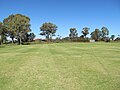
 Springvale Park in Warwick, Perth, Western Australia.
 -

-
-
-

-

-

-

-

-

-

-

-

-
-

-

-
-

-
-

-

-

-
-

-

-
-

-

-

-

-

-

-

-

-

-

-
-

-

-

-
-

-

-

-

-

-

-

-

-
-

-

-

-

-

-

-

-

-

-

-

-

-

-
-

-

-

-

-
-

-

-

-

-

-
-

-

-


.jpg)


.jpg)


.jpg)


.jpg)
.jpg)


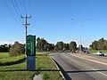
Outer north edit
-
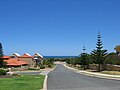
 Looking west along Santorini Promenade from Benenden Avenue in the Trinity estate, Alkimos.
 -
 Looking west along Santorini Promenade from Benenden Avenue in the Trinity estate, Alkimos.
 -
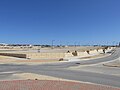
 Looking south along Benenden Avenue from the Trinity estate (departure sign in frame) in Alkimos towards the suburb of Butler. In this picture, the Butler commercial centre has not yet been completed.
 -
 Garden at Alford Park, Alkimos
 -
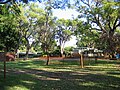
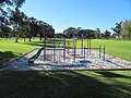
 Playground at Alford Park, Alkimos
 -
 Garden feature made from treated foam containing representations of a frog, snake and crocodile in Alford Park, Alkimos
 -
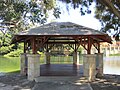
 Sheltered eating area and barbecue facilities Alford Park, Alkimos
 -
 Benenden Avenue, Alkimos, looking north from Myrlea. This is part of the Trinity Alkimos Estate.
 -
 Football oval (already built as of September 2014) at Trinity Primary School site, Alkimos
 -
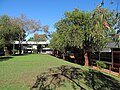
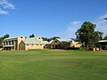
 Trinity Primary School site, Alkimos
 -
 Trinity Primary School site, Alkimos
 -
 Looking north along Benenden Avenue at Trinity Primary School site, Alkimos
 -
 Houses on Balmain Terrace (near Santorini Promenade), Alkimos
 -
 Houses on Benenden Avenue in the Trinity Estate, Alkimos
 -
 Public art near the Trinity Primary School site, Alkimos.
 -
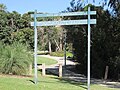
 Sign welcoming visitors to the Trinity Estate in Alkimos.
 -
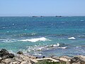
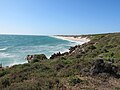
 View of the Alkimos wreck from the northwest off the coast of Perth.
 -
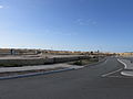
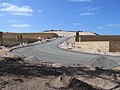
 The approved line of Butler Boulevard looking east from Benenden Avenue, Butler. As of September 2014, clearing works have not significantly progressed.
 -
 Butler Boulevard looking east from Glenkeen St, Butler. As at September 2014, the street terminates in a construction site.
 -
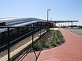
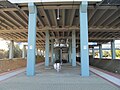
 Butler Boulevard looking east from the railway station, Butler.
 -
 Butler Boulevard looking west from Exmouth Drive (outside the Butler railway station), Butler. As at September 2014, the town centre has not yet been built, although traffic lights have been installed at the intersection.
 -
 Butler Boulevard looking west from Glenkeen St, Butler. The new Butler railway station is plainly visible on the right.
 -
 Construction near Exmouth Drive, Butler in September 2014.
 -
 Benenden Avenue heading north alongside Eastwall Park, Butler
 -
 Eastwall Park, Butler
 -
 Eastwall Park, Butler
 -
 Eastwall Park, Butler
 -
 Eastwall Park, Butler
 -
 Eastwall Park, Butler
 -
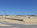
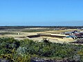
 Proposed town centre area (September 2014) in Butler, looking east from Hollyford Parade and Doncaster Grange.
 -
 Proposed town centre area (September 2014) in Butler, looking south-west from Benenden Avenue and Hollyford Parade.
 -
 Proposed town centre area (September 2014) in Butler, looking south-west from Benenden Avenue and Hollyford Parade.
 -
 Proposed town centre area (September 2014) in Butler, looking south-west from Hollyford Parade.
 -
 A view of Butler railway station, Butler, across the proposed commercial centre.
 -
 Bus station at Butler on opening day, looking north.
 -
 Bus station at Butler on opening day, looking south.
 -
 Butler railway station as seen from Hollyford Parade and Doncaster Grange, Butler, five days before the station's opening.
 -
 Two Transperth B-series trains in Butler railway station, Butler, seen from the Butler Boulevard bridge five days before the station's opening.
 -
 Butler railway station as viewed from the as yet unbuilt commercial centre, Butler.
 -
 Looking south towards the Butler Boulevard bridge at Butler railway station, Butler.
 -
 Butler railway station, Butler, viewed from south.
 -
 Butler railway station, Butler, viewed from north-east.
 -
 Butler railway station, Butler, viewed from eastern carpark.
 -
 Platform 1 of Butler railway station, Perth.
 -
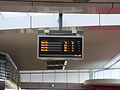
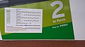 Wall at platform 2 of the new Butler railway station showing train routes.
 -
 Sign for Butler railway station, Butler, at Exmouth Drive and Butler Boulevard.
 -
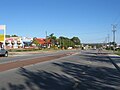
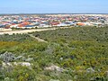
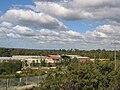
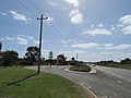
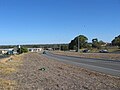
 The suburb of Carabooda, taken from Wanneroo and Karoborup Roads.
 -
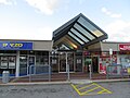
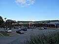
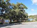
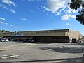
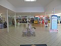
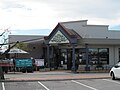
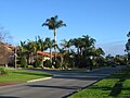
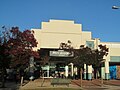
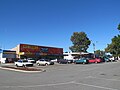
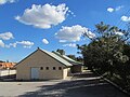
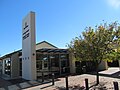
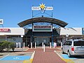
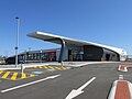
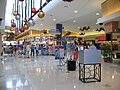
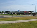
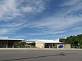
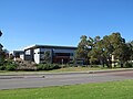
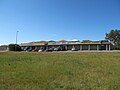
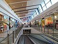
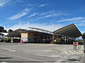
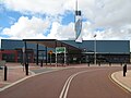
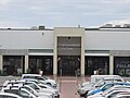 Currambine Central front entrance, Currambine, Western Australia
 -
 Currambine Central front entrance, Currambine, Western Australia
 -
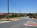
 The intersection of Alizarin Loop and Wheat Lane, Eglinton, as seen from the north in October 2014.
 -
 The intersection of Alizarin Loop and Wheat Lane, Eglinton, as seen from the west in October 2014.
 -
 Construction of the Amberton Estate in Eglinton, near Leeward Avenue.
 -
 Construction of Amberton Estate in Eglinton, on its eastern side near Marmion Avenue in October 2014.
 -
 Cornflower Drive, Eglinton, looking south-east from Wheat Lane in October 2014.
 -
 Park at the entrance of Amberton Estate in Eglinton.
 -
 Entrance sign to Amberton Estate, Eglinton at the corner of Marmion Avenue and Cinnabar Drive.
 -
 Houses and lots on Cinnabar Drive, Eglinton in the Amberton Estate in October 2014.
 -
 View from the intersection of Leeward Avenue and Cinnabar Drive over the Amberton Estate in Eglinton, in October 2014.
 -
 Sales office and information centre for the Amberton Estate in Eglinton, in October 2014.
 -
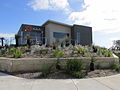 Sales office and information centre for the Amberton Estate in Eglinton, in October 2014.
 -
 Sales office and information centre for the Amberton Estate in Eglinton, in October 2014.
 -
 Cinnabar Drive, Eglinton, looking west from Leeward Avenue.
 -
 Leeward Park, Eglinton
 -
 Leeward Park, Eglinton
 -
 Leeward Park, Eglinton
 -
 View east from Marmion Avenue near Cinnabar Drive, Eglinton.
 -
 View east from Marmion Avenue near Cinnabar Drive, Eglinton.
 -
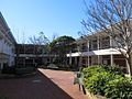
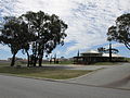
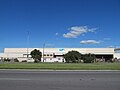
 Joondalup chambers, taken from the east in 2007.
 -

-
-

-

-

-

-
-

-

-

-

-

-

-

-
-

-

-

-

-
-

-

-

-

-

-
-

-

-

-

-

-

-

-

-

-

-
-

-

-
-
-
-

-

-
-

-
 "The Bag Project" by Margaret Dillon at Clarkson railway station, Perth.
 -
 View north from Clarkson railway station, after the extension of the line to Butler. (See File:OIC clarkson station 2012 view north.jpg for a comparison)
 -
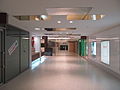
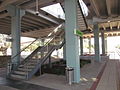
 Part of the interior, including the lift and stairs, at Clarkson railway station, Perth.
 -
-

-
-
-
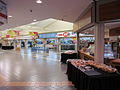
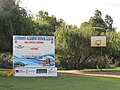
 Works at Currambine Central shopping centre in Currambine
 -

-

-

-

-

-

-

-

-
-

-

-
-
 Sign and eastern view of James McCusker Park, Iluka.
 -
 James McCusker Park, Iluka.
 -
 Wooden walkway at James McCusker Park, Iluka
 -
 Approaching covered lookout on lake at James McCusker Park, Iluka.
 -
 Lookout on lake at James McCusker Park, Iluka.
 -
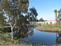
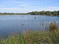
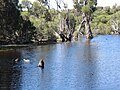
 Lake at James McCusker Park, Iluka.
 -
 View from lake at James McCusker Park, Iluka.
 -
 Part of the lake at James McCusker Park, Iluka.
 -
 Naturaliste Park, Iluka
 -
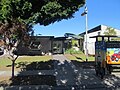
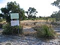
 Sign for Naturaliste Park, Iluka
 -

-

-

-
-

-

-

-

-

-
-
-
-

-

-
-

-

-
-

-

-

-

-

-

-

-

-

-

-

-

-

-
-

-

-

-

-

-
-

-

-
-

-
-

-

-

-

-
-
-

-

-

-
-
-

-

-
-

-
-

-

-

-

-

-

-
-
-
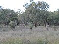
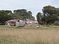
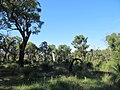
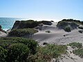
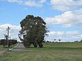
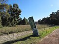
 Farms near Wattle Avenue, Neerabup, Western Australia.
 -

-
-

-

-

-
-

-
-

-

-

-

-

-

-

-

-

-

-

-

-

-

-

-

-

-

-

-

-
-

-

-

-

-
-
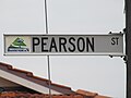
 Archer Street looking north from Goundrey Drive, Pearsall
 -
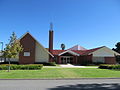
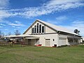
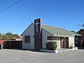
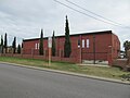
 Church of the Nazarene, Pearsall.
 -
 Church of the Nazarene, Pearsall, in 2014.
 -
 Cullen Rise in Pearsall, in October 2014, looking east from Archer Street.
 -
 Shiraz Boulevard looking east from Simeon Way, Pearsall.
 -
 Entrance to The Terraces Estate in Pearsall
 -
 Entrance to The Terraces Estate in Pearsall
 -
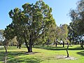
 Willespie Park in Pearsall
 -
 Willespie Park in Pearsall
 -
 Willespie Park in Pearsall
 -

-
 First train getting ready to leave Butler Station.
 -
 First train getting ready to leave Butler Station.
 -
 Information board listing the first four trains to leave Butler Station.
 -
 Information officer holding a sign marking the opening of Butler Station.
 -
 First train getting ready to leave Butler Station.
 -
 Onlookers viewing the first train as it gets ready to leave Butler Station.
 -
 Aboard the first train leaving Butler, with Transperth information officers interviewing train passengers on camera.
 -
 Looking south from Clarkson railway station as the first Butler-to-Perth train departs.
 -
 Clarkson railway station platform, waiting for the first Butler-bound train.
 -
 Looking south from Clarkson railway station as the first Perth-to-Butler train arrives.
 -
 Staff member dressed as the SmartRider mascot on Butler railway station's opening day.


.jpg)


Southern suburbs edit
-
-

-

-

-

-

-

-

-

-

-
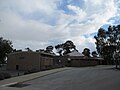
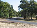
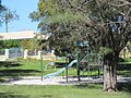
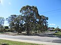
 Bushland at the corner of Campbell and Amherst Roads, Canning Vale.
 -
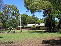
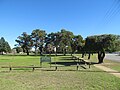
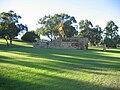
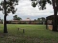
 Cromarty Gardens Reserve, Campbell Road, Canning Vale.
 -

-

-
-

-

-

-

-

-

-

-

-

-

-

-
-

-

-

-

-
-

-

-

-

-
-

-

-

-

-

-
-
-

-

-

-

-
-

-

-

-
-

-

-

-

-

-

-
-
-
-

-

-

-

-

-
-

-

-

-

-
-

-

-

-
-

-

-

-

-

-

-

-

-

-

-

-

-

-
-

-

-

-

-

-
-

-

-

-
-

-

-

-

-

-

-
-

-

-

-

-

-

-

-

-

-

-

-

-

-

-

-

-

-

-
-

-

-

-

-

-
-
-

-

-

-
-

-
-

-

-

-

-

-
-
-

-

-

-
-

-

-

-

-

-

-

-

-

-

-

-

-

-
-

-

-

-

-

-

-

-

-

-

-
-

-

-

-

-

-

-

-

-

-
-
-

-

-

-

-

-
-

-

-

-

-

-
-
-


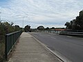
Peel region and outer south edit
-
-

-
-

-

-

-

-
-

-

-
-

-

-

-
-

-
-

-

-

-
-
-
-

-
-
-

-

-

-

-

-
-
-

-

-

-
-

-

-

-

-

-

-

-

-

-

-

-

-
-

-

-

-

-

-
-

-

-

-

-

-

-
-

-

-

-

-

-

-

-

-

-

-
-

-

-

-

-

-

-

-

-

-

-

-

-
-

-
-

-

-

-
-

-

-

-
-

-

-

-

-

-

-

-

-

-

-

-

-

-

-

-
-
-

-

-

-

-

-
-

-

-

-

-

-

-

-
-

-

-

-

-

-

-

-

-
-

-

-

-

-

-

-

-

-

-

-

-
-

-

-

-

-

-

-

-

-

-

-

-

-

-

-

-

-

-

-

-

-
-
-

-
-

-

-

-

-

-
-

-

-

-

-

-
-

-
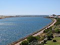
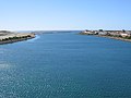
 Canal estate at Port Bouvard, Wannanup, Western Australia.
 -
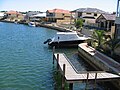 Canal estate at Port Bouvard, Wannanup, Western Australia.
 -
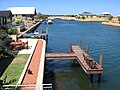 Canal estate at Port Bouvard, Wannanup, Western Australia.
 -

-

-

-

-

-

-
-

-

-

-

-

-

-

-

-

-

-

-

-

-
-

-

-

-

-

-

-
-

-

-
-
-

-

-

-

-
-

-

-

-

-

-
-

-

-

-

-

-

-

-
-

-

-

-
-

-

-

-

-
-

-

-

-

-

-

-

-

-

-

-

-

-

-

-
-
-

-
-

-

-

-

-

-

-

-
-
-

-

-

-

-

-
-
-

-
-
-

-

-
-
-
-

-

-

-

-

-

-
-

-

-

-

-
-

-

-
-

-

-

-

-

-

-


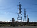
_W_to_Kwinana_Beach.jpg)


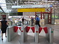
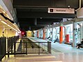
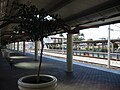
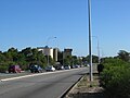
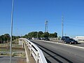
Railway stations/Transperth edit
-

-

-

-

-

-

-

-

-

-

-

-

-

-

-

-

-

-

-

-

-

-

-
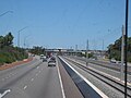
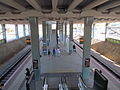
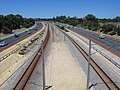
 Canning Bridge
 -
 Canning Bridge
 -
 Canning Bridge
 -
 Canning Bridge
 -
 Canning Bridge
 -

-

-

-
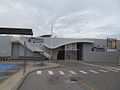
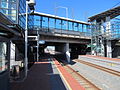
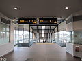
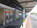
 Clarkson
 -
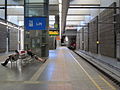
 Cottesloe
 -
 Cottesloe
 -
 Cottesloe
 -

-

-

-

-

-

-

-

-

-

-

-

-
-

-

-

-
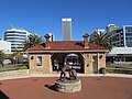
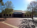
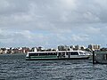 Barrack Street Jetty
 -

-
-

-

-
 Glendalough
 -
 Grant Street
 -
 Grant Street
 -

-

-

-

-

-

-

-

-

-

-

-

-
-

-

-

-

-

-

-

-

-

-
-
-

-

-

-

-

-

-
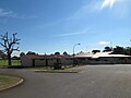
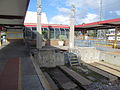
 Murdoch
 -
 Murdoch
 -
 Murdoch
 -
-

-

-

-

-

-
-

-
 Clarkson (2004)
 -
 Clarkson (2004)
 -
 Clarkson (2004)
 -
 Clarkson (2007)
 -
 Clarkson
 -
 Clarkson
 -
 Currambine (2006)
 -
-
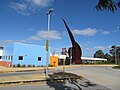
 Esplanade
 -
 Esplanade
 -
 Esplanade
 -
 Esplanade
 -
 Mandurah (2006)
 -
 Mandurah (2006)
 -
 Mandurah (2007)
 -
 Mandurah (2007)
 -
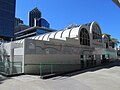
 Mirrabooka bus station
 -

-
 Perth
Perth -
-
 Perth
Perth -
 Perth
Perth -
 Perth
Perth -
 Perth
Perth -

-
 Perth
Perth -
 Perth
Perth -
 Perth
Perth -
 Perth
Perth -
 Perth
Perth -
 Perth
Perth -
 Perth
Perth -
 Perth
Perth -
 Perth
Perth -

-

-

-

-

-
-
 Stirling
 -
 Stirling
 -
 Fremantle
 -
 Fremantle
 -
 Esplanade
 -
 Esplanade
 -
 Esplanade
 -
-
 Queens Park
 -

-

-
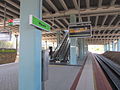
 Victoria Park
 -
 Victoria Park
 -
 Victoria Park
 -
 Victoria Park
 -
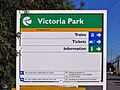 Victoria Park
 -
 Warwick (2002)
 -
 Warwick (2004)
 -
 Warwick (2004)
 -
 Warwick
 -
 Warwick
 -

-

-

-

-

-
-

-

-
-

-

-

-

-

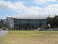
-

-

-
-

-

-
-

-

-

-

-
-

-

-

-

-

-
 Warwick
 -

-
 Warwick
 -
 Warwick
 -
 Warwick
 -

-

-
-
 Warwick
 -
 Warwick
 -
 Warwick
 -
 Warwick
 -
 Warwick
 -
 Warwick
 -

-


.jpg)


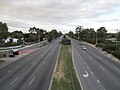
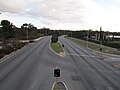
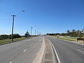
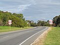
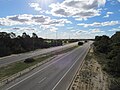
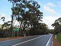
Major roads edit
-
 Adelaide Terrace
 -
 Albany Highway
 -
 Albany Highway
 -
 Albany Highway
 -
 Albany Highway
 -
 Albany Highway
 -
 Albany Highway
 -
 Albany Highway
 -
 Alexander Drive
 -
 Alexander Drive
 -
 Alexander Drive
 -
 Alexander Drive
 -
 Balcatta Road
 -
 Balcatta Road
 -
 Balcatta Road
 -
 Balcatta Road
 -
 Beach Road
 -
 Beach Road
 -
 Beach Road
 -
 Beach Road
 -
 Beach Road
 -
 Beach Road
 -
 Beach Road
 -
 Beach Road
 -
 Beach Road
 -
 Beach Road
 -
 Beach Road
 -

-
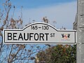
 Beaufort Street
 -
 Beaufort Street
 -
 Beechboro Road
 -
 Beechboro Road
 -
 Beechboro Road
 -
 Benara Road
 -
 Berwick Street
 -
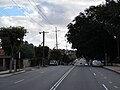
 Canning Highway
 -
 Canning Highway
 -
 Canning Highway
 -
 Canning Highway
 -
 Canning Highway
 -
 Canning Highway
 -
 Canning Highway
 -
 Canning Highway
 -
 Canning Highway
 -
 Canning Highway
 -
 Canning Highway
 -
 Canning Highway
 -
 Carrington Street
 -
 Erindale Road
 -
 Erindale Road
 -
 Erindale Road
 -
 Erindale Road
 -
 Erindale Road
 -
 Erindale Road
 -
 Erindale Road
 -
 Flinders Street
 -
 Flinders Street
 -
 Flinders Street
 -

-
 Great Eastern Highway
 -
 Great Eastern Highway
 -
 Great Eastern Highway
 -
 Great Eastern Highway
 -
 Great Eastern Highway
 -
 Great Eastern Highway
 -
 Graham Farmer Freeway
 -
 Graham Farmer Freeway
 -
 Great Eastern Highway
 -
 Guildford Road
 -
 Guildford Road
 -
 Guildford Road
 -
 Guildford Road
 -
 Guildford Road
 -

-

-
-

-

-
-

-
 High Road
 -
 Kalamunda Road
 -
 Kalamunda Road
 -
 Kalamunda Road
 -
 Kalamunda Road
 -
 Kwinana Freeway
 -
 Kwinana Freeway
 -
 Kwinana Freeway
 -
 Kwinana Freeway
 -
 Kwinana Freeway
 -
 Leach Highway
 -
 Leach Highway
 -
 Leach Highway
 -
 Leach Highway
 -
 Leach Highway
 -
 Leach Highway
 -
 Main Street
 -
 Malaga Drive
 -
 Mandurah Road
 -
 Mandurah Road
 -
 Mandurah Road
 -
 Mandurah Road
 -
 Mandurah Road
 -
 Mandurah Terrace
 -
 Marangaroo Drive
 -
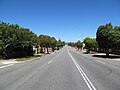
 Marmion Avenue
 -
 Marmion Avenue
 -
 Marmion Avenue
 -
 Marmion Avenue
 -
 Marmion Avenue
 -
Marmion Avenue
-
 Marmion Avenue (2004)
 -
 Marmion Avenue
 -
 Marmion Avenue (2006)
 -
 Marmion Avenue (2006)
 -
 Marmion Avenue
 -
 Mitchell Freeway
 -
 Mitchell Freeway
 -
 Mitchell Freeway
 -
 Mitchell Freeway
 -
 Mitchell Freeway
 -
 Mitchell Freeway
 -
 Mitchell Freeway
 -
 Mitchell Freeway
 -
 Mitchell Freeway
 -
 Morley Drive
 -
 Morley Drive
 -
 Morley Drive
 -
 Morley Drive
 -
 Morley Drive
 -
 Morley Drive
 -
 Nicholson Road
 -
 Nicholson Road
 -
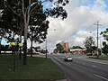
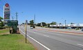
 North Beach Road
 -
 Beach Road
 -
 Pinjarra Road
 -
 Pinjarra Road
 -
 Hepburn Avenue (2007)
 -
Hepburn Avenue (2007)
-
 Karrinyup Road
 -
 Kwinana Freeway
 -
 Main Street
 -
 Main Street
 -
 Ocean Reef Road
 -
 Ocean Reef Road
 -
 Ocean Reef Road
 -
 Oceanic Drive
 -
 Old Coast Road
 -
 Roe Highway
 -
 Roe Highway
 -
 Roe Highway
 -
 Scarborough Beach Road
 -
 Welshpool Road
 -
 Patterson Road
 -
 Patterson Road
 -
 Reid Highway
 -
 Reid Highway
 -
 Reid Highway
 -
 Reid Highway
 -
 Reid Highway
 -
 Reid Highway
 -
 Reid Highway
 -
 Rockingham Road
 -
 South Street
 -
 South Street
 -
 South Street
 -
 Spencer Road
 -
 St Georges Terrace
 -
 Stirling Highway
 -
 Stirling Highway
 -
 Stirling Highway
 -
 Stirling Highway
 -
 Stirling Highway
 -
 Stirling Highway
 -
 Stock Road
 -
 Stock Road
 -
 Tonkin Highway
 -
 Tonkin Highway
 -
 Toodyay Road
 -
 Vincent Street
 -
 Vincent Street
 -
 Walcott Street
 -
 Walter Road
 -
 Wanneroo Road
 -
 Wanneroo Road
 -

-
 Wanneroo Road
 -
 Wanneroo Road
 -
 Wanneroo Road
 -
 Wanneroo Road
 -
 Wanneroo Road
 -
 Wanneroo Road
 -
 Wanneroo Road
 -
 Wanneroo Road
 -
 Wanneroo Road
 -
 West Coast Hwy


.jpg)


.jpg)


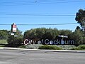
Municipal border signs edit
-

-

-

-

-

-

-

-

-

-

-

-
-

-
-

-

-

-

-

-
-
-

-

-

-
-
-
-

-

-

-

-
-

-

-

-
-

-

-
-

-

-

-

-
-
-

-

-

-

-

-

-

-

-

-

-
-

-
-
-

-

-

-

-

-

-
-

-
-

-

-

-
-

-

-
-

-
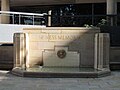
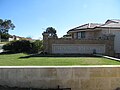
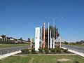
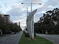 Welcome monument - City of Perth - Kings Park Road, West Perth (shot 1 - from west)
 -
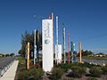
 Welcome monument - City of Perth - Kings Park Road, West Perth (shot 2 - from north-west)
 -

-

-

-

-

-
-

-

-
-

-

-

-
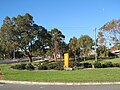
 Welcome monument - City of Stirling - Beach Road/Alexander Drive, Mirrabooka.
 -
 Welcome monument - City of Stirling - Beach Road/Alexander Drive, Mirrabooka.
 -

-

-
-

-

-

-

-

-
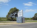
 Welcome monument - City of Swan - Beach Road/Alexander Drive, Mirrabooka.
 -
-
-

-

-

-

-

-

-

-

-
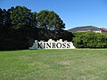
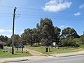
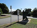
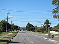
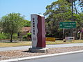
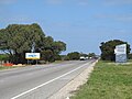
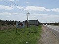
 Welcome sign - City of Wanneroo - Alexander Drive near Beach Road, Koondoola.
 -

-


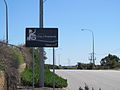
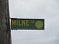
Street signs edit
-

-

-
-

-

-

-

-

-

-
-

-

-

-

-

-

-

-

-

-

-

-

-

-

-
-

-

-

-

-

-
-

-

-

-

-

-

-

-

-

-

-

-

-

-

-

-
-

-

-

-
-

-

-

-

-

-

-

-

-
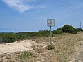
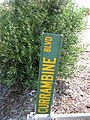 Fallen street sign, taken in 2006, on Currambine Boulevard, Currambine, Western Australia. Although a City of Wanneroo design, the sign would have been placed by the City of Joondalup.
 -

-

-

-

-

-

-

-

-

-

-

-

-

-

-

-
-
-

-

-

-
-

-

-

-

-
 Street sign for Wellington Street, Perth, Western Australia.
 -

-
-

-
-

-

-

-

-

-

-
-

-

-

-

-

-

-
 1980s-era street sign for Beach Road, Malaga in the City of Swan.
 -

-

-

-

-

-
-

-

-

-

-

-

-

-

-
-

-

-

-
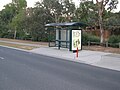
 1990s-era street sign in the City of Wanneroo on Alexander Drive, Koondoola.
 -
-

-

-

-

-

-

-

-

-

-

-

-

-

-
-

-
-

-

-

-

-

-


