Category:Watarase River
(Redirected from 渡良瀬川)
- English: Watarase River (Watarasegawa) is a branch of the Tone River, in the northern Kantō region of Japan.
river in Japan  | |||||
| Upload media | |||||
| Instance of | |||||
|---|---|---|---|---|---|
| Location | |||||
| Length |
| ||||
| Origin of the watercourse | |||||
| Mouth of the watercourse | |||||
| Drainage basin |
| ||||
| Tributary |
| ||||
| Lake on watercourse | |||||
 | |||||
Subcategories
This category has the following 15 subcategories, out of 15 total.
A
- Ashio Dam (12 F)
B
I
K
- Koshin Dam (4 F)
- Kurosakaishi Dam (3 F)
M
- Mato Power Station (4 F)
O
- Odaira Power Station (2 F)
S
- Sori Power Station (2 F)
T
- Takatsudo Dam (3 F)
W
- Watarase Reservoir (40 F)
Media in category "Watarase River"
The following 41 files are in this category, out of 41 total.
-
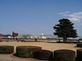
 Ashikaga-city.jpg 1,417 × 945; 236 KB
-
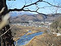
 AshikagaWataraseRiver.jpg 2,048 × 1,536; 1.41 MB
-
 Ashio hydroelectric power station Watarase Weir.jpg 4,320 × 3,240; 1.92 MB
-
 Ashio hydroelectric power station.jpg 3,139 × 2,358; 1,009 KB
-
 Ashio Seirenjo.jpg 1,280 × 960; 222 KB
-
 Ashiomachi Honzan, Nikko, Tochigi Prefecture 321-1508, Japan - panoramio.jpg 1,600 × 1,067; 378 KB
-
 Boat on the Watarase River March 27 2018.jpg 4,160 × 2,336; 2.47 MB
-
 Burg Koga Plan.jpg 1,253 × 1,771; 693 KB
-
 Former Ashio Copper Mine Chimney ac (2).jpg 3,831 × 5,107; 3.44 MB
-
 Former Ashio Copper Mine Chimney ac (3).jpg 5,672 × 3,771; 4.62 MB
-
 Godo hydroelectric power station 1975.jpg 563 × 422; 111 KB
-
 Godo hydroelectric power station weir 1975.jpg 508 × 377; 86 KB
-
 Huge body of water.jpg 1,952 × 4,160; 2.53 MB
-
 Kazo Watarase River Most Downstream 1.JPG 3,264 × 2,448; 2.5 MB
-
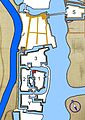
 Koga-joshi-aerophotograph.png 660 × 944; 1.7 MB
-
 Koga-jou.jpg 1,187 × 1,470; 130 KB
-
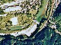
 Koga-joushi-aerophotograph.png 603 × 922; 1.4 MB
-
 Koga-joushi.png 1,292 × 1,629; 381 KB
-
 NakaBashiAshikaga.JPG 1,600 × 1,200; 565 KB
-
 OttoseiIwa.jpg 288 × 343; 53 KB
-
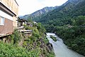
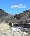
 Takatsudokyo, Gunma, Japan 26-Apr-2015.jpg 6,016 × 4,016; 19.27 MB
-
 Tanaka Shozo M01.JPG 3,072 × 2,304; 3.17 MB
-
 Tanaka Shozo M02.JPG 3,072 × 2,304; 3.2 MB
-
 Tatebayashi Watarase River Oratoshuko 1.JPG 3,040 × 2,280; 2.05 MB
-
 Tochigi Omoi River Most Downstream 1.JPG 3,264 × 2,448; 1.49 MB
-
-

-
 Tone riverine system 16century.png 480 × 285; 150 KB
-
 Tone riverine system 20century.png 480 × 285; 152 KB
-
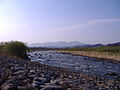
 View of Watarase River, at Omama (3110698662).jpg 760 × 649; 60 KB
-
 Watarase River - sep 18 2016.jpg 3,810 × 2,346; 1.66 MB
-

-
 Watarase-river.JPG 2,304 × 1,728; 1.63 MB
-
 Wataraseriver.jpg 2,304 × 1,728; 1.85 MB
-
 Watarase~river.JPG 2,304 × 1,728; 968 KB
-
 カスリーン台風決壊口の碑.jpg 4,160 × 3,120; 5.49 MB
-
 ニホンカモシカ・間藤駅-足尾本山駅・1.jpg 427 × 640; 87 KB
-
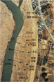
 古河城跡・本丸跡河川敷.jpg 3,077 × 2,308; 1.18 MB
-
 渡良瀬川 - panoramio - Yobito KAYANUMA.jpg 1,600 × 900; 238 KB
-
 渡良瀬川自転車道 - panoramio - Yobito KAYANUMA.jpg 1,600 × 900; 242 KB
-
 群馬県桐生市の富士山の山頂からの景色.jpg 4,608 × 3,456; 5.24 MB


.jpg)
.jpg)


.jpg)

.jpg)


